North Battleford is a city in west-central Saskatchewan, Canada. It is the seventh largest city in the province and is directly across the North Saskatchewan River from the town of Battleford. Together, the two communities are known as "The Battlefords".
North Battleford and the greater Battlefords area are a notable stop along the Yellowhead Highway, part of the Trans-Canada system, and serve as a commercial and cultural hub for west- and north-central Saskatchewan. Together, the Battlefords are served by the Yellowhead Highway as well as Highway 4, Highway 26, Highway 29, and Highway 40.
Early European settlement began as a result of fur trading by French colonists in the late 18th century. The Canadians founded Fort Montaigne d'Aigle (Eagle Hills Fort)[7] nine miles below the confluence of the North Saskatchewan and Battle Rivers in 1778.[8] A year later the fort was abandoned following conflict between traders and natives.[citation needed]
Permanent European settlement in the area centred around the town of Battleford, founded 1875 and located on the south side of the North Saskatchewan River. Battleford served as capital of the North-West Territories between 1876 and 1883.[9]
In 1905, the construction of the Canadian Northern Railway main line to Edmonton placed the line on the north side of the North Saskatchewan River. North Battleford, built along the railway line, was incorporated as a village in 1906, as a town in 1907, and as a city (with a population of 5,000) in 1913.[10]
The Assyrians were one of the first settlers of the area in and around North Battleford. The immigrant colony comprised 36 men and a few women from the town of Urmia in northwestern Persia. It was established in 1903 by Dr. Isaac Adams, an Assyrian Presbyterian missionary. In 1907, 40 more settlers arrived. Eventually, due to economic hardships, Dr. Isaac Adams and a few close relatives emigrated to Turlock, California. The descendants of the families who remained in North Battleford have names that are Assyrian in origin. Examples of Assyrian family names include Bakus, Essau, George and Odishaw.[11][12]
Population growth stagnated until the 1940s and then grew to approximately 10,000 by the 1960s. The city has grown into an administrative centre and service hub for the economic, education, health and social needs of the region.[citation needed]
North Battleford used STV-PR in its city elections from 1920 to 1924.[13]
North Battleford experiences a humid continental climate (Köppen climate classificationDfb). The average high during the end of July is 24.6°C (76.3°F) and the average low is 11.3°C (52.3°F).[18] For the middle of January the average high is −12.3°C (9.9°F) and the average low is −22.6°C (−8.7°F).[19]
The highest temperature ever recorded in North Battleford was 39.5°C (103.1°F) on 13 July 2002.[20] The coldest temperature ever recorded was −51.7°C (−61°F) on 1 February 1893 and 12 January 1916.[21][22]
View of North Battleford from King Hill showing the Yellowhead Highway leading to Battleford.
Demographics
In the 2021 Census of Population conducted by Statistics Canada, North Battleford had a population of 13,836 living in 5,696 of its 6,346 total private dwellings, a change of -3.3% from its 2016 population of 14,315. With a land area of 33.55km2 (12.95sqmi), it had a population density of 412.4/km2 (1,068.1/sqmi) in 2021.[1]
Canada census – North Battleford community profile
Note: Totals greater than 100% due to multiple origin responses
Crime rate
Residents of Valleyview Towers often report disturbances, harassment, loud parties, and intoxicated individuals entering hallways.
In 2018, Maclean's ranked North Battleford as Canada's most dangerous place for overall crime.[33] The prior year, Maclean's published an article about this, Canada's most dangerous place, North Battleford, is fighting for its future, discussing the safety initiatives planned by the community.[34]
After the article was published, Mayor Ryan Bater said:
The reality is we require the provincial and federal levels of government to take notice of this and align their efforts with ours. This needs to be a partnership. This can't be something the governments do in silos and we need to be working together. If we can do that, then sometime in the future we can see some great results.[35]
City Manager Jim Puffalt added that the per person index may not be accurate because the population data does not consider the numerous transients, estimated at just over 14,000. In his view, the city has roughly 30,000 people at any time. "If you put our rates over 30,000 people we wouldn't be number one [in the Maclean's study]," he said.[35]
In 2023, North Battleford earned its highest position on the Crime Severity Index (CSI) since 1998,[36] with the city challenging the dubious 'Crime Town' moniker.[37]
Government
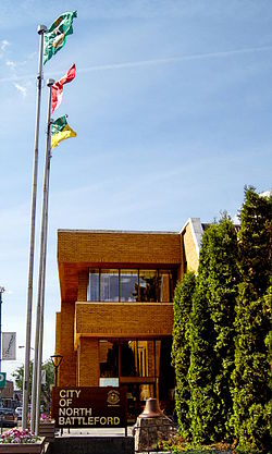
North Battleford City Hall
North Battleford is represented in the provincial Legislative Assembly by the member for The Battlefords.
The InnovationPlex (formerly North Battleford CUplex),[43][44] which opened in 2013, includes the Dekker Centre for the Performing Arts,[45] the Northland Power Curling Centre,[46] the NationsWest Field House,[47] and the Battlefords CO-OP Aquatic Centre.[48]
Infrastructure
In 2001, a problem with the city's water system led to the infection of approximately 6,280 people with cryptosporidiosis; a lawsuit seeking several million dollars in damages was filed in 2003.[49] Between 5,800 and 7,100 people suffered from diarrheal illness, and 1,907 cases of cryptosporidiosis were confirmed. Equipment failures at the city's antiquated water filtration plant following maintenance were found to have caused the outbreak.[50] The provincial and municipal government offered compensation to victims[51] after the lawsuit was approved in 2017.[52]
North Battleford is served by the North Battleford Airport, while the North Battleford/Hamlin Airport is no longer in use. The city also recently added a public transit system, in addition to the book-as-needed "Handi-bus" for people with disabilities.
Local media
Newspaper
BattlefordsNOW.com is an online local news site focusing on what's happening "right NOW" in the Battlefords and surrounding area.[citation needed]
The local newspaper is the Battlefords' News-Optimist.[53] It is published weekly on Thursdays and has circulation in the surrounding area.
Feed The Artist Magazine[54] is a local non-profit periodical print and online publication that features the work of primarily local artists, photographers, and writers.
The Battlefords were served by CFQC-TV-2 channel 6, an analogue repeater of CTV station CFQC-DT Saskatoon. That repeater ended all analog broadcasting transmissions in 2021, and there are no plans for converting it to digital television.[56][57]
This page is based on this Wikipedia article Text is available under the CC BY-SA 4.0 license; additional terms may apply. Images, videos and audio are available under their respective licenses.