Battleford

Last updated
Battleford
Town
Battleford Post Office 2022.jpg
Post office in downtown Battleford
Nicknames: 
"The Battlefords", "South Battleford"
Canada Saskatchewan location map.svg
Red pog.svg
Battleford
Coordinates: 52°44′18″N108°18′55″W / 52.73833°N 108.31528°W / 52.73833; -108.31528
CountryCanada
Province Saskatchewan
Census division 12
Rural Municipality Battle River
Post office founded1877
Incorporated (town)1904
Government
   Mayor Ames Leslie
   CAO Landon Chambers
  Governing bodyBattleford Town Council
Area
  Total23.33 km2 (9.01 sq mi)
Population
 (2021)
  Total4,400
  Density174.2/km2 (451/sq mi)
  National population rank (out of 5,008)
867
Time zone UTC−6 (Central Standard Time)
Postal code
S0M 0E0
Area code 306
Highways Highway 4
Waterways North Saskatchewan
Battle River
Website www.battleford.ca OOjs UI icon edit-ltr-progressive.svg
[1] [2]

Battleford (2011 population 4,065) is a town located across the North Saskatchewan River from the City of North Battleford, in Saskatchewan, Canada.

Contents

Battleford and North Battleford are collectively referred to as "The Battlefords" by Saskatchewan residents, as well as on highway signage. Although there has been occasional talk of the two communities merging, as of 2023 they remain separate entities. The local economy is fuelled mainly by agriculture. Battleford is bordered by the Rural Municipality of Battle River No. 438, as well as by the city of North Battleford and a small section of the Rural Municipality of North Battleford No. 437.

The 1973 western Alien Thunder was partially filmed in Battleford.

History

CensusPopulation
1901609
19111,335
19211,229
19311,096
19411,336
19511,319
19611,627
19711,803
19813,565
19914,107
20013,820
20063,685
20114,065

The Battleford area was the site of numerous independent and Hudson's Bay Company fur trading houses dating from the 1770s. [3] William Holmes [4] operated a post for the North West Company just above the confluence of the Battle and Saskatchewan rivers in 1784. [5] At least three posts were in use between 1868 and 1914. [6] The town was founded in 1875 as a fur trading post and North-West Mounted Police (NWMP) fort. Its post office opened in 1877. [7] Between 1876 and 1883, Battleford was the territorial capital of the North-West Territories (now Alberta, Saskatchewan, Nunavut, northern Quebec, northern Ontario and the Northwest Territories) and the NWMP fort (Fort Battleford) located there played an important role in the 1885 North-West Rebellion. It is also the terminus of the historic Swift Current-Battleford Trail.

Looting of Battleford

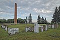
On March 30, 1885, during the North-West Rebellion, the town of Battleford was looted by a party of Cree people, who were short on food due to declining bison populations. When the Cree approached Battleford, the 500 residents [8] fled to the nearby North-West Mounted Police post, Fort Battleford. The Crees then took food and supplies from the abandoned stores and houses. Two people were murdered during the looting. Crooked Leg was accused of killing John Payne, and Man Without Blood was accused of killing a farmer named Tremont. They were convicted of murder and hanged later that year.

Demographics

In the 2021 Census of Population conducted by Statistics Canada, Battleford had a population of 4,400 living in 1,758 of its 1,877 total private dwellings, a change of -0.7% from its 2016 population of 4,429. With a land area of 23.26 km2 (8.98 sq mi), it had a population density of 189.2/km2 (489.9/sq mi) in 2021. [9]

Canada census – Battleford community profile
2021 2011
Population4,400 (-0.7% from 2016)4,065 (+10.3% from 2006)
Land area23.26 km2 (8.98 sq mi)23.33 km2 (9.01 sq mi)
Population density189.2/km2 (490/sq mi)174.2/km2 (451/sq mi)
Median age41.6 (M: 40.4, F: 42.4)40.6 (M: 39.9, F: 41.1)
Private dwellings1,877 (total)  1,758 (occupied)1,652 (total) 
Median household income$91,000
References: 2021 [10] 2011 [11] earlier [12] [13]

Historic buildings

National historic sites in Battleford include Fort Battleford National Historic Site of Canada, [14] Battleford Court House National Historic Site of Canada [15] and Old Government House / Saint-Charles Scholasticate National Historic Site of Canada. The Old Government House, built in 1878–1879, was destroyed by fire in 2003 and was the seat of Territorial Government from 1878 to 1883 [16] [17]

The Battleford Land Registry Office built between 1877 and 1878 is the last remaining building on Battleford's Government Ridge that dates from the Territorial era. [18] Other heritage buildings include the District Court House, [19] the Town Hall / Opera House, [20] the Former Land Titles Building, [21] the Station Building, [22] the Fred Light Museum (St. Vital School), [23] St. Vital Church, [24] Gardiner Church [25] and the Former Bank of Montreal Building. [26]

Local media

Newspaper

The local newspaper is The Battlefords News Optimist . It is published weekly on Thursday and has circulation in the surrounding area.

Radio

Three local radio stations serve the area; CJNB, CJCQ-FM ("Q98"), and CJHD-FM ("93.3 Beach Radio [27] "). Some Saskatoon radio stations can also be received.

Television

The Battlefords are served by CFQC-TV-2 channel 6, an analogue repeater of CTV station CFQC-DT Saskatoon.

See also

Related Research Articles

<span class="mw-page-title-main">North-West Rebellion</span> 1885 rebellion by the Métis and Cree peoples against Canada

The North-West Rebellion, also known as the North-West Resistance, was an armed resistance movement by the Métis under Louis Riel and an associated uprising by First Nations Cree and Assiniboine of the District of Saskatchewan against the Canadian government. Many Métis felt that Canada was not protecting their rights, their land, and their survival as a distinct people.

<span class="mw-page-title-main">North Battleford</span> City in Saskatchewan, Canada

North Battleford is a city in west-central Saskatchewan, Canada. It is the seventh largest city in the province and is directly across the North Saskatchewan River from the Town of Battleford. Together, the two communities are known as "The Battlefords". North Battleford borders the Rural Municipality of North Battleford No. 437, as well as the North Battleford Crown Colony.

<span class="mw-page-title-main">Fort Saskatchewan</span> City in Alberta, Canada

Fort Saskatchewan is a city along the North Saskatchewan River in Alberta, Canada. It is 25 kilometres (16 mi) northeast of Edmonton, the provincial capital. It is part of the Edmonton census metropolitan area and one of 24 municipalities that constitute the Edmonton Metropolitan Region Board. Its population in the 2021 federal census was 27,088.

<span class="mw-page-title-main">Battlefords—Lloydminster</span> Federal electoral district in Saskatchewan, Canada

Battlefords—Lloydminster is a federal electoral district in Saskatchewan, Canada, that has been represented in the House of Commons of Canada since 1997.

<span class="mw-page-title-main">Fort Qu'Appelle</span> Town in Saskatchewan, Canada

Fort Qu'Appelle is a town in Canadian province of Saskatchewan located in the Qu'Appelle River valley 70 km (43 mi) north-east of Regina, between Echo and Mission Lakes of the Fishing Lakes. It is not to be confused with the once-significant nearby town of Qu'Appelle. It was originally established in 1864 as a Hudson's Bay Company trading post. Fort Qu'Appelle, with its 1,919 residents in 2006, is at the junction of Highway 35, Highway 10, Highway 22, Highway 56, and Highway 215. The 1897 Hudson's Bay Company store, 1911 Grand Trunk Pacific Railway station, Fort Qu'Appelle Sanatorium, and the Treaty 4 Governance Centre in the shape of a teepee are all landmarks of this community. Additionally, the Noel Pinay sculpture of a man praying commemorates a burial ground, is a life-sized statue in a park beside Segwun Avenue.

<span class="mw-page-title-main">Martensville</span> City in Saskatchewan, Canada

Martensville is a city located in Saskatchewan, Canada, just 8 kilometres (5.0 mi) north of Saskatoon, 10 kilometres (6.2 mi) west of the city of Warman and 14 kilometres (8.7 mi) southwest of Clarkboro Ferry which crosses the South Saskatchewan River. It is a bedroom community of Saskatoon. It is surrounded by the Rural Municipality of Corman Park No. 344. The community is served by the Saskatoon/Richter Field Aerodrome located immediately west of the city across Highway 12, as well as by Saskatoon's John G. Diefenbaker International Airport, only a few miles to the south.

<span class="mw-page-title-main">Fort Battleford</span> Historical fort in Saskatchewan, Canada

Fort Battleford was the sixth North-West Mounted Police fort to be established in the North-West Territories of Canada, and played a central role in the events of the North-West Rebellion of 1885. It was here Chief Poundmaker was arrested, and where six Cree and two Stoney men were hanged for murders committed in the Frog Lake Massacre and the Looting of Battleford. In reference to the hanging, Prime Minister John A. Macdonald said in a letter that "the executions... ought to convince the Red Man that the White Man governs."

<span class="mw-page-title-main">Cumberland House, Saskatchewan</span> Village in Saskatchewan, Canada

Cumberland House is a community in Census Division No. 18 in northeast Saskatchewan, Canada on the Saskatchewan River. It is the oldest community in Saskatchewan and has a population of about 2,000 people. Cumberland House Provincial Park, which provides tours of an 1890s powder house built by the Hudson's Bay Company, is located nearby.

<span class="mw-page-title-main">Blaine Lake</span> Town in Saskatchewan, Canada

Blaine Lake is a town in central Saskatchewan, Canada. It is located 85 km north of Saskatoon, 104 km southwest of Prince Albert and 104 km east of North Battleford at the junction of Highway 12 and Highway 40. Nearby are the urban centres of Shellbrook and Rosthern. Blaine Lake is considered the "Gateway to the Northern Lakes" due to its proximity to fishing, hunting and camping sites, as well as its convenient location at a junction of two highways.

<span class="mw-page-title-main">Cut Knife, Saskatchewan</span> Town in Saskatchewan, Canada

Cut Knife is a town located in the Canadian province of Saskatchewan on Highway 40, northwest of Saskatoon and 55 km west of North Battleford. The population of Cut Knife in 2011 was 517.

<span class="mw-page-title-main">Saskatchewan Highway 16</span> Highway in Saskatchewan, Canada

Highway 16 is a provincial highway in the Canadian province of Saskatchewan. It is the Saskatchewan section of the Yellowhead Highway, and also the Trans-Canada Highway Yellowhead section. The main purpose of this highway is to connect Saskatchewan with Canadian cities such as Edmonton and Winnipeg. The highway runs from the Alberta boundary in Lloydminster to the Manitoba boundary near Marchwell. Major cities it passes through are Saskatoon, North Battleford in the central part of the province, Yorkton in the far east and Lloydminster to the far west.

<span class="mw-page-title-main">Duck Lake, Saskatchewan</span> Town in Saskatchewan, Canada

Duck Lake is a town in the boreal forest of central Saskatchewan, Canada. Its location is 88 km (55 mi) north of Saskatoon and 44 km (27 mi) south of Prince Albert on highway 11, in the rural municipality of Duck Lake. Immediately to the north of Duck Lake is the south block of the Nisbet Provincial Forest.

<span class="mw-page-title-main">Elrose, Saskatchewan</span> Town in Saskatchewan, Canada

Elrose is a town located just to the north of the Coteau Hills. It is south of Rosetown and north of Swift Current on Highway 4 and Highway 44. A community in the middle of an agricultural economy, Elrose has also become a local hub of activity in the oil industry. The town is surrounded by the Rural Municipality of Monet No. 257.

<span class="mw-page-title-main">Battleford Court House</span>

Battleford Court House is the facility located in Battleford to provide a public forum used by the Saskatchewan legal system to adjudicate disputes and dispense civil, labour, administrative and criminal justice under its laws.

Raymore is a town in the Canadian province of Saskatchewan, located 110 km north of Regina.

<span class="mw-page-title-main">Harris, Saskatchewan</span> Village in Saskatchewan, Canada

Harris is a village in the Canadian province of Saskatchewan within the Rural Municipality of Harris No. 316 and Census Division No. 12. It was the site of the Great Ruby Hoax in 1914. Harris was named for Richard Elford Harris, an early settler to the area.

There are numerous heritages and cultural attractions in the province of Saskatchewan. Museums, dinosaur digs, aboriginal cultural and heritage sites, art galleries, professional sport venues, spas, handcraft, antique and tea shops, agricultural tours, theatre and archaeological sites comprise over 600 varied Saskatchewan institutions.

Green Lake is a northern village in Saskatchewan, Canada. Its residents are predominantly Métis people. Green Lake is located northeast of Meadow Lake, and northwest of Big River. It lies in the southern boreal forest, and takes its name from nearby Green Lake. Fishing, tourism, and farming, are the major industries.

<span class="mw-page-title-main">Looting of Battleford</span>

The Looting of Battleford began at the end of March, 1885, during the North-West Rebellion, in the town of Battleford, Saskatchewan, then a part of the Northwest Territories.

References

  1. National Archives, Archivia Net. "Post Offices and Postmasters". Archived from the original on 6 October 2006. Retrieved 6 September 2009.
  2. Government of Saskatchewan, MRD Home. "Municipal Directory System". Archived from the original on 15 January 2016. Retrieved 6 September 2009.
  3. Voorhis, Ernest (1930). "Historic Forts of the French Regime and of the English Fur Trading Companies". Historic Forts of the French Regime and of the English Fur Trading Companies. Govt. of Canada. Retrieved 2016-04-28.
  4. Ray, Arthur. "William Holmes". Dictionary of Canadian Biography. University of Toronto/Universite Laval. Retrieved 2016-04-28.
  5. Morton, Arthur (1973). A History of the Canadian West. University of Toronto Press. pp. 337 ff. ISBN   0-8020-4033-0.
  6. Martz, Lawrence; et al. (2000). Atlas of Saskatchewan (CD ed.). Saskatoon: University of Saskatchewan. Map of Trading Posts pre 1759 – post 1930.
  7. "Battleford". Encyclopedia of Saskatchewan. Canadian Plains Research Center, University of Regina. 2006. Archived from the original on 2007-12-31. Retrieved 2013-12-08.
  8. Henry Thomas McPhillips (1888), McPhillips' alphabetical and business directory of the district of Saskatchewan, N.W.T.: Together with brief historical sketches of Prince Albert, Battleford and the other settlements in the district, 1888 (p. 53), Prince Albert, NWT: Henry Thomas McPhillips
  9. "Population and dwelling counts: Canada, provinces and territories, census divisions and census subdivisions (municipalities), Saskatchewan". Statistics Canada. February 9, 2022. Retrieved April 1, 2022.
  10. "2021 Community Profiles". 2021 Canadian Census . Statistics Canada. February 4, 2022. Retrieved 2023-10-19.
  11. "2011 Community Profiles". 2011 Canadian Census . Statistics Canada. March 21, 2019. Retrieved 2013-12-09.
  12. "2006 Community Profiles". 2006 Canadian Census . Statistics Canada. August 20, 2019.
  13. "2001 Community Profiles". 2001 Canadian Census . Statistics Canada. July 18, 2021.
  14. Fort Battleford . Canadian Register of Historic Places . Retrieved 2013-12-07.
  15. Battleford Court House . Canadian Register of Historic Places . Retrieved 2013-12-07.
  16. Old Government House / Saint-Charles Scholasticate . Canadian Register of Historic Places . Retrieved 2013-12-07.
  17. Government House, Battleford . Canadian Register of Historic Places . Retrieved 2013-12-07.
  18. Battleford Land Registry Office . Canadian Register of Historic Places . Retrieved 2013-12-07.
  19. District Court House . Canadian Register of Historic Places . Retrieved 2013-12-07.
  20. Town Hall / Opera House . Canadian Register of Historic Places . Retrieved 2013-12-07.
  21. Former Land Titles Building . Canadian Register of Historic Places . Retrieved 2013-12-07.
  22. The Station Building . Canadian Register of Historic Places . Retrieved 2013-12-07.
  23. Fred Light Museum (St. Vital School) . Canadian Register of Historic Places . Retrieved 2013-12-07.
  24. St. Vital Church . Canadian Register of Historic Places . Retrieved 2013-12-07.
  25. Gardiner Church . Canadian Register of Historic Places . Retrieved 2013-12-07.
  26. Former Bank of Montreal Building . Canadian Register of Historic Places . Retrieved 2013-12-07.
  27. Staff, battlefordsNOW. "CJHD transitions to endless summers as 93.3 BEACH RADIO". battlefordsNOW. Retrieved 2023-08-27.

52°44′18″N108°18′55″W / 52.73833°N 108.31528°W / 52.73833; -108.31528