Rosthern

Last updated

Rosthern
Town
Business District Rosthern Saskatchewan.jpg
Business District
Sixth Street
Canada Saskatchewan location map.svg
Red pog.svg
Rosthern
Canada location map 2.svg
Red pog.svg
Rosthern
Coordinates: 52°39′50″N106°20′16″W / 52.66389°N 106.33778°W / 52.66389; -106.33778
CountryCanada
Province Saskatchewan
Rural municipality Rosthern
Post office founded1893-09-01
Village established1898
Town incorporated1903
Government
   Mayor Dennis Helmuth
   M.P. (Carlton Trail—Eagle Creek) Kelly Block
   M.L.A. (Rosthern-Shellbrook) Scott Moe
Area
  Total4.31 km2 (1.66 sq mi)
Population
 (2016)
  Total1,688
  Density392.0/km2 (1,015/sq mi)
Time zone UTC-6 (CST)
Postal code
S0K 3R0
Area code 306
Highways Saskatchewan Highway 11 (jct).svgSaskatchewan Highway 312 (jct).svg Hwy 11  / Hwy 312
Website Official website
[1] [2] [3] [4] [5]

Rosthern is a town at the juncture of Highway 11 and Highway 312 in central Saskatchewan, Canada. It is located roughly halfway between the cities of Prince Albert and Saskatoon.

Contents

History

Mennonite settlers, led by Gerhard Ens, began arriving in the area around 1890, with the establishment of the Qu'Appelle, Long Lake & Saskatchewan Railway to Prince Albert. [6] The post office was established in 1893, and by 1898 the community achieved village status. In 1903, Rosthern was incorporated as a town. [7]

There are several apocryphal versions of the story about how the town got its name. One is that in the late 1880s when the railway ran through from Regina to Prince Albert a man by the name of Ross drowned in the creek that flows through the town. Terne is old English for tarn meaning a pool, and the name stuck. [8] In all likelihood, however, the town's name echoes an old world name brought over by a homesick worker on the railroad, in this case that of Rostherne, a village in the United Kingdom. [9]

Attractions and recreation

Mennonite Heritage Museum (1910) Rosthern Mennonite Heritage Museum.jpg
Mennonite Heritage Museum (1910)

Rosthern has a public library, many parks and walking trails, Valley Regional Park with an 18-hole grass green golf course, two ball-diamonds, two indoor hockey rinks, a curling rink, bowling alley, and three school gyms. An outdoor swimming pool was completed in 2005. Rosthern is also home to the Youth Farm Bible Camp.

Nearby Rosthern is the Seager Wheeler Farm, a National Historic Site of Canada, and the Rosthern Mennonite Heritage Museum (c. 1909–10). It is a Municipal Heritage Property on the Canadian Register of Historic Places. [10]

Valley Regional Park

Valley Regional Park entrance ValleyRegionalPark.jpg
Valley Regional Park entrance

Valley Regional Park ( 52°41′00″N106°18′02″W / 52.6834°N 106.3006°W / 52.6834; -106.3006 ), [11] founded in 1974, is a regional park about 2 kilometres (1.2 mi) north-east of Rosthern on the western shore of Rempel Lake. The park has an 18-hole golf course, campground, and picnic area. There is also a 100-foot slide and an 80-foot zip line. The campground has about 80 campsites and modern washrooms and showers. Access to the park is from Highway 11. [12] [13]

Valley Regional Park Golf Club is an 18-hole, par 72 course with grass greens and 6,577 total yards. There is a pro shop, practice green, and a licensed clubhouse. [14]

Churches

Rosthern is home to over ten churches including Mennonite, Ukrainian Orthodox, Swedenborgian, Pentecostal, Anglican, Roman Catholic, Ukrainian Catholic, Lutheran, Seventh-day Adventist, Christian & Missionary Alliance, and Baptist.

Demographics

In the 2021 Census of Population conducted by Statistics Canada, Rosthern had a population of 1,602 living in 642 of its 694 total private dwellings, a change of -5.1% from its 2016 population of 1,688. With a land area of 4.14 km2 (1.60 sq mi), it had a population density of 387.0/km2 (1,002.2/sq mi) in 2021. [15]

Canada census – Rosthern community profile
2021 2016 2011
Population1,602 (-5.1% from 2016)1,688 (7.4% from 2011)1,572 (13.7% from 2006)
Land area4.14 km2 (1.60 sq mi)4.31 km2 (1.66 sq mi)4.31 km2 (1.66 sq mi)
Population density386.9/km2 (1,002/sq mi)392.0/km2 (1,015/sq mi)365.0/km2 (945/sq mi)
Median age41.2 (M: 40, F: 42.4)43.3 (M: 41.8, F: 44.8)46.0 (M: 43.6, F: 47.7)
Private dwellings645 (total) 747 (total) 731 (total) 
Median household income$N/A$N/A
References: 2021 [16] 2016 [17] 2011 [18] earlier [19] [20]

Notable people

See also

Related Research Articles

<span class="mw-page-title-main">Nipawin</span> Town in Saskatchewan, Canada

Nipawin is a town in Saskatchewan, Canada, on the Saskatchewan River portion of Tobin Lake. The town lies between Codette Lake, created by the Francois-Finlay Dam and Tobin Lake, created by the E.B. Campbell Dam built in 1963, renamed from Squaw Rapids. The construction of Francois-Finlay Dam earned Nipawin the nickname the "Town of Two Lakes".

<span class="mw-page-title-main">Kindersley</span> Town in Saskatchewan, Canada

Kindersley is a town surrounded by the Rural Municipality of Kindersley No. 290 in west-central Saskatchewan, Canada. It is located along Highway 7, a primary highway linking Calgary, Alberta and Saskatoon, at its junction with Highway 21. With a population of 4,567 in 2021, it is an established industrial base for the resource-rich west-central region of the province and a service centre to the oil and gas industry and agriculture production.

<span class="mw-page-title-main">Melville, Saskatchewan</span> City in Saskatchewan, Canada

Melville is a small city in the east-central portion of Saskatchewan, Canada. The city is 145 kilometres (90 mi) northeast of the provincial capital of Regina and 45 kilometres (28 mi) southwest of Yorkton. Melville is bordered by the rural municipalities of Cana No. 214 and Stanley No. 215. Its population at the 2016 census was 4,562, making it Saskatchewan's smallest city. It is also home of hockey's Melville Millionaires, who compete in the Saskatchewan Junior Hockey League, and baseball's Melville Millionaires, who competed in the Western Canadian Baseball League until 2019.

Melfort is a city in Saskatchewan, Canada, located approximately 95 kilometres (59 mi) southeast of Prince Albert, 172 kilometres (107 mi) northeast of Saskatoon and 280 kilometres (170 mi) north of Regina.

<span class="mw-page-title-main">Davidson, Saskatchewan</span> Town in Saskatchewan, Canada

Davidson is a town in south central Saskatchewan, Canada. It is located 104 kilometres (65 mi) south-east of Saskatoon beside provincial highway 11 as well as Highway 44, in the rural municipality of Arm River. Located approximately halfway between Saskatoon and Regina, it is a popular stopping point with many restaurants and gas stations located adjacent to the highway.

<span class="mw-page-title-main">Radville</span> Town in Saskatchewan, Canada

Radville is a small town in Canadian province of Saskatchewan, in the RM of Laurier No. 38. It was incorporated in 1911 after being settled in 1895. Highway 28 and Highway 377 pass through the town. Nearby communities include the village of Ceylon, 23 km to the west, and the city of Weyburn, 51 km to the north-east. Major nearby urban centres include Regina, which is 148 km to the north, and Moose Jaw, which is 143 km north-west.

<span class="mw-page-title-main">Langham, Saskatchewan</span> Town in Saskatchewan, Canada

Langham is a town in Saskatchewan, Canada. It is located on Highway 16, 35 kilometres northwest of the city of Saskatoon. The 2011 census reported a population of 1,290, with 489 homes in the community.

<span class="mw-page-title-main">Esterhazy, Saskatchewan</span> Town in Saskatchewan, Canada

Esterhazy is a town in the south-eastern part of the Canadian province of Saskatchewan, 83 kilometres (52 mi) south-east of Yorkton along Highways 22 and 80. The town is in the Rural Municipality of Fertile Belt No. 183.

<span class="mw-page-title-main">Craik, Saskatchewan</span> Town in Saskatchewan

Craik is a town in south central Saskatchewan, Canada, incorporated on August 1, 1907. It is strategically located along Provincial Highway 11 in the RM of Craik No. 222, 140 km south-east of Saskatoon and 117 km north-west of Regina.

<span class="mw-page-title-main">Alameda, Saskatchewan</span> Town in Saskatchewan

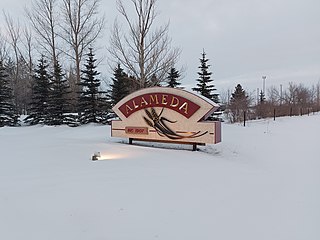
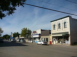
Alameda is a town in south-eastern Saskatchewan, Canada, approximately 50 km east of Estevan. A translation of Alameda from Spanish is "Poplar Grove" or "Tree Lined Avenue". One popular story is that the town was named for Alameda, California although there is no written documentation to support this. Alameda had a population of 369 in the Canada Census of 2016.

<span class="mw-page-title-main">Hague, Saskatchewan</span> Town in Saskatchewan, Canada

Hague is a small rural town in Saskatchewan, Canada, located approximately 47 kilometers north of Saskatoon. Hague was established in the late nineteenth century as a Mennonite community farming the fertile land in the area.

<span class="mw-page-title-main">Ponteix</span> Town in Saskatchewan, Canada

Ponteix is a town in southwestern Saskatchewan, Canada, 86 kilometres (53 mi) southeast of Swift Current. It is on Highway 628, just north of Highway 13.

<span class="mw-page-title-main">Saskatchewan Highway 11</span> Highway in Saskatchewan, Canada

Highway 11 is a major north-south highway in Saskatchewan, Canada that connects the province's three largest cities: Regina, Saskatoon and Prince Albert. It is a structural pavement major arterial highway which is approximately 391 kilometres (243 mi) long. It is also known as the Louis Riel Trail (LRT) after the 19th century Métis leader. It runs from Highway 1 in Regina until Highway 2 south of Prince Albert. Historically the southern portion between Regina and Saskatoon was Provincial Highway 11, and followed the Dominion Survey lines on the square, and the northern portion between Saskatoon and Prince Albert was Provincial Highway 12.

<span class="mw-page-title-main">Waldheim, Saskatchewan</span> Town in Saskatchewan, Canada

Waldheim is a town of 1,035 residents in the Rural Municipality of Laird No. 404, in the Canadian province of Saskatchewan, 57 kilometres (35 mi) north of Saskatoon. Waldheim is located on Highway 312 in central Saskatchewan, the "Heart of the Old North-Wes". Fort Carlton, Batoche, Battle of Fish Creek, and Seager Wheeler's Maple Grove Farm are all near Waldheim.

<span class="mw-page-title-main">Watson, Saskatchewan</span> Town in Saskatchewan, Canada

Watson is a town of 777 residents in the Rural Municipality of Lakeside No. 338, in the Canadian province of Saskatchewan. Watson is located on the intersection of Highway 5 and Highway 6, the Canam Highway. Watson is approximately the same distance from Saskatoon which is to the west, and Regina to the south, which gives rise to its town motto, "Industrial Crossroads of Saskatchewan".

<span class="mw-page-title-main">St. Brieux</span> Town in Saskatchewan, Canada

St. Brieux is a town in the Canadian province of Saskatchewan. It is located near Highway 368 and Highway 779. St. Brieux is located north of the village of Lake Lenore on the eastern shore of St. Brieux Lake. St. Brieux Regional Park and Golf Course is adjacent to the west side of the town.

Big River is a town located on the southern end of Cowan Lake in north central Saskatchewan, Canada. It is just north of Saskatchewan's extensive grain belt on Highway 55 and about 16 kilometres (10 mi) west of Prince Albert National Park. Delaronde Lake is accessed east of the town. Big River is approximately 132 kilometres (82 mi) from Prince Albert.

<span class="mw-page-title-main">Meota</span> Village in Saskatchewan, Canada

Meota is a village in the Canadian province of Saskatchewan within the Rural Municipality of Meota No. 468 and Census Division No. 17. The village name is derived from the Cree phrase Meotate or Mo-Was-In-Ota, meaning "good place to camp" or "it is good here."

<span class="mw-page-title-main">Rural Municipality of Rosthern No. 403</span> Rural municipality in Saskatchewan, Canada

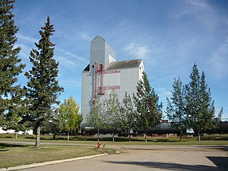
The Rural Municipality of Rosthern No. 403 is a rural municipality (RM) in the Canadian province of Saskatchewan within Census Division No. 15 and SARM Division No. 5. It is located in the central portion of the province north of the City of Saskatoon.

<span class="mw-page-title-main">Rural Municipality of Duck Lake No. 463</span> Rural municipality in Saskatchewan, Canada

The Rural Municipality of Duck Lake No. 463 is a rural municipality (RM) in the Canadian province of Saskatchewan within Census Division No. 15 and SARM Division No. 5.

References

  1. "2011 Community Profiles". Statistics Canada. Government of Canada. Archived from the original on 26 December 2018. Retrieved 2 August 2014.
  2. National Archives, Archivia Net, Post Offices and Postmasters, archived from the original on 6 October 2006, retrieved 2 August 2007
  3. Government of Saskatchewan, MRD Home. "Municipal Directory System". Archived from the original on 15 January 2016. Retrieved 2 August 2014.
  4. Canadian Textiles Institute. (2005), CTI Determine your provincial constituency, archived from the original on 11 September 2007
  5. Commissioner of Canada Elections, Chief Electoral Officer of Canada (2005), Elections Canada On-line, archived from the original on 21 April 2007, retrieved 2 August 2007
  6. Rosthern (Saskatchewan, Canada). Global Anabaptist Mennonite Encyclopedia.
  7. "Rosthern". Encyclopedia of Saskatchewan. Canadian Plains Research Center, University of Regina. 2006. Archived from the original on 18 April 2016. Retrieved 13 May 2016.
  8. Russell, E. T. (1975), What's in a Name?, Saskatoon, Sk: Western Producer Prairie Books, p. 276, ISBN   1-894022-92-0
  9. Barry, Bill (2003), People Places Contemporary Saskatchewan Placenames, Regina, Canada: Print West communications, p. 230, ISBN   1-894022-92-0
  10. http://www.historicplaces.ca/visit-visite/affichage-display.aspx?id=1576 Archived 2012-02-24 at the Wayback Machine Canadian Register of Historic Places.
  11. "Valley Regional Park (Rosthern Section)". Canadian Geographical Names Database. Government of Canada. Retrieved 23 September 2023.
  12. "Golf, Regional Park Campground, Municipal / Regional Park". Tourism Saskatchewan. Government of Saskatchewan. Retrieved 24 September 2023.
  13. "Valley". Regional Parks of Saskatchewan. Saskatchewan Regional Parks. Retrieved 24 September 2023.
  14. "Valley Regional Park Golf Club". Golf Canada. Golf Canada. Retrieved 24 September 2023.
  15. "Population and dwelling counts: Canada, provinces and territories, census divisions and census subdivisions (municipalities), Saskatchewan". Statistics Canada. 9 February 2022. Archived from the original on 5 September 2022. Retrieved 1 April 2022.
  16. "2021 Community Profiles". 2021 Canadian Census . Statistics Canada. 4 February 2022. Retrieved 27 April 2022.
  17. "2016 Community Profiles". 2016 Canadian Census . Statistics Canada. 12 August 2021. Retrieved 5 June 2017.
  18. "2011 Community Profiles". 2011 Canadian Census . Statistics Canada. 21 March 2019. Retrieved 1 July 2012.
  19. "2006 Community Profiles". 2006 Canadian Census . Statistics Canada. 20 August 2019.
  20. "2001 Community Profiles". 2001 Canadian Census . Statistics Canada. 18 July 2021.