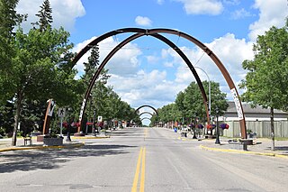
Yorkton is a city located in south-eastern Saskatchewan, Canada. It is about 450 kilometres (280 mi) north-west of Winnipeg and 300 kilometres (190 mi) south-east of Saskatoon and is the sixth largest city in the province.

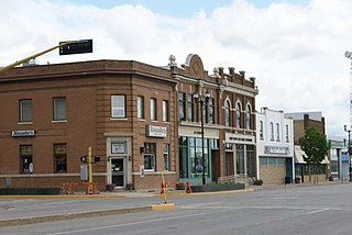
Melville is a small city in the east-central portion of Saskatchewan, Canada. The city is 145 kilometres (90 mi) northeast of the provincial capital of Regina and 45 kilometres (28 mi) southwest of Yorkton. Melville is bordered by the rural municipalities of Cana No. 214 and Stanley No. 215. Its population at the 2016 census was 4,562, making it Saskatchewan's smallest city. It is also home of hockey's Melville Millionaires, who compete in the Saskatchewan Junior Hockey League, and baseball's Melville Millionaires, who competed in the Western Canadian Baseball League until 2019.
Sturgis is a town of 620 people in east central Saskatchewan, Canada. The Town of Sturgis is 95 km north of Yorkton on Highway 9. It is located in the Assiniboine river valley near the lakes and woods region of the province.

Grenfell is a town in Southern Saskatchewan, Canada. It is situated at the junction of Highway 47 and the Trans-Canada Highway 1 80 miles (130 km) east of Regina, the provincial capital. It is 15 miles (24 km) south of the Qu'Appelle Valley where Crooked Lake Provincial Park and Bird's Point Resort are popular beach destinations in summer and are accessed by Highway 47.

Esterhazy is a town in the south-eastern part of the Canadian province of Saskatchewan, 83 kilometres (52 mi) south-east of Yorkton along Highways 22 and 80. The town is in the Rural Municipality of Fertile Belt No. 183.
Binscarth is an unincorporated urban community in the Municipality of Russell – Binscarth, Manitoba. It is located approximately 167 km (104 mi) northwest of Brandon, 16 km (9.9 mi) south from Russell, and 16 km (10 mi) east of the Saskatchewan border.
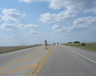
Highway 16 is a provincial highway in the Canadian province of Saskatchewan. It is the Saskatchewan section of the Yellowhead Highway, and also the Trans-Canada Highway Yellowhead section. The main purpose of this highway is to connect Saskatchewan with Canadian cities such as Edmonton and Winnipeg. The highway runs from the Alberta boundary in Lloydminster to the Manitoba boundary near Marchwell. Major cities it passes through are Saskatoon, North Battleford in the central part of the province, Yorkton in the far east and Lloydminster to the far west.
Arran is a special service area in the Canadian province of Saskatchewan within the Rural Municipality of Livingston No. 331 and Census Division No. 9. It held village status between 1916 and 2022.

Division No. 5 is one of eighteen census divisions in the province of Saskatchewan, Canada, as defined by Statistics Canada. It is located in the east-southeastern part of the province, bordering Manitoba. The most populous community in this division is Melville.
Saltcoats is a town in east-central Saskatchewan near the Manitoba border in Canada. The town's population was 474 in 2011. It was built in the late 19th century, and its economy was driven by the railway. There is no longer passenger service to the town.
Russell is an unincorporated urban community in the Municipality of Russell – Binscarth, Manitoba.
Langenburg is a town in the rural municipality of Langenburg No. 181, located within the Saskatchewan Association of Rural Municipalities SARM Division No. 1 and Census Division No. 5, in the Canadian province of Saskatchewan.

Highway 9 is a paved, undivided provincial highway in the Canadian province of Saskatchewan. It runs from North Dakota Highway 8 at the US border near Port of Northgate until it transitions into Provincial Road 283 at the Manitoba provincial boundary.
The Saskota Flyway is known as the International Road to Adventure, because it takes you from Hudson Bay, Saskatchewan, all the way south to Bismarck, North Dakota.
Calder is a village in the Canadian province of Saskatchewan within the Rural Municipality of Calder No. 241 and Census Division No. 9. The village lies approximately 56 km east of the City of Yorkton and 35 km west of Roblin, Manitoba, approximately 5 km south of Highway 8 and Highway 10.

Bienfait is a town in Saskatchewan on Highway 18 that is 14 kilometres (8.7 mi) east of Estevan. It is 30 kilometres (19 mi) north-west of the town of North Portal, which is next to the Canada–United States border and is also 10 kilometres (6.2 mi) south of Estevan. It is surrounded by the RM of Coalfields.
Churchbridge is a town in the province of Saskatchewan, Canada, located at the junction of the Yellowhead Highway, and Highway 80. Churchbridge is a part of the rural municipality of Churchbridge 211, which is located within Saskatchewan Association of Rural Municipalities (SARM) Division No. 1 and census division Number 5.

Herbert is a town located in the Rural Municipality of Morse No. 165, in southwest Saskatchewan, Canada. The community is 48 km east of the city of Swift Current, and 197 km west of Regina, the provincial capital, on the Trans-Canada Highway. Its population as of 2016 was 856.
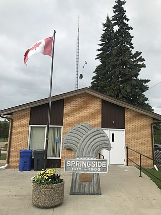
Springside is a town in Saskatchewan, Canada within Rural Municipality of Orkney No. 244. It is located about 24km northwest of the city of Yorkton along the Yellowhead Highway.

Broadview is a community in Saskatchewan along the Highway 1, the Trans-Canada Highway, 155 kilometres (96 mi) east of Regina. The local economy is based mainly on agriculture. It is also the administrative headquarters of the Rural Municipality of Elcapo No. 154

The Rural Municipality of Saltcoats No. 213 is a rural municipality (RM) in the Canadian province of Saskatchewan within Census Division No. 5 and SARM Division No. 1. It is located in the east-central portion of the province.


