
The Rural Municipality of Invergordon No. 430 is a rural municipality (RM) in the Canadian province of Saskatchewan within Census Division No. 15 and SARM Division No. 5. It is located west of the city of Melfort.
The Rural Municipality of Montmartre No. 126 is a rural municipality (RM) in the Canadian province of Saskatchewan within Census Division No. 6 and SARM Division No. 1. It is located in the southeast portion of the province along Highway 48.
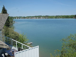
Crystal Lake is an organized hamlet within the Rural Municipality (RM) of Keys No. 303 in the Canadian province of Saskatchewan. It is also recognized as part of a designated place by Statistics Canada. The organized hamlet is on the majority of the shores of Crystal Lake, 1.0 km (0.62 mi) west of Highway 9 and approximately 70 km (43 mi) north of the City of Yorkton. The second part of the designated place is on the balance of the shores of Crystal Lake within the adjacent RM of Buchanan No. 304.

Maryfield is a village in the Canadian province of Saskatchewan within the Rural Municipality of Maryfield No. 91 and Census Division No. 1. The village lies south of the intersection of Highway 48 and Highway 600 and is about 8 kilometres (5.0 mi) west of the Manitoba border. It is a junction point on the Canadian National Railway between the main line heading northwest towards Regina and a branch line heading southwest toward Carlyle and Lampman.
Vibank is a village in the Canadian province of Saskatchewan within the Rural Municipality of Francis No. 127 and Census Division No. 6. It is accessed from Highway 48.

Fairlight is a village in the Canadian province of Saskatchewan within the Rural Municipality of Maryfield No. 91 and Census Division No. 1. The village lies just south of Provincial Highway 48 and the Canadian National Railway, about a kilometre west of Highway 8.
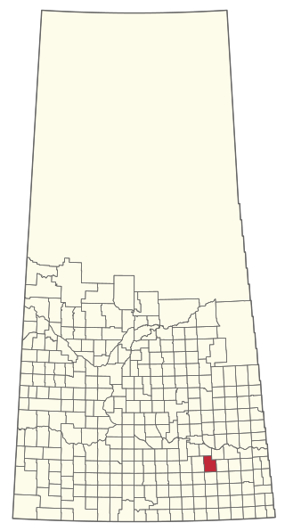
Kennedy is a village in the Canadian province of Saskatchewan within the Rural Municipality of Wawken No. 93 and Census Division No. 1. The village lies just south of Provincial Highway 48 about 3 km west of Highway 9.
Walsh is a hamlet in Alberta, Canada within Cypress County.
Josephburg is a hamlet in Alberta, Canada within Strathcona County. It is located on Highway 830, 6.5 kilometres (4.0 mi) east of Fort Saskatchewan. It is near Alberta's Industrial Heartland, home to petrochemical industries.
Chortitz is a hamlet in Coulee Rural Municipality No. 136, Saskatchewan, Canada. Listed as a designated place by Statistics Canada, the hamlet had a population of 26 in the Canada 2006 Census. The hamlet is located on Highway 379, about 25 km south of Swift Current.
Wishart is a hamlet in Emerald Rural Municipality No. 277 in the Canadian province of Saskatchewan. It is listed as a designated place by Statistics Canada. The hamlet had a population of 95 in the Canada 2006 Census. It previously held the status of village until January 1, 2002. The hamlet is located 32 km southwest of the village of Elfros at the intersection of highway 639 and highway 743.

Wymark is a hamlet in the Rural Municipality of Swift Current No. 137, Saskatchewan, Canada. Listed as a designated place by Statistics Canada, the hamlet had a population of 144 in the Canada 2006 Census. The hamlet is located on Highway 379 about 2 km east of Highway 4, and 15 km south of Swift Current.
Wiseton is a village in the Canadian province of Saskatchewan within the Rural Municipality of Milden No. 286 and Census Division No. 12. The village is located at the junction of Highway 44 and Highway 664 approximately 40 km southwest of Outlook.

The Rural Municipality of Golden West No. 95 is a rural municipality (RM) in the Canadian province of Saskatchewan within Census Division No. 1 and SARM Division No. 1. It is located in the southeast portion of the province.

The Rural Municipality of Chester No. 125 is a rural municipality (RM) in the Canadian province of Saskatchewan within Census Division No. 5 and SARM Division No. 1. It is located in the southeast portion of the province.

The Rural Municipality of Cote No. 271 is a rural municipality (RM) in the Canadian province of Saskatchewan within Census Division No. 9 and SARM Division No. 4.

The Rural Municipality of Hazel Dell No. 335 is a rural municipality (RM) in the Canadian province of Saskatchewan within Census Division No. 9 and SARM Division No. 4.

The Rural Municipality of Lakeview No. 337 is a rural municipality (RM) in the Canadian province of Saskatchewan within Census Division No. 10 and SARM Division No. 4.

The Rural Municipality of Paddockwood No. 520 is a rural municipality (RM) in the Canadian province of Saskatchewan within Census Division No. 15 and SARM Division No. 5.

Cando is a hamlet in Rosemount Rural Municipality No. 378, Saskatchewan, Canada.


