Gerald | |
---|---|
Village of Gerald | |
Coordinates: 50°39′50″N101°47′35″W / 50.664°N 101.793°W | |
Country | Canada |
Province | Saskatchewan |
Region | Southeast |
Census division | 5 |
Rural Municipality | Spy Hill No. 152 |
Post office | 1909-2003 |
Government | |
• Type | Municipal |
• Governing body | Gerald Village Council |
• Mayor | Trevor Rieger |
• Administrator | Susan Gawryluk |
• MP | Robert Kitchen |
• MLA | Dan D'Autremont |
Area | |
• Total | 0.80 km2 (0.31 sq mi) |
Population (2016) | |
• Total | 136 |
• Density | 170.6/km2 (442/sq mi) |
Time zone | UTC-6 (CST) |
Postal code | S0A 1B0 |
Area code | 306 |
Highways | Highway 636 |
Railways | Canadian National Railway |
[1] [2] [3] [4] |
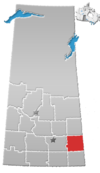
Gerald (2016 population: 136) is a village in the Canadian province of Saskatchewan within the Rural Municipality of Spy Hill No. 152 and Census Division No. 5.
Gerald incorporated as a village on March 25, 1953. [5]
In the 2021 Census of Population conducted by Statistics Canada, Gerald had a population of 129 living in 55 of its 68 total private dwellings, a change of -5.1% from its 2016 population of 136. With a land area of 0.74 km2 (0.29 sq mi), it had a population density of 174.3/km2 (451.5/sq mi) in 2021. [8]
In the 2016 Census of Population, the Village of Gerald recorded a population of 136 living in 58 of its 65 total private dwellings, a 16.2% change from its 2011 population of 114. With a land area of 0.8 km2 (0.31 sq mi), it had a population density of 170.0/km2 (440.3/sq mi) in 2016. [9]
Albertville is a village in the Canadian province of Saskatchewan within the Rural Municipality of Garden River No. 490 and is in Census Division No. 15. It is approximately 25 km northeast of the City of Prince Albert.
The Rural Municipality of Colonsay No. 342 is a rural municipality (RM) in the Canadian province of Saskatchewan within Census Division No. 11 and SARM Division No. 5. it is located east of the City of Saskatoon.
The Rural Municipality of McCraney No. 282 is a rural municipality (RM) in the Canadian province of Saskatchewan within Census Division No. 11 and SARM Division No. 5. It is located in the south-central portion of the province.
Sedley is a village in the Canadian province of Saskatchewan within the Rural Municipality of Francis No. 127 and Census Division No. 6. It is 40 kilometres (25 mi) southeast of the city of Regina on Highway 33. This village is located at the intersection of Highway 33 and Highway 620. Sedley lies in a wheat-producing agricultural district.
The Rural Municipality of Big Stick No. 141 is a rural municipality (RM) in the Canadian province of Saskatchewan within Census Division No. 8 and SARM Division No. 3. It is located in southwest portion of the province.
The Rural Municipality of The Gap No. 39 is a rural municipality (RM) in the Canadian province of Saskatchewan within Census Division No. 2 and SARM Division No. 2.
The Rural Municipality of Indian Head No. 156 is a rural municipality (RM) in the Canadian province of Saskatchewan within Census Division No. 6 and SARM Division No. 1. It is located in the southeast portion of the province.
Carievale is a village in the Canadian province of Saskatchewan within the Rural Municipality of Argyle No. 1 and Census Division No. 1. The village lies at the intersection of Highway 8 and Highway 18.
Coderre ) is a village in the Canadian province of Saskatchewan within the Rural Municipality of Rodgers No. 133 and Census Division No. 7. The village is located approximately 85 km southwest of the City of Moose Jaw on Highway 627.
Killaly is a village in the Canadian province of Saskatchewan within the Rural Municipality of Grayson No. 184 and Census Division No. 5. The village is about 23 kilometres (14 mi) south of the city of Melville on Highway 47 at the intersection of Highway 22 and 47.
Bjorkdale is a village in the Canadian province of Saskatchewan within the Rural Municipality of Bjorkdale No. 426 and Census Division No. 14. The village is at the junctions of Highways 23, 679, and 776, approximately 78 kilometres (48 mi) east of the city of Melfort.
Fillmore is a village in the Canadian province of Saskatchewan within the Rural Municipality of Fillmore No. 96 and Census Division No. 2.
Glenside is a village in the Canadian province of Saskatchewan within the Rural Municipality of Rudy No. 284 and Census Division No. 11. The village is located on Highway 219 approximately 20 km east of the Town of Outlook.
Kelliher is a village in the Canadian province of Saskatchewan within the Rural Municipality of Kellross No. 247 and Census Division No. 10. The village is located about 140 km north of the City of Regina.
Smeaton is a village in the Canadian province of Saskatchewan within the Rural Municipality of Torch River No. 488 and Census Division No. 14. It is at the foot of Hanson Lake Road, which ends at Creighton near Flin Flon, Manitoba). Narrow Hills Provincial Park is 70 km north.
The Rural Municipality of Coulee No. 136 is a rural municipality (RM) in the Canadian province of Saskatchewan within Census Division No. 7 and SARM Division No. 3. The RM is located in the southwest portion of the province, southeast of the City of Swift Current.
Codette is a village in the Canadian province of Saskatchewan within the Rural Municipality of Nipawin No. 487 and Census Division No. 14. The village is located 10 km south of Nipawin at the junction of Highway 35 and Highway 789.
Chorney Beach is a resort village in the Canadian province of Saskatchewan within Census Division No. 10. It is on the shores of Fishing Lake in the Rural Municipality of Foam Lake No. 276.
The Rural Municipality of Bengough No. 40 is a rural municipality (RM) in the Canadian province of Saskatchewan within Census Division No. 2 and SARM Division No. 2. It is located in the southeast portion of the province.
The Rural Municipality of Reford No. 379 is a rural municipality (RM) in the Canadian province of Saskatchewan within Census Division No. 13 and SARM Division No. 6.