Prelate, Saskatchewan

Last updated • 2 min readFrom Wikipedia, The Free Encyclopedia

Prelate
Prelate, Saskatchewan 2011.jpg
Grain elevator in Prelate
Canada Saskatchewan location map.svg
Red pog.svg
Prelate
Canada location map 2.svg
Red pog.svg
Prelate
Coordinates: 50°51′07″N109°24′32″W / 50.852°N 109.409°W / 50.852; -109.409
Country Canada
Province Saskatchewan
Region South-west Saskatchewan
Census division 8
Rural Municipality Happyland
Settled1908
Village (incorporated)1913
Post office founded1914
Special service area (dissolved) [1] July 1, 2024
Government
   Mayor Rodney Bosch
  AdministratorJennifer Baldwin
  Governing bodyPrelate Village Council
Area
  Total
0.87 km2 (0.34 sq mi)
Population
 (2021)
  Total
116
  Density144.5/km2 (374/sq mi)
Time zone CST
Postal code
S0N 2B0
Area code 306
Highways Highway 32
[2] [3] [4] [5]

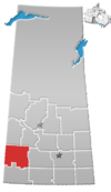
Prelate (2021 pop.: 116) is a special service area in the Canadian province of Saskatchewan within the Rural Municipality of Happyland No. 231 and Census Division No. 8. Formerly an incorporated village, it is 12 kilometres (7.5 mi) east of Leader and 146 kilometres (91 mi) northwest of Swift Current just off Highway 32.

Contents

History

Prelate was first settled in 1908. [6] Prelate incorporated as a village on October 25, 1913. [7] It dissolved on July 1, 2024 becoming a special service area under the jurisdiction of the Rural Municipality of Happyland No. 231. [1]

Historical sites

Demographics

Population history
(1981–2016)
YearPop.±%
1981317    
1986254−19.9%
1991191−24.8%
1996 189−1.0%
2001 164−13.2%
2006 126−23.2%
2011 124−1.6%
2016 154+24.2%
Source: Statistics Canada via Saskatchewan Bureau of Statistics [10] [11]

In the 2021 Census of Population conducted by Statistics Canada, Prelate had a population of 116 living in 52 of its 60 total private dwellings, a change of

In the 2016 Census of Population, the Village of Prelate recorded a population of 154 living in 62 of its 77 total private dwellings, a

Education

The Islamic Academy of Saskatchewan, [14] an Islamic boarding school for boys, opened in 2011 in the former St. Angela's Convent and Academy building. [8]

Notable people

See also

Related Research Articles

<span class="mw-page-title-main">Annaheim, Saskatchewan</span> Village in Saskatchewan, Canada

Annaheim is a village in the Canadian province of Saskatchewan within the Rural Municipality of St. Peter No. 369 and Census Division No. 15. The village is located about 125 km east of the City of Saskatoon, at the junction of provincial Highway 756 and Highway 779. Annaheim hosts the offices of the Rural Municipality of St. Peter No. 369.

Quill Lake is a village in the Canadian province of Saskatchewan within the Rural Municipality of Lakeside No. 338 and Census Division No. 10. It is 170 km east of Saskatoon and 200 km northeast of Regina.

Marengo is a village in the Canadian province of Saskatchewan within the Rural Municipality of Milton No. 292 and Census Division No. 13. It is about 45 km (28 mi) west of Kindersley. It is located within the Sun West School Division.

Albertville is a village in the Canadian province of Saskatchewan within the Rural Municipality of Garden River No. 490 and is in Census Division No. 15. It is approximately 25 km northeast of the City of Prince Albert.

<span class="mw-page-title-main">Alvena</span> Village in Saskatchewan, Canada

Alvena is a village in the Canadian province of Saskatchewan within the Rural Municipality of Fish Creek No. 402 and Census Division No. 15. It is approximately 60 kilometres (37 mi) northeast of Saskatoon.
<span class="mw-page-title-main">Prud'homme, Saskatchewan</span> Village in Saskatchewan, Canada

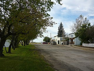
Prud'homme is a village in the Canadian province of Saskatchewan within the Rural Municipality of Bayne No. 371 and Census Division No. 15. It is approximately 60 kilometres (37 mi) northeast of Saskatoon. Prud'homme was first known by the name of Bluebell Ranch, then Lally Siding. In 1905 the Canadian Northern Railway came through and renamed it Marcotte's Crossing; two years later it became known as Howell; and finally, in 1922, it was named after the Suffragan Bishop of Prince-Albert–Saskatoon, Joseph H. Prud'homme. The community is mostly based on agriculture.

<span class="mw-page-title-main">Rural Municipality of Happyland No. 231</span> Rural municipality in Saskatchewan, Canada

The Rural Municipality of Happyland No. 231 is a rural municipality (RM) in the Canadian province of Saskatchewan within Census Division No. 8 and SARM Division No. 3. Located in the southwest portion of the province, it is adjacent to the Alberta boundary and south of the South Saskatchewan River.

Dysart is a village in the Canadian province of Saskatchewan within the Rural Municipality of Lipton No. 217 and Census Division No. 6. The village is located east of Cupar and northwest of Lipton. It is about 91 kilometres (57 mi) north of the city of Regina. The village was named for Dysart, Fife in Scotland.
<span class="mw-page-title-main">Lucky Lake</span> Village in Saskatchewan, Canada

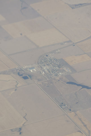
Lucky Lake is a village in the Canadian province of Saskatchewan within the Rural Municipality of Canaan No. 225 and Census Division No. 7. The Village is located at the junction of Highway 42, Highway 45 and Highway 646 approximately 90 km northeast of Swift Current, Saskatchewan.

Mendham is a village in the Canadian province of Saskatchewan within the Rural Municipality of Happyland No. 231 and Census Division No. 8.

<span class="mw-page-title-main">Rural Municipality of Carmichael No. 109</span> Rural municipality in Saskatchewan, Canada

The Rural Municipality of Carmichael No. 109 is a rural municipality (RM) in the Canadian province of Saskatchewan within Census Division No. 4 and SARM Division No. 3.

St. Benedict is a village in the Canadian province of Saskatchewan within the Rural Municipality of Three Lakes No. 400 and Census Division No. 15. Located along the Carlton Trail, it is 56 kilometres (35 mi) north of the city of Humboldt off Highway 20.

<span class="mw-page-title-main">Rural Municipality of Wallace No. 243</span> Rural municipality in Saskatchewan, Canada

The Rural Municipality of Wallace No. 243 is a rural municipality (RM) in the Canadian province of Saskatchewan within Census Division No. 9 and SARM Division No. 4. It is located in the east-central portion of the province.

Senlac is a village in the Canadian province of Saskatchewan within the Rural Municipality of Senlac No. 411 and Census Division No. 13. The village was named after Senlac Hill, the location of the Battle of Hastings in England in 1066.

Windthorst is a village in the Canadian province of Saskatchewan within the Rural Municipality of Chester No. 125 and Census Division No. 5. It is accessed from Highway 48.

<span class="mw-page-title-main">Rural Municipality of Grant No. 372</span> Rural municipality in Saskatchewan, Canada

The Rural Municipality of Grant No. 372 is a rural municipality (RM) in the Canadian province of Saskatchewan within Census Division No. 15 and SARM Division No. 5. The RM's office is located in Vonda.
<span class="mw-page-title-main">Rural Municipality of Buffalo No. 409</span> Rural municipality in Saskatchewan, Canada

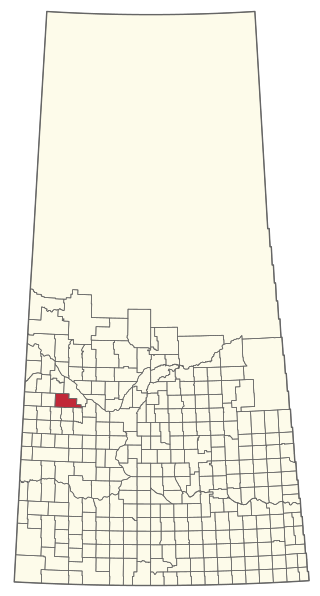
The Rural Municipality of Buffalo No. 409 is a rural municipality (RM) in the Canadian province of Saskatchewan within Census Division No. 13 and SARM Division No. 6.

<span class="mw-page-title-main">Rural Municipality of Fertile Belt No. 183</span> Rural municipality in Saskatchewan, Canada

The Rural Municipality of Fertile Belt No. 183 is a rural municipality (RM) in the Canadian province of Saskatchewan within Census Division No. 5 and SARM Division No. 1.

<span class="mw-page-title-main">Rural Municipality of McLeod No. 185</span> Rural municipality in Saskatchewan, Canada

The Rural Municipality of McLeod No. 185 is a rural municipality (RM) in the Canadian province of Saskatchewan within Census Division No. 5 and SARM Division No. 1. It is located in the southeast portion of the province.

<span class="mw-page-title-main">Rural Municipality of Newcombe No. 260</span> Rural municipality in Saskatchewan, Canada

The Rural Municipality of Newcombe No. 260 is a rural municipality (RM) in the Canadian province of Saskatchewan within Census Division No. 8 and SARM Division No. 3. It is located in the west-central portion of the province.

References

  1. 1 2 "The Saskatchewan Gazette: Restructuring of the Village of Prelate". Government of Saskatchewan. June 21, 2024. p. 789. Retrieved December 7, 2024.
  2. National Archives, Archivia Net, Post Offices and Postmasters , retrieved 2011-08-01
  3. Government of Saskatchewan, MRD Home. "Municipal Directory System" . Retrieved 2003-11-16.
  4. Canadian Textiles Institute. (2005), CTI Determine your provincial constituency, archived from the original on 2007-09-11
  5. Commissioner of Canada Elections, Chief Electoral Officer of Canada (2005), Elections Canada On-line
  6. Prelate History Book Committee (1990), Our Heritage Recalled, Prelate, Saskatchewan, 1908-1990, Battleford, SK: Marian Press Ltd.
  7. "Urban Municipality Incorporations". Saskatchewan Ministry of Government Relations. Archived from the original on October 15, 2014. Retrieved June 1, 2020.
  8. 1 2 The B. C. Catholic, August 30, 2011. "Saskatchewan Catholic school to become Islamic boys' school" . Retrieved 4 September 2013.{{cite web}}: CS1 maint: multiple names: authors list (link) CS1 maint: numeric names: authors list (link)
  9. "Blumenfeld Church" . Retrieved 2013-11-17.
  10. "Saskatchewan Census Population" (PDF). Saskatchewan Bureau of Statistics. Archived from the original (PDF) on September 24, 2015. Retrieved May 31, 2020.
  11. "Saskatchewan Census Population". Saskatchewan Bureau of Statistics. Retrieved May 31, 2020.
  12. "Population and dwelling counts: Canada, provinces and territories, census divisions and census subdivisions (municipalities), Saskatchewan". Statistics Canada. February 9, 2022. Retrieved April 1, 2022.
  13. "Population and dwelling counts, for Canada, provinces and territories, and census subdivisions (municipalities), 2016 and 2011 censuses – 100% data (Saskatchewan)". Statistics Canada. February 8, 2017. Retrieved May 30, 2020.
  14. "Islamic Academy of Saskatchewan" . Retrieved 4 September 2013.

50°51′07″N109°24′32″W / 50.852°N 109.409°W / 50.852; -109.409