Kenosee Lake, Saskatchewan

Last updated

Kenosee Lake
We-non-cha
Village of Kenosee Lake
Kenosee Lake downtown.jpg
Kenosee Lake
Canada Saskatchewan location map.svg
Red pog.svg
Kenosee Lake
Coordinates: 49°49′59″N102°17′7″W / 49.83306°N 102.28528°W / 49.83306; -102.28528
Country Flag of Canada (Pantone).svg  Canada
Province Flag of Saskatchewan.svg  Saskatchewan
Region South-east
Census division 1
Rural Municipality Wawken No. 93
Post office Founded1908-07-01
Government
  Type Municipal
  Governing body Kenosee Lake Village Council
   Mayor Mark Doty
   Administrator Andrea Kosior
   MP Robert Kitchen
   MLA Dan D'Autremont
Area
  Total0.35 km2 (0.14 sq mi)
Population
 (2016)
  Total234
  Density662.9/km2 (1,717/sq mi)
Time zone UTC-6 (CST)
Postal code
S0C 2S0
Area code 306
Highways Saskatchewan Highway 9 (jct).svg Hwy 9
Saskatchewan Highway 209 (jct).svg Hwy 209
Railways None
[1] [2] [3] [4]

Kenosee Lake (2016 population: 234) is a village in the Canadian province of Saskatchewan within the Rural Municipality of Wawken No. 93 and Census Division No. 1.

Contents

Tumble Inn Dance Hall, built in 1909 and restored in 1991 Tumble Inn Kenosee Lake.jpg
Tumble Inn Dance Hall, built in 1909 and restored in 1991
Kenosee Gardens Dance Hall, built in 1933 Kenosee Gardens.jpg
Kenosee Gardens Dance Hall, built in 1933
Downtown Kenosee Lake Kenosee Lake 03.jpg
Downtown Kenosee Lake
Piers at Kenosee Lake Kenosee Lake 01.jpg
Piers at Kenosee Lake

The village is situated on Moose Bay, which is on the north-east part of Kenosee Lake, just off Highway 9, on a forested plateau called Moose Mountain Upland. It is entirely surrounded by Moose Mountain Provincial Park, which was established in 1931. Kenosee Lake was incorporated as a village on 1 October 1987. [5] The closest town is Carlyle, which is about 24 kilometres south along Highway 9.

History

Long before Kenosee Lake became an official village, the area around the lake, which had been called Fish Lake until 1932, [6] was quite popular as a resort community. In the 1890s, Fred Christopher and sons, who were German immigrants and had a homestead seven miles east of Fish Lake, and the Fripp brothers, Harold and Percy who owned the land that the village of Kenosee Lake currently sits on, agreed to cut a trail through the bush from Fish Lake to Cannington Manor. That trail became known as Christopher Trail and is still used today as the main gravel road between Kenosee Lake and Cannington Manor. The first actual road to the lake, though, was built from a spot about 3 miles west of Carlyle past the lakes of McGurk, Stevenson, and Hewitt to the west side of Fish Lake in 1905. On that west side of the lake was another resort called Arcola Resort. For a variety of reasons, such as a lack of potable water and when the new Highway 9 was built in the early 1930s, it went to the east side of the lake, it wasn't as successful as the resorts on the north-east shore. By the 1940s, the last cottage was gone. That spot on the west side of the lake is now occupied by three Christian summer camps.

The Christopher family built the Saint Rest Resort in 1897 on Percy Fripp's land and then in 1899, bought the land. About that same time, several dance halls, stores, and cabins sprung up along the beaches. The oldest surviving dance hall is Tumble Inn, which was built in 1909 by the Christopher family. The Inn was part of the Pioneer Host hotel, also built and owned by the Christophers. The large bay on the north-west portion of the lake, Christopher Bay, is named after that early pioneering family. Tumble Inn is located on Waseca Avenue and was restored in 1991.

In 1913, Fred Christopher sold 40 of the 42 acres he owned to Henry William Holquist "Hank" who immediately started expansion and upgrades to the resort. He built a new hotel, dance hall, and store, and was soon out-pacing the competing resort, Clarke's Resort which had been started six years prior when Ray Boilean Clarke bought 40 acres to the east in 1907. Holquist named his resort We-non-cha Summer Resort. By the late 1920s, there were two hotels and 60 cottages. In 1933, he built the Kenosee Gardens, which was the largest dance hall there. The Gardens, as it came to be known, attracted big names in the Big Band era. There was even a casino in the Gardens. Ray Boilean Clarke's health started to fail in the 1930s. His two sons, Hugh "Puddy" and Charlie Clarke took over day-to-day operations. Charlie, though, left the resort later in the 1930s to work on a nearby farm. Ray died in 1941 leaving his widow and son, Hugh, to tend the resort. Although now closed and in disrepair, Kenosee Gardens still stands overlooking the lake from the centre of the village.

In 1942, Clarke Resort's hotel burnt down. Holquist, who was by this time getting on in years, sold his We-non-cha Summer Resort to Hugh Clarke. Clarke soon absorbed the resort into his own, removed the name We-non-cha, and became the dominant resort in the region. In 1956, Kenosee Gardens was sold to Lawrence James Albert Hirtle. Hugh died in 1958. By 1959, much of the land was surveyed and subdivided into 200 lots, which sold quickly. At this time, the RM of Wawken built roads throughout the new subdivision. In the early 1970s, it was sold to Leipert & Jones. The village of Kenosee Lake sits mostly on the original Clarke, Hirtle lands. On 5 July 1978, the community became independent of the RM and named itself "We-non-cha". In 1981, it was renamed to the Village of Kenosee Lake. In 1987, it gained official village status. [7]

Demographics

Population history
(1981–2016)
YearPop.±%
1981114    
1986139+21.9%
1991163+17.3%
1996 202+23.9%
2001 182−9.9%
2006 194+6.6%
2011 258+33.0%
2016 234−9.3%
Source: Statistics Canada via Saskatchewan Bureau of Statistics [8] [9]

In the 2021 Census of Population conducted by Statistics Canada, Kenosee Lake had a population of 236 living in 105 of its 147 total private dwellings, a change of

In the 2016 Census of Population, the Village of Kenosee Lake recorded a population of 234 living in 117 of its 179 total private dwellings, a

Attractions and services

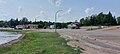
The village is at the heart of Moose Mountain Provincial Park and as such provides many of the park's services, such as a gas station, restaurant, convenience store, a private full-service campground, [12] [13] a church (Moose Mountain Church of Christ), [14] and a volunteer fire department. Nearby Kenosee, in and around the park, is full-service camping, 18-hole golf, miniature golf, a casino, [15] piers for fishing and boating, swimming, hiking, picnicking, Moose Mountain Chalet, the Kenosee Superslides, the Red Barn Market, [16] and accommodations, such as cabins. [17]

Sports

Kenosee Cubs logo Kenosee Cubs 03.jpg
Kenosee Cubs logo

The Kenosee Cubs of the Saskota Baseball League [18] play at the ball diamonds just west of the village in Moose Mountain Park.

See also

Related Research Articles

<span class="mw-page-title-main">Cannington (electoral district)</span> Provincial electoral district in Saskatchewan, Canada

Cannington is a provincial electoral district for the Legislative Assembly of Saskatchewan, Canada. Located in the extreme southeast corner of the province, this constituency was redrawn to include the former district of Souris for the 18th Saskatchewan general election in 1975.

<span class="mw-page-title-main">Kenosee Lake</span> Lake in Saskatchewan, Canada

Kenosee Lake is a closed-basin lake in south-east corner of the Canadian province of Saskatchewan. The lake lies in Moose Mountain Provincial Park in the heart of the Moose Mountain Upland, a forested plateau that rises about 200 metres above the surrounding prairie.

<span class="mw-page-title-main">Division No. 1, Saskatchewan</span> Census division in Saskatchewan in Canada

Division No. 1 is one of eighteen census divisions in the province of Saskatchewan, Canada, as defined by Statistics Canada. It is located in the southeast corner of the province, bordering Manitoba and North Dakota. The most populous community in this division is Estevan.

Kannata Valley is a resort village in the Canadian province of Saskatchewan within Census Division No. 6. It is on the shores of Last Mountain Lake in the Rural Municipality of Longlaketon No. 219. It is approximately 52 km (32 mi) northwest of Regina.

<span class="mw-page-title-main">Saskatchewan Highway 9</span> Highway in Saskatchewan, Canada

Highway 9 is a paved, undivided provincial highway in the Canadian province of Saskatchewan. It runs from North Dakota Highway 8 at the US border near Port of Northgate until it transitions into Provincial Road 283 at the Manitoba provincial boundary.

The Saskota Flyway is known as the International Road to Adventure, because it takes you from Hudson Bay, Saskatchewan, all the way south to Bismarck, North Dakota.

<span class="mw-page-title-main">Moose Mountain Provincial Park</span> Provincial park in Saskatchewan

Moose Mountain Provincial Park is a provincial park, located in south-eastern Saskatchewan 24 km north of the town of Carlyle on the Moose Mountain Upland. It is one of Saskatchewan's few parks with a community inside the park as there are several subdivisions with both year-round and seasonal residents. The village of Kenosee Lake is completely surrounded by the park but is not part of the park.

<span class="mw-page-title-main">Carlyle, Saskatchewan</span> Town in Saskatchewan, Canada

Carlyle is a town in the province of Saskatchewan, Canada. Carlyle is the largest town servicing the far south-eastern corner of Saskatchewan and as a result, has become the economic and services centre of the region. Estevan and Weyburn are the closest cities and both are a little over 100 kilometres away. Regina, the provincial capital, lies 200 km to the north-west.

<span class="mw-page-title-main">Manor, Saskatchewan</span> Village in Saskatchewan, Canada

Manor is a village in the Canadian province of Saskatchewan within the RM of Moose Mountain No. 63 and Census Division No. 1. The Manor Museum (1904) is designated a Municipal Heritage Property under the provincial Heritage Property Act.

<span class="mw-page-title-main">Cannington Lake</span> Organized hamlet in Saskatchewan, Canada

Cannington Lake, also known as Cannington Lake Resort, is a hamlet within the Rural Municipality of Wawken No. 93, Saskatchewan, Canada. Listed as a designated place by Statistics Canada, the hamlet had a population of 0 in the Canada 2011 Census.

Etters Beach is a resort village in the Canadian province of Saskatchewan within Census Division No. 11. It is on the west shore of Last Mountain Lake in the Rural Municipality of Big Arm No. 251.

Glen Harbour is a resort village in the Canadian province of Saskatchewan within Census Division No. 6. It is on the shores of Last Mountain Lake in the Rural Municipality of McKillop No. 220.

Pelican Pointe is a resort village in the Canadian province of Saskatchewan within Census Division No. 6. It is on the shores of Last Mountain Lake in the Rural Municipality of McKillop No. 220.

Sun Valley is a resort village in the Canadian province of Saskatchewan within Census Division No. 7. It is on the shores of Buffalo Pound Lake in the Rural Municipality of Marquis No. 191. It is south of the Resort Village of South Lake.

<span class="mw-page-title-main">Thode, Saskatchewan</span> Resort village in Saskatchewan, Canada

Thode is a resort village in the Canadian province of Saskatchewan within Census Division No. 11. It is on the shores of Blackstrap Lake in the Rural Municipality of Dundurn No. 314. It is east of the town of Dundurn.

Tobin Lake is a resort village in the Canadian province of Saskatchewan within Census Division No. 14. It is on the shores of Tobin Lake in the Rural Municipality of Moose Range No. 486. It is approximately 34 km (21 mi) northeast of Nipawin at the end of Highway 255, which is accessed via Highway 55.

<span class="mw-page-title-main">Rural Municipality of Moose Creek No. 33</span> Rural municipality in Saskatchewan, Canada

The Rural Municipality of Moose Creek No. 33 is a rural municipality (RM) in the Canadian province of Saskatchewan within Census Division No. 1 and SARM Division No. 1.

<span class="mw-page-title-main">Rural Municipality of Moose Mountain No. 63</span> Rural municipality in Saskatchewan, Canada

The Rural Municipality of Moose Mountain No. 63 is a rural municipality (RM) in the Canadian province of Saskatchewan within Census Division No. 1 and SARM Division No. 1. It is located in the south-east portion of the province.

<span class="mw-page-title-main">Rural Municipality of Wawken No. 93</span> Rural municipality in Saskatchewan, Canada

The Rural Municipality of Wawken No. 93 is a rural municipality (RM) in the Canadian province of Saskatchewan within Census Division No. 1 and SARM Division No. 1. It is located in the southeast portion of the province.

<span class="mw-page-title-main">Rural Municipality of Moose Range No. 486</span> Rural municipality in Saskatchewan, Canada

The Rural Municipality of Moose Range No. 486 is a rural municipality (RM) in the Canadian province of Saskatchewan within Census Division No. 14 and SARM Division No. 4.

Moose Mountain Upland, Moose Mountain Uplands, or commonly Moose Mountain, is a hilly plateau located in the south-east corner of the Canadian province of Saskatchewan, that covers an area of about 13,000 km2 (5,000 sq mi). The upland rises about 200 m (660 ft) above the broad, flat prairie which is about 600 m (2,000 ft) above sea level. The highest peak is "Moose Mountain" at 830 m (2,720 ft) above sea level. The area was named Moose Mountain because of the large number of moose that lived in the area. When it was originally used by fur traders, Métis, and the Indigenous peoples, the plateau was called Montagne a la Bosse, which is French for "The Mountain of The Bump or Knob."

References

  1. National Archives, Archivia Net, Post Offices and Postmasters, archived from the original on 6 October 2006
  2. Government of Saskatchewan, MRD Home, Municipal Directory System, archived from the original on 21 November 2008
  3. Canadian Textiles Institute. (2005), CTI Determine your provincial constituency, archived from the original on 11 September 2007
  4. Commissioner of Canada Elections, Chief Electoral Officer of Canada (2005), Elections Canada On-line, archived from the original on 21 April 2007
  5. "Urban Municipality Incorporations". Saskatchewan Ministry of Government Relations. Archived from the original on 15 October 2014. Retrieved 1 June 2020.
  6. CraigBaird (21 January 2021). "The History Of Carlyle". Canadian History Ehx. Retrieved 13 July 2021.
  7. "Moose Mountains -".
  8. "Saskatchewan Census Population" (PDF). Saskatchewan Bureau of Statistics. Archived from the original (PDF) on 24 September 2015. Retrieved 31 May 2020.
  9. "Saskatchewan Census Population". Saskatchewan Bureau of Statistics. Retrieved 31 May 2020.
  10. "Population and dwelling counts: Canada, provinces and territories, census divisions and census subdivisions (municipalities), Saskatchewan". Statistics Canada. 9 February 2022. Retrieved 1 April 2022.
  11. "Population and dwelling counts, for Canada, provinces and territories, and census subdivisions (municipalities), 2016 and 2011 censuses – 100% data (Saskatchewan)". Statistics Canada. 8 February 2017. Retrieved 30 May 2020.
  12. "Kenosee Klassic Campground".
  13. https://klassiccampground.com/
  14. "Kenosee Village: Moose Mountain church of Christ – The Gospel Herald". gospelherald.org. Retrieved 13 July 2021.
  15. "Bear Claw Casino". bearclawcasino.ca. Retrieved 13 July 2021.{{cite web}}: CS1 maint: url-status (link)
  16. "The Red Market Barn | Tourism Saskatchewan". www.tourismsaskatchewan.com. Retrieved 13 July 2021.
  17. "Kenosee Lake Restaurant | Kenosee Inn & Cabins Saskatchewan | Carlyle Conventions | Carlyle Conference |" . Retrieved 13 July 2021.
  18. "Saskota Baseball League - Teams". ballcharts.com. Retrieved 13 July 2021.

Coordinates: 49°49′59″N102°17′7″W / 49.83306°N 102.28528°W / 49.83306; -102.28528