Abbey is a village in the Canadian province of Saskatchewan within the Rural Municipality of Miry Creek No. 229 and Census Division No. 8. This village is in the south-western region of the province, north-west of the city of Swift Current. Abbey is serviced by Highway 32 near Highway 738.

Loon Lake is a village in the Canadian province of Saskatchewan within the Rural Municipality of Loon Lake No. 561 and Census Division No. 17. The Makwa Sahgaiehcan First Nation reserve is to the east of the village. The village is located on Highway 26 north-east of the city of Lloydminster.

The Rural Municipality of Loreburn No. 254 is a rural municipality (RM) in the Canadian province of Saskatchewan within Census Division No. 11 and SARM Division No. 5. It is located in the south-central portion of the province.

The Rural Municipality of Maple Bush No. 224 is a rural municipality (RM) in the Canadian province of Saskatchewan within Census Division No. 7 and SARM Division No. 2. It is located in the southwest portion of the province.

The Rural Municipality of Blucher No. 343 is a rural municipality (RM) in the Canadian province of Saskatchewan within Census Division No. 11 and SARM Division No. 5. It is located in the north-central portion of the province on the South Saskatchewan River.

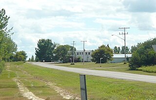
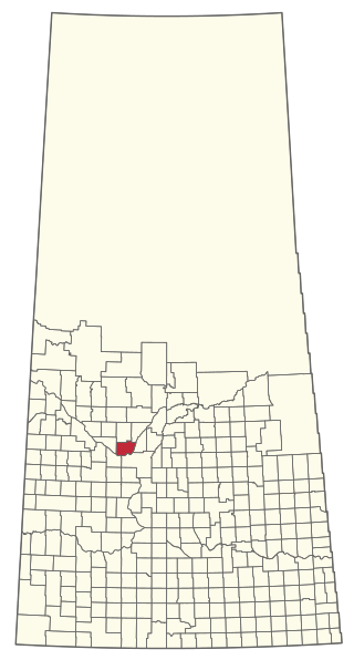
Strongfield is a village in the Canadian province of Saskatchewan within the Rural Municipality of Loreburn No. 254 and Census Division No. 11. It lies approximately 100 km south of the city of Saskatoon on Highway 19 between its sister communities of Hawarden and Loreburn.
Shell Lake is a village in the Canadian province of Saskatchewan within the Rural Municipality of Spiritwood No. 496 and Census Division No. 16. This village is 90 kilometres west of the City of Prince Albert. It was formerly part of the Rural Municipality (RM) of Shell Lake No. 495 before it was absorbed by the RM of Spiritwood No. 496. It is the administrative centre of the Ahtahkakoop Cree First Nation band government.
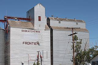
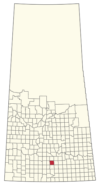
Frontier is a village in the Canadian province of Saskatchewan within the Rural Municipality of Frontier No. 19 and Census Division No. 4. Frontier is on Highway 18 and is served by the Frontier Airport located (3.7 km) south of the village.
The Rural Municipality of Baildon No. 131 is a rural municipality (RM) in the Canadian province of Saskatchewan within Census Division No. 7 and SARM Division No. 2. It is located in the south-central portion of the province south of Moose Jaw.
Hawarden is a village in the Canadian province of Saskatchewan within the Rural Municipality of Loreburn No. 254 and Census Division No. 11. The village is located on Highway 19 north of Strongfield, Loreburn, and Elbow.

Loreburn is a village in the Canadian province of Saskatchewan within the Rural Municipality of Loreburn No. 254 and Census Division No. 11. The village is about 16 kilometres (9.9 mi) north of Elbow and 16 kilometres (9.9 mi) south-east of Danielson Provincial Park, which is located near Gardiner Dam, Lake Diefenbaker.
The Rural Municipality of Great Bend No. 405 is a rural municipality (RM) in the Canadian province of Saskatchewan within Census Division No. 16 and SARM Division No. 6. Located in the west-central portion of the province, it is approximately 50 km (31 mi) to the northwest of Saskatoon.

The Rural Municipality of Fertile Valley No. 285 is a rural municipality (RM) in the Canadian province of Saskatchewan within Census Division No. 12 and SARM Division No. 5. It is located in the southwest portion of the province.
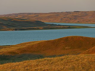
Riverhurst is a village in the Canadian province of Saskatchewan within the Rural Municipality of Maple Bush No. 224 and Census Division No. 7. It is in the southwest Coteau Hills area of the province, north of the Vermillion Hills. The community is located on Highway 42 east of Riverhurst Ferry. The village is primarily a farming community.

The Rural Municipality of Victory No. 226 is a rural municipality (RM) in the Canadian province of Saskatchewan within Census Division No. 7 and SARM Division No. 3.
Tugaske is a village in the Canadian province of Saskatchewan within the Rural Municipality of Huron No. 223 and Census Division No. 7. It is nicknamed Gateway to Lake Diefenbaker. It is near Eyebrow Lake, a prairie lake in the Qu'Appelle Valley. It was named after an eyebrow-shaped hill also in the Qu'Appelle Valley above Eyebrow Lake. The lake, which is 9 km long and 1 km wide, is a bird sanctuary and is near Highway 627.
Etters Beach is a resort village in the Canadian province of Saskatchewan within Census Division No. 11. It is on the west shore of Last Mountain Lake in the Rural Municipality of Big Arm No. 251.
Mistusinne is a resort village in the Canadian province of Saskatchewan within Census Division No. 7. It is on the shores of Gordon McKenzie Arm of Lake Diefenbaker in the Rural Municipality of Maple Bush No. 224.
The Rural Municipality of Riverside No. 168 is a rural municipality (RM) in the Canadian province of Saskatchewan within Census Division No. 8 and SARM Division No. 3.

The Rural Municipality of Coteau No. 255 is a rural municipality (RM) in the Canadian province of Saskatchewan within Census Division No. 7 and SARM Division No. 3.


