Amsterdam is a hamlet within the Rural Municipality of Buchanan No. 304, Saskatchewan, Canada. Listed as a designated place by Statistics Canada, the hamlet had a population of 25 in the Canada 2016 Census. The hamlet is located 63.9 km north of the city of Yorkton and 1.5 km west of Highway 9. The community was founded at the turn of the 20th century by Dutch immigrants, hence the name. In its prime, the community had a post office, grain elevator, garage, and a school. It, like many small towns, has been hit hard by the gradual trend toward urbanization. The hamlet now has fewer than 25 people; most are of Ukrainian descent.
Ferintosh is a hamlet in central Alberta, Canada within Camrose County. It is located approximately 38 kilometres (24 mi) south of Camrose, and 102 kilometres (63 mi) southeast of Edmonton. The hamlet is situated on Little Beaver Lake. The community takes its name from Ferintosh, in Scotland.

Beaver Mines is a hamlet in southern Alberta, Canada within the Municipal District of Pincher Creek No. 9. It is located in the foothills of the Canadian Rockies on Highway 507, approximately 19 km (12 mi) west of Pincher Creek.
Ponteix is a town in southwestern Saskatchewan, Canada, 86 km (53 mi) southeast of Swift Current. It is located on Highway 628 just north of Highway 13.
Birsay, Saskatchewan is an unincorporated community in southern Saskatchewan, Canada. It is located in the Rural Municipality of Coteau No. 255.
Piapot is a hamlet within the Rural Municipality of Piapot No. 110, Saskatchewan, Canada. Listed as a designated place by Statistics Canada, the hamlet had a population of 50 in the Canada 2016 Census.

White Bear is an unincorporated community in the Rural Municipality of Lacadena No. 228, Saskatchewan, Canada. Listed as a designated place by Statistics Canada, the hamlet had a population of 15 in the Canada 2006 Census. The community is approximately 55 mi (89 km) northwest of Swift Current on the north side of the South Saskatchewan River.
Mantario is a special service area in the Rural Municipality of Chesterfield No. 261 in the Canadian province of Saskatchewan.It held village status prior to June 30, 2007. The population was 5 people in 2011. The community is located 70 km southwest of the Town of Kindersley on Highway 44.

Simmie is a hamlet in Bone Creek Rural Municipality No. 108, Saskatchewan, Canada. Listed as a designated place by Statistics Canada, the hamlet had a population of 41 in the Canada 2016 Census. The hamlet is located on Highway 343 and Highway 631, about 50 km southwest of Swift Current.
Kylemore is an unincorporated community in the Rural Municipality of Sasman No. 336, Saskatchewan, Canada. Listed as a designated place by Statistics Canada, the community had a population of 0 in the Canada 2016 Census. It was designated as an organized hamlet prior to 2018. The community is located 12 km east of Wadena, and approximately 250 km east of Saskatoon.

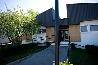
Osler is a town in the Canadian province of Saskatchewan, founded in the 1890s. The community was named after Sir Edmund Boyd Osler (1845–1924), who was an Ontario-based explorer, railroad financier, and Member of Parliament.

Fiske is a hamlet in Pleasant Valley Rural Municipality No. 288, Saskatchewan, Canada. Listed as a designated place by Statistics Canada, the hamlet had a population of 65 in the Canada 2016 Census. Fiske is located approximately 53.7 kilometres (33.4 mi) east of Kindersley and 30.6 kilometres (19.0 mi) west of Rosetown on Highway 7.
Delmas is a hamlet in Battle River Rural Municipality No. 438, Saskatchewan, Canada. Listed as a designated place by Statistics Canada, the hamlet had a population of 128 in the Canada 2016 Census. The hamlet is located approximately 32.6 kilometres (20.3 mi) west of North Battleford on Highway 16.
Hendon is a hamlet in the Rural Municipality of Lakeview No. 337, Saskatchewan, Canada. Listed as a designated place by Statistics Canada, the hamlet had a population of 20 in the Canada 2016 Census.
Kuroki is a hamlet in the Rural Municipality of Sasman No. 336, Saskatchewan, Canada. Listed as a designated place by Statistics Canada, the hamlet had a population of 50 in the Canada 2016 Census. The community is named after the Japanese general Kuroki Tamemoto.
North Shore Fishing Lake is a hamlet in the Rural Municipality of Sasman No. 336, Saskatchewan, Canada. Listed as a designated place by Statistics Canada, the hamlet had a population of 50 in the Canada 2016 Census. It is located on the north-eastern shore of Fishing Lake.
Ottman-Murray Beach is a hamlet in the Canadian province of Saskatchewan. Listed as a designated place by Statistics Canada, the hamlet had a population of 15 in the Canada 2016 Census. It is located on the eastern shore of Fishing Lake.
Wishart is a hamlet in Emerald Rural Municipality No. 277 in the Canadian province of Saskatchewan. It is listed as a designated place by Statistics Canada. The hamlet had a population of 95 in the Canada 2006 Census. It previously held the status of village until January 1, 2002. The hamlet is located 32 km southwest of the village of Elfros at the intersection of highway 639 and highway 743.

Wymark is a hamlet in Swift Current Rural Municipality No. 137, Saskatchewan, Canada. Listed as a designated place by Statistics Canada, the hamlet had a population of 144 in the Canada 2006 Census. The hamlet is located on Highway 628 about 2 km north of Highway 363, and 15 km south of Swift Current.
Shackleton is a special service area in the Rural Municipality of Miry Creek No. 229, Saskatchewan, Canada. It previously held the status of village until December 31, 2013. The community is located 81 km (50 mi) northwest of the City of Swift Current on Highway 32.

