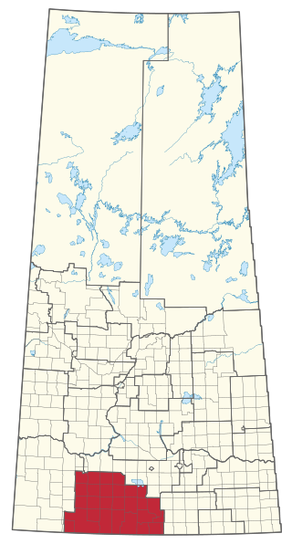
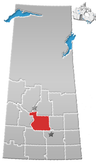
Wood River is a provincial electoral district for the Legislative Assembly of Saskatchewan, Canada. Located in southern Saskatchewan, the district was created by the Representation Act, 1994 (Saskatchewan) out of parts of the former Assiniboia-Gravelbourg and Shaunavon constituencies. The district takes its name from the R.M. of Wood River, which is located in the center of the constituency.

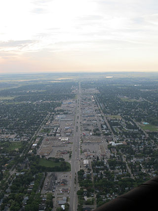
Macklin is a town in the Rural Municipality of Eye Hill No. 382, Saskatchewan, Canada. The population was 1,247 at the 2021 Canadian census. The town is located on Highway 14 and Highway 31 about 5 kilometres (3.1 mi) east of the provincial border with Alberta, and is situated near one of the most productive oil and natural gas producing fields in the province.

The Rural Municipality of Corman Park No. 344 is a rural municipality (RM) in the Canadian province of Saskatchewan within Census Division No. 11 and SARM Division No. 5. Located in the central portion of the province, the RM surrounds the City of Saskatoon.

The Rural Municipality of Maple Bush No. 224 is a rural municipality (RM) in the Canadian province of Saskatchewan within Census Division No. 7 and SARM Division No. 2. It is located in the southwest portion of the province.

The Rural Municipality of Blucher No. 343 is a rural municipality (RM) in the Canadian province of Saskatchewan within Census Division No. 11 and SARM Division No. 5. It is located in the north-central portion of the province on the South Saskatchewan River.

The Saskatchewan Transportation Company (STC) was a Crown corporation in the Canadian province of Saskatchewan responsible for operating intercity bus routes in the province from 1946 to 2017. Created in 1946 by an Order in Council giving the company a mandate to provide service between major urban centres and to as much of the rural population as possible, STC was a wholly owned subsidiary of the Crown Investments Corporation of Saskatchewan.
Division No. 11 is one of eighteen census divisions in the province of Saskatchewan, Canada, as defined by Statistics Canada. It is located in the central part of the province and includes the largest city in the province, Saskatoon.
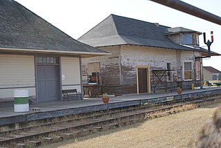
Floral, Saskatchewan is an unincorporated community in the province of Saskatchewan, Canada.

The Rural Municipality of Canwood No. 494 is a rural municipality (RM) in the Canadian province of Saskatchewan within Census Division No. 16 and SARM Division No. 5. The RM is located in the north-central portion of the province, west of the city of Prince Albert.
8th Street East is an arterial road serving the city of Saskatoon, Saskatchewan. It begins as a continuation of a minor residential street at Lorne Avenue in Saskatoon, and runs through the eastern part of city, eventually exiting the city limits as a country road.

The Rural Municipality of Blaine Lake No. 434 is a rural municipality (RM) in the Canadian province of Saskatchewan within Census Division No. 16 and SARM Division No. 5. The RM extends east to the North Saskatchewan River and north to the village of Marcelin.

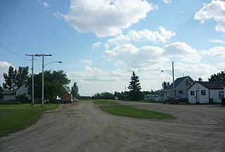
Leroy is a town in the Canadian province of Saskatchewan.

Maidstone is a town in west central Saskatchewan, Canada about 57 km east of Lloydminster and 84 km west of North Battleford at the junction of Highway 16 and Highway 21. The community was named after Maidstone, Kent, England.

Elbow is a village in the Canadian province of Saskatchewan within the Rural Municipality of Loreburn No. 254 and Census Division No. 11. Elbow was founded in 1909, near what is now Lake Diefenbaker. It is 8 kilometres (5.0 mi) north-west of Mistusinne, 10 kilometres (6.2 mi) north-west of Douglas Provincial Park, and 16 kilometres (9.9 mi) south-east of Loreburn. The village got its name from its position on the elbow of the South Saskatchewan River.
Elstow is a special service area within the Rural Municipality of Blucher No. 343 in Saskatchewan, Canada. It dissolved from village status on December 31, 2014. It was originally incorporated as a village on December 17, 1908.

The Rural Municipality of Mayfield No. 406 is a rural municipality (RM) in the Canadian province of Saskatchewan within Census Division No. 16 and SARM Division No. 6.

The Rural Municipality of Fertile Valley No. 285 is a rural municipality (RM) in the Canadian province of Saskatchewan within Census Division No. 12 and SARM Division No. 5. It is located in the southwest portion of the province.
Argo is an unincorporated community or a siding administered by the rural municipality of Biggar No. 347, in the Canadian province of Saskatchewan. Argo was on the Dodsland Branch of the Canadian National Railway between Biggar and Duperow. The closest town is Biggar to the northeast. Biggar railway station is a divisional point for the Canadian National Railway (CNR).
Rhein is a village in the Canadian province of Saskatchewan within the Rural Municipality of Wallace No. 243 and Census Division No. 9.
Michel Village is a northern hamlet in Saskatchewan. It is located on the western shore of Peter Pond Lake at the end of Highway 925 north of Dillon. There were 66 residents in Michel Village in 2011. The mayor is Cliff Coombs.
