Rural Municipality of Rosedale No. 283

Last updated

Rosedale No. 283
Rural Municipality of Rosedale No. 283
Business District Hanley Saskatchewan.jpg
Downtown Hanley
SK RM 283 Rosedale.svg
Location of the RM of Rosedale No. 283 in Saskatchewan
Coordinates: 51°34′19″N106°28′16″W / 51.572°N 106.471°W / 51.572; -106.471 [1]
Country Canada
Province Saskatchewan
Census division 11
SARM division 5
Formed [2] December 13, 1909
Government
[3]
   Reeve Kevin Ouellette
  Governing bodyRM of Rosedale No. 283 Council
  AdministratorDanielle Hache
  Office location Hanley
Area
 (2016) [4]
  Land921.51 km2 (355.80 sq mi)
Population
 (2016) [4]
  Total526
  Density0.6/km2 (2/sq mi)
Time zone CST
  Summer (DST) CST
Area code(s) 306 and 639

The Rural Municipality of Rosedale No. 283 (2016 population: 526) is a rural municipality (RM) in the Canadian province of Saskatchewan within Census Division No. 11 and SARM Division No. 5. It is located in the central portion of the province along Highway 11 between Saskatoon and Regina.

Contents

History

The RM of Rosedale No. 283 incorporated as a rural municipality on December 13, 1909. [2] It was formed through the amalgamation of Local Improvement District (LID) 15-B-3 and LID 15-C-3.[ citation needed ]

Geography

Communities and localities

The following urban municipalities are surrounded by the RM.

Towns

The following unincorporated communities are within the RM.

Localities

Demographics

Population history
(1981–2016)
YearPop.±%
1981528    
1986557+5.5%
1991524−5.9%
1996 520−0.8%
2001 493−5.2%
2006 455−7.7%
2011 515+13.2%
2016 526+2.1%
Source: Statistics Canada via Saskatchewan Bureau of Statistics [5] [6]

In the 2021 Census of Population conducted by Statistics Canada, the RM of Rosedale No. 283 had a population of 542 living in 146 of its 158 total private dwellings, a change of

In the 2016 Census of Population, the RM of Rosedale No. 283 recorded a population of 526 living in 147 of its 153 total private dwellings, a

Government

The RM of Rosedale No. 283 is governed by an elected municipal council and an appointed administrator that meets on the second Tuesday of every month. [3] The reeve of the RM is Nick Patkau while its administrator is Danielle Hache. [3] The RM's office is located in Hanley. [3]

Transportation

Rail [8]
Roads

See also

Related Research Articles

<span class="mw-page-title-main">Rural Municipality of Craik No. 222</span> Rural municipality in Saskatchewan, Canada

The Rural Municipality of Craik No. 222 is a rural municipality (RM) in the Canadian province of Saskatchewan within Census Division No. 7 and SARM Division No. 2. The RM is centrally located between the cities of Regina and Saskatoon.

<span class="mw-page-title-main">Rural Municipality of Arm River No. 252</span> Rural municipality in Saskatchewan, Canada

The Rural Municipality of Arm River No. 252 is a rural municipality (RM) in the Canadian province of Saskatchewan within Census Division No. 11 and SARM Division No. 5. It is located along Highway 11 between Saskatoon and Regina.

<span class="mw-page-title-main">Rural Municipality of Loreburn No. 254</span> Rural municipality in Saskatchewan, Canada

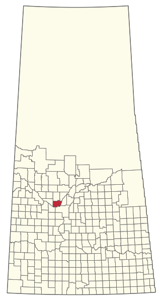
The Rural Municipality of Loreburn No. 254 is a rural municipality (RM) in the Canadian province of Saskatchewan within Census Division No. 11 and SARM Division No. 5. It is located in the south-central portion of the province.

<span class="mw-page-title-main">Rural Municipality of Lumsden No. 189</span> Rural municipality in Saskatchewan, Canada

The Rural Municipality of Lumsden No. 189 is a rural municipality (RM) in the Canadian province of Saskatchewan within Census Division No. 6 and SARM Division No. 2. It is located in the south-east portion of the province.

<span class="mw-page-title-main">Rural Municipality of Lost River No. 313</span> Rural municipality in Saskatchewan, Canada

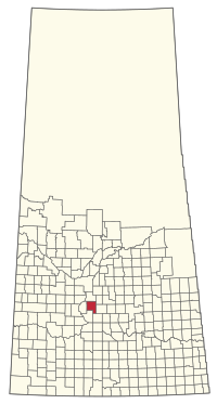
The Rural Municipality of Lost River No. 313 is a rural municipality (RM) in the Canadian province of Saskatchewan within Census Division No. 11 and SARM Division No. 5. Located in the central portion of the province, it is adjacent to the South Saskatchewan River.

<span class="mw-page-title-main">Rural Municipality of Vanscoy No. 345</span> Rural Municipality in Saskatchewan, Canada

The Rural Municipality of Vanscoy No. 345 is a rural municipality (RM) in the Canadian province of Saskatchewan within Census Division No. 12 and SARM Division No. 5. Located in the central portion of the province, it is southwest of the city of Saskatoon.

<span class="mw-page-title-main">Rural Municipality of Eye Hill No. 382</span> Rural municipality in Saskatchewan, Canada

The Rural Municipality of Eye Hill No. 382 is a rural municipality (RM) in the Canadian province of Saskatchewan within Census Division No. 13 and SARM Division No. 6. It is located in the west-central portion of the province adjacent to the Alberta boundary.

<span class="mw-page-title-main">Rural Municipality of Milton No. 292</span> Rural municipality in Saskatchewan, Canada

The Rural Municipality of Milton No. 292 is a rural municipality (RM) in the Canadian province of Saskatchewan within Census Division No. 13 and SARM Division No. 6. Located in the west-central portion of the province, it is adjacent to the Alberta boundary.

<span class="mw-page-title-main">Rural Municipality of Argyle No. 1</span> Rural municipality in Saskatchewan, Canada

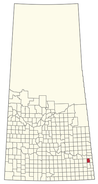
The Rural Municipality of Argyle No. 1 is a rural municipality (RM) in the Canadian province of Saskatchewan within Census Division No. 1 and SARM Division No. 1. It is located in the southeast corner of the province along Highway 18.

<span class="mw-page-title-main">Rural Municipality of Leroy No. 339</span> Rural municipality in Saskatchewan, Canada

The Rural Municipality of Leroy No. 339 is a rural municipality (RM) in the Canadian province of Saskatchewan within Census Division No. 10 and SARM Division No. 5. It is located east of Saskatoon.

<span class="mw-page-title-main">Rural Municipality of Wolverine No. 340</span> Rural municipality in Saskatchewan, Canada

The Rural Municipality of Wolverine No. 340 is a rural municipality (RM) in the Canadian province of Saskatchewan within Census Division No. 11 and SARM Division No. 5. It is located in the central portion of the province east of Saskatoon.

<span class="mw-page-title-main">Rural Municipality of Humboldt No. 370</span> Rural municipality in Saskatchewan, Canada

The Rural Municipality of Humboldt No. 370 is a rural municipality (RM) in the Canadian province of Saskatchewan within Census Division No. 15 and SARM Division No. 5. Located in the central portion of the province, it is along Highway 5 and Highway 20 north of Regina and east of Saskatoon.

<span class="mw-page-title-main">Rural Municipality of Birch Hills No. 460</span> Rural municipality in Saskatchewan, Canada

The Rural Municipality of Birch Hills No. 460 is a rural municipality (RM) in the Canadian province of Saskatchewan within Census Division No. 15 and SARM Division No. 5. It is located in the north-central portion of the province on Highway 3 southeast of Prince Albert and north of Saskatoon.

<span class="mw-page-title-main">Rural Municipality of Martin No. 122</span> Rural municipality in Saskatchewan, Canada

The Rural Municipality of Martin No. 122 is a rural municipality (RM) in the Canadian province of Saskatchewan within Census Division No. 5 and SARM Division No. 1. It is approximately 200 km (120 mi) east of Regina and bisected by the Trans-Canada Highway.

<span class="mw-page-title-main">Rural Municipality of Pense No. 160</span> Rural municipality in Saskatchewan, Canada

The Rural Municipality of Pense No. 160 is a rural municipality (RM) in the Canadian province of Saskatchewan within Census Division No. 6 and SARM Division No. 2. It is located in the southeast portion of the province.

<span class="mw-page-title-main">Rural Municipality of Great Bend No. 405</span> Rural municipality in Saskatchewan, Canada

The Rural Municipality of Great Bend No. 405 is a rural municipality (RM) in the Canadian province of Saskatchewan within Census Division No. 16 and SARM Division No. 6. Located in the west-central portion of the province, it is approximately 50 km (31 mi) to the northwest of Saskatoon.

<span class="mw-page-title-main">Rural Municipality of Reciprocity No. 32</span> Rural municipality in Saskatchewan, Canada

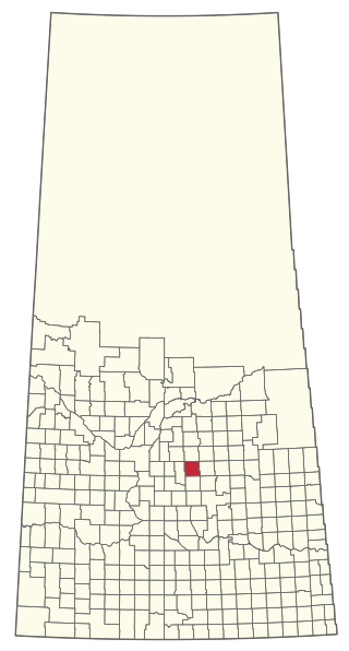
The Rural Municipality of Reciprocity No. 32 is a rural municipality (RM) in the Canadian province of Saskatchewan within Census Division No. 1 and SARM Division No. 1. It is located in the southeast portion of the province.

<span class="mw-page-title-main">Rural Municipality of Kellross No. 247</span> Rural municipality in Saskatchewan, Canada

The Rural Municipality of Kellross No. 247 is a rural municipality (RM) in the Canadian province of Saskatchewan within Census Division No. 10 and SARM Division No. 4.

<span class="mw-page-title-main">Rural Municipality of Milden No. 286</span> Rural municipality in Saskatchewan, Canada

The Rural Municipality of Milden No. 286 is a rural municipality (RM) in the Canadian province of Saskatchewan within Census Division No. 12 and SARM Division No. 5.

<span class="mw-page-title-main">Rural Municipality of Montrose No. 315</span> Rural municipality in Saskatchewan, Canada

The Rural Municipality of Montrose No. 315 is a rural municipality (RM) in the Canadian province of Saskatchewan within Census Division No. 12 and SARM Division No. 5.

References

  1. "Pre-packaged CSV files - CGN, Canada/Province/Territory (cgn_sk_csv_eng.zip)". Government of Canada. July 24, 2019. Retrieved May 23, 2020.
  2. 1 2 "Rural Municipality Incorporations (Alphabetical)". Saskatchewan Ministry of Municipal Affairs. Archived from the original on April 21, 2011. Retrieved May 9, 2020.
  3. 1 2 3 4 "Municipality Details: RM of Rosedale No. 283". Government of Saskatchewan. Retrieved May 21, 2020.
  4. 1 2 3 "Population and dwelling counts, for Canada, provinces and territories, and census subdivisions (municipalities), 2016 and 2011 censuses – 100% data (Saskatchewan)". Statistics Canada. February 8, 2017. Retrieved May 1, 2020.
  5. "Saskatchewan Census Population" (PDF). Saskatchewan Bureau of Statistics. Archived from the original (PDF) on September 24, 2015. Retrieved May 9, 2020.
  6. "Saskatchewan Census Population". Saskatchewan Bureau of Statistics. Retrieved May 9, 2020.
  7. "Population and dwelling counts: Canada, provinces and territories, census divisions and census subdivisions (municipalities), Saskatchewan". Statistics Canada. February 9, 2022. Retrieved April 13, 2022.
  8. Canadian Maps: January 1925 Waghorn's Guide. Post Offices in Man. Sask. Alta. and West Ontario.