Demographics
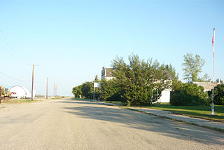
In the 2021 Census of Population conducted by Statistics Canada, Plunkett had a population of 60 living in 28 of its 36 total private dwellings, a change of 0% from its 2016 population of 60. With a land area of 0.67 km2 (0.26 sq mi), it had a population density of 89.6/km2 (231.9/sq mi) in 2021. [8]
In the 2016 Census of Population, the village of Plunkett recorded a population of 60 living in 33 of its 36 total private dwellings, a -25% change from its 2011 population of 75. With a land area of 0.64 km2 (0.25 sq mi), it had a population density of 93.8/km2 (242.8/sq mi) in 2016. [9]
Aylesbury is a village in the Canadian province of Saskatchewan within the Rural Municipality of Craik No. 222 and Census Division No. 7. The village is approximately 60 km north of the City of Moose Jaw.
Milden is a village in the Canadian province of Saskatchewan within the Rural Municipality of Milden No. 286 and Census Division No. 12. The village is located at the junction of Highway 15 and Highway 655 approximately 20 km west of Outlook on Highway 15.

The Rural Municipality of Wolverine No. 340 is a rural municipality (RM) in the Canadian province of Saskatchewan within Census Division No. 11 and SARM Division No. 5. It is located in the central portion of the province east of Saskatoon.
Zelma is a village in the Canadian province of Saskatchewan within the Rural Municipality of Morris No. 312 and Census Division No. 11. The village is located along Saskatchewan Highway 763.
Carievale is a village in the Canadian province of Saskatchewan within the Rural Municipality of Argyle No. 1 and Census Division No. 1. The village lies at the intersection of Highway 8 and Highway 18.

Disley is a village in the Canadian province of Saskatchewan within the Rural Municipality of Lumsden No. 189 and Census Division No. 6. It is located 18 km (11 mi) west of Lumsden just south of the Louis Riel Trail and 48 kilometres northwest of the City of Regina.

Glenside is a village in the Canadian province of Saskatchewan within the Rural Municipality of Rudy No. 284 and Census Division No. 11. The village is located on Highway 219 approximately 10 km east of the Town of Outlook.

Holdfast is a village in the Canadian province of Saskatchewan within the Rural Municipality of Sarnia No. 221 and Census Division No. 6. The village is located 2 km east of Highway 2 on Highway 732, about 97.6 km northwest of the City of Regina.

Meacham is a village in the Canadian province of Saskatchewan within the Rural Municipality of Colonsay No. 342 and Census Division No. 11. It is located 69 kilometres east of the City of Saskatoon on Highway 2.

Viscount is a village in the Canadian province of Saskatchewan within the Rural Municipality of Viscount No. 341 and Census Division No. 11. Viscount is located on Saskatchewan Highway 16, the Yellowhead Highway, in central Saskatchewan east of Colonsay and west of Lanigan. As of the Canada 2016 Census, Viscount had a population of 232.

Sheho is a village in the Canadian province of Saskatchewan within the Rural Municipality of Viscount No. 341 and Census Division No. 9. Sheho is located on Saskatchewan Highway 16, the Yellowhead, in southeast Saskatchewan between Foam Lake to the west and the City of Yorkton to the east. Sheho Lake post office first opened in 1891 at the legal land description of Sec.28, Twp.30, R.9, W2 before moving slightly and changing name to Sheho.

The Rural Municipality of Viscount No. 341 is a rural municipality (RM) in the Canadian province of Saskatchewan within Census Division No. 11 and SARM Division No. 5. It is located in the central portion of the province.
Waseca is a village in the Canadian province of Saskatchewan within the Rural Municipality of Eldon No. 471 and Census Division No. 17. Waseca is located on Highway 16, the Yellowhead Highway, in northwest Saskatchewan. Waseca is located east of Lashburn and west of Maidstone. It was probably named after Waseca, Minnesota. A former resident of the Waseca area (1923-1942) has stated she was told that Waseca was an Indigenous name meaning "looking upwards" and the name was assigned when the CN railway station was built.
Quinton is a village in the Canadian province of Saskatchewan within the Rural Municipality of Mount Hope No. 279 and Census Division No. 10. The village is located on Highway 15 between the Town of Raymore and the Village of Punnichy. It is near the administrative office of the Kawacatoose First Nations.
Smiley is a village in the Canadian province of Saskatchewan within the Rural Municipality of Prairiedale No. 321 and Census Division No. 13. The village is located approximately 20 km northwest of the Town of Kindersley at the intersection of Highway 307 and Highway 772. The Grand Trunk Pacific Railway was completed in 1913 bringing an economic boom to the village's early years. On April 26, 1987 the Dodsland subdivision between Dodsland and Smiley was transferred to the Canadian Pacific Railway. Due to the close proximity to major grain centres such as Kindersley, CPR put the line up for abandonment and was granted permission to remove the track by the Canadian Transportation Agency on October 29, 1997.

Speers is a village in the Canadian province of Saskatchewan within the Rural Municipality of Douglas No. 436 and Census Division No. 16. The village is located approximately 50 minutes southeast of the City of North Battleford on Highway 40.

Tessier is a village in the Canadian province of Saskatchewan within the Rural Municipality of Harris No. 316 and Census Division No. 12. The village is located approximately 60 km southwest of the City of Saskatoon on Highway 7.

Tuxford is a village in the Canadian province of Saskatchewan within the Rural Municipality of Marquis No. 191 and Census Division No. 7. Moose Jaw is 14 kilometres (8.7 mi) south and Buffalo Pound Lake is 16 kilometres (9.9 mi) north. Highway 2, Highway 42 and Highway 202 all intersect in the community. Highway 202 connects the community to Buffalo Pound Provincial Park 11 kilometres (6.8 mi) to the east.
Codette is a village in the Canadian province of Saskatchewan within the Rural Municipality of Nipawin No. 487 and Census Division No. 14. The village is located 10 km south of Nipawin at the junction of Highway 35 and Highway 789.

The Rural Municipality of Perdue No. 346 is a rural municipality (RM) in the Canadian province of Saskatchewan within Census Division No. 12 and SARM Division No. 5.
This page is based on this
Wikipedia article Text is available under the
CC BY-SA 4.0 license; additional terms may apply.
Images, videos and audio are available under their respective licenses.


