Krydor, Saskatchewan

Last updated
Krydor
Village of Krydor
Krydor Saskatchewan Main Street 2011.jpg
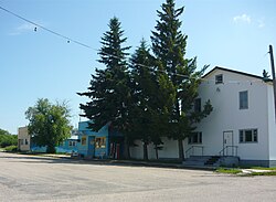
Krydor's Main Street
Canada Saskatchewan location map.svg
Red pog.svg
Location of Krydor in Saskatchewan
Canada location map 2.svg
Red pog.svg
Krydor, Saskatchewan (Canada)
Coordinates: 52°44′42″N107°11′42″W / 52.745°N 107.195°W / 52.745; -107.195
Country Flag of Canada (Pantone).svg  Canada
Province Flag of Saskatchewan.svg  Saskatchewan
Region Central
Census division 16
Rural Municipality Redberry No. 435
Post office foundedSeptember 1, 1911
Incorporated (Village)1914
Government
  Type Municipal
  Governing body Krydor Village Council
   Mayor Russell Krysak
   Administrator Wendy Tanchak
Area
  Total0.82 km2 (0.32 sq mi)
Population
 (2016)
  Total14
  Density18.2/km2 (47/sq mi)
Time zone UTC-6 (CST)
Postal code
S0J 1A0
Area code(s) 306
Highways Saskatchewan Highway 40 (jct).svg Hwy 40
Railways Carlton Trail Railway
[1] [2] [3] [4]

Krydor (2016 population: 15) is a village in the Canadian province of Saskatchewan within the Rural Municipality of Redberry No. 435 and Census Division No. 16. The community's name is a combination of the names of two early settlers, Petro Krysak and Teodor Lucyk (KRYsak + teoDOR). [5] Petro Krysak also served as the first postmaster, from September 1, 1911, to July 7, 1913. [1]

Contents

Ukrainian Orthodox Church, Krydor Orthodox Church Krydor Saskatchewan 2011.jpg
Ukrainian Orthodox Church, Krydor

History

Krydor incorporated as a village on August 25, 1914. [6]

Demographics

Population history
(1981–2016)
YearPop.±%
198173    
198653−27.4%
199134−35.8%
1996 29−14.7%
2001 25−13.8%
2006 25+0.0%
2011 15−40.0%
2016 15+0.0%
Source: Statistics Canada via Saskatchewan Bureau of Statistics [7] [8]

In the 2021 Census of Population conducted by Statistics Canada, Krydor had a population of 15 living in 15 of its 25 total private dwellings, a change of

In the 2016 Census of Population, the Village of Krydor recorded a population of 15 living in 12 of its 24 total private dwellings, a

Notable people

See also

Related Research Articles

Milden is a village in the Canadian province of Saskatchewan within the Rural Municipality of Milden No. 286 and Census Division No. 12. The village is located at the junction of Highway 15 and Highway 655 approximately 20 km west of Outlook on Highway 15.

Prudhomme, Saskatchewan Village in Saskatchewan, Canada

Prud'homme is a village in the Canadian province of Saskatchewan within the Rural Municipality of Bayne No. 371 and Census Division No. 15. It is approximately 60 kilometres northeast of Saskatoon. Prud'homme was first known by the name of Bluebell Ranch, then Lally Siding. In 1905 the Canadian Northern Railway came through and renamed it Marcotte's Crossing; two years later it became known as Howell; and finally, in 1922, it was named after the Suffragan Bishop of Prince-Albert–Saskatoon, Joseph H. Prud'homme. The community is mostly based on agriculture.

Neudorf is a village in the Canadian province of Saskatchewan within the Rural Municipality of McLeod No. 185 and Census Division No. 5. It is on Highway 22 east of Lemberg, and Abernethy, and west of Killaly.

Debden, Saskatchewan Village in Saskatchewan, Canada

Debden is a village in the Canadian province of Saskatchewan within the Rural Municipality of Canwood No. 494 and Census Division No. 16. The village is located on Highway 55 and is 94 km from the City of Prince Albert and 194 km from the City of Saskatoon. It is also the administrative headquarters of the Big River Cree First Nations band government. The village is at the edge of the Prince Albert National Park and with all the lakes nearby it becomes a popular area in the summer months.

Neville is a village in the Canadian province of Saskatchewan within the Rural Municipality of Whiska Creek No. 106 and Census Division No. 3. It is located on Highway 43.

Borden, Saskatchewan Village in Saskatchewan, Canada

Borden is a village in the Canadian province of Saskatchewan within the Rural Municipality of Great Bend No. 405 and Census Division No. 16. Borden is named after Sir Frederick William Borden, Minister of Militia in the Laurier Cabinet. An abandoned arch bridge of the same name is located to the southeast and once carried Highway 16 across the North Saskatchewan River.

Dinsmore, Saskatchewan Village in Saskatchewan, Canada

Dinsmore is a village in the Canadian province of Saskatchewan within the Rural Municipality of Milden No. 286 and Census Division No. 12.

Dorintosh is a village in the Canadian province of Saskatchewan within the Rural Municipality of Meadow Lake No. 588 and Census Division No. 17.

Glenside, Saskatchewan Village in Saskatchewan, Canada

Glenside is a village in the Canadian province of Saskatchewan within the Rural Municipality of Rudy No. 284 and Census Division No. 11. The village is located on Highway 219 approximately 10 km east of the Town of Outlook.

Kincaid, Saskatchewan Village in Saskatchewan, Canada

Kincaid is a village in the Canadian province of Saskatchewan within the Rural Municipality of Pinto Creek No. 75 and Census Division No. 3.

Tramping Lake is a village in the Canadian province of Saskatchewan within the Rural Municipality of Tramping Lake No. 380 and Census Division No. 13. The village gets its name from nearby Tramping Lake.

Hyas is a village in the Canadian province of Saskatchewan within the Rural Municipality of Clayton No. 333 and Census Division No. 9.

Lake Lenore is a village in the Canadian province of Saskatchewan within the Rural Municipality of Lake Lenore No. 399 and Census Division No. 15. The village is located 144.6 km northeast of the City of Saskatoon. Outside the village is a lake that shares its name, Lake Lenore, renowned for its fishing activity, as well the Rural Municipality of Lake Lenore No. 399 to the north. Lake Lenore possesses a fully operational school, Co-op Grocery and Agro Service Station and also contains a Credit Union and Public Library.

Loreburn, Saskatchewan Village in Saskatchewan, Canada

Loreburn is a village in the Canadian province of Saskatchewan within the Rural Municipality of Loreburn No. 254 and Census Division No. 11. The village is 16 km (9.9 mi) north of Elbow and 16 km southeast of Danielson Provincial Park, which is located near Gardiner Dam, Lake Diefenbaker.

Lucky Lake, Saskatchewan Village in Saskatchewan, Canada

Lucky Lake is a village in the Canadian province of Saskatchewan within the Rural Municipality of Canaan No. 225 and Census Division No. 7. The Village is located at the junction of Highway 42, Highway 45 and Highway 646 approximately 90 km northeast of Swift Current, Saskatchewan.

Marsden, Saskatchewan Village in Saskatchewan, Canada

Marsden is a village in the Canadian province of Saskatchewan within the Rural Municipality of Manitou Lake No. 442 and Census Division No. 13. It gained notoriety shortly after the impact of the Buzzard Coulee meteorite near the village on 20 November 2008.

Maymont, Saskatchewan Village in Saskatchewan, Canada

Maymont is a village in the Canadian province of Saskatchewan within the Rural Municipality of Mayfield No. 406 and Census Division No. 16. It is 90 kilometres northwest of the City of Saskatoon.

Senlac is a village in the Canadian province of Saskatchewan within the Rural Municipality of Senlac No. 411 and Census Division No. 13. The village was named after Senlac Hill, the location of the Battle of Hastings in England in 1066.

Speers, Saskatchewan Village in Saskatchewan, Canada

Speers is a village in the Canadian province of Saskatchewan within the Rural Municipality of Douglas No. 436 and Census Division No. 16. The village is located approximately 50 minutes southeast of the City of North Battleford on Highway 40.

Wiseton is a village in the Canadian province of Saskatchewan within the Rural Municipality of Milden No. 286 and Census Division No. 12. The village is located at the junction of Highway 44 and Highway 664 approximately 40 km southwest of Outlook.

References

  1. 1 2 National Archives, Archivia Net, Post Offices and Postmasters, archived from the original on October 6, 2006
  2. Government of Saskatchewan, MRD Home, Municipal Directory System, archived from the original on November 21, 2008
  3. Canadian Textiles Institute. (2005), CTI Determine your provincial constituency, archived from the original on 2007-09-11
  4. Commissioner of Canada Elections, Chief Electoral Officer of Canada (2005), Elections Canada On-line, archived from the original on April 21, 2007
  5. "Krydor". An Exhibition: Main Street, Saskatchewan. Saskatchewan Council for Archives and Archivists. 2002. Retrieved 2011-06-29.
  6. "Urban Municipality Incorporations". Saskatchewan Ministry of Government Relations. Archived from the original on October 15, 2014. Retrieved June 1, 2020.
  7. "Saskatchewan Census Population" (PDF). Saskatchewan Bureau of Statistics. Archived from the original (PDF) on September 24, 2015. Retrieved May 31, 2020.
  8. "Saskatchewan Census Population". Saskatchewan Bureau of Statistics. Retrieved May 31, 2020.
  9. "Population and dwelling counts: Canada, provinces and territories, census divisions and census subdivisions (municipalities), Saskatchewan". Statistics Canada. February 9, 2022. Retrieved April 1, 2022.
  10. "Population and dwelling counts, for Canada, provinces and territories, and census subdivisions (municipalities), 2016 and 2011 censuses – 100% data (Saskatchewan)". Statistics Canada. February 8, 2017. Retrieved May 30, 2020.