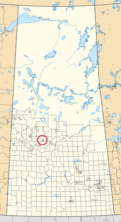
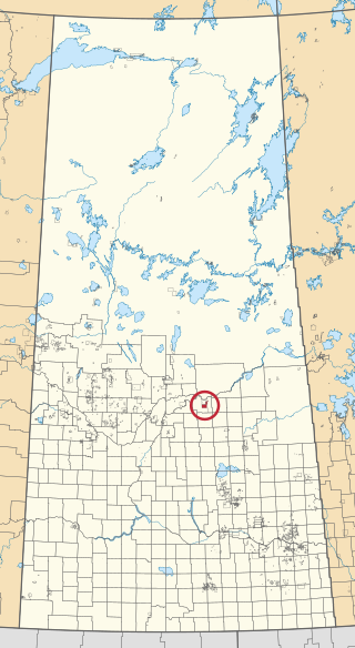
Gordon 86 is a Cree Indian reserve in Saskatchewan, Canada located about 61 kilometres (38 mi) north-west of Fort Qu'Appelle. Also known as the George Gordon Reserve, it is one of three territories of the George Gordon First Nation, as arranged by the signing of Treaty 4. The reserve has an area of 14,438.3 hectares. In the 2016 Canadian Census, it recorded a population of 837 living in 218 of its 238 total private dwellings. In the same year, its Community Well-Being index was calculated at 52 of 100, compared to 58.4 for the average First Nations community and 77.5 for the average non-Indigenous community. It is almost completely surrounded by the rural municipality of Touchwood No. 248.

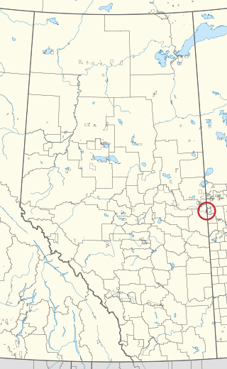
The Enoch Cree Nation #440 is a First Nations band government in Alberta, Canada. Members of the Nation are of Cree ancestry and speak the Plains Cree dialect of the Cree language group. The band is a signatory of Treaty 6 and is a member of the Confederacy of Treaty Six First Nations. The chief of the Enoch Cree Nation is Cody Thomas.
Patuanak is a community in northern Saskatchewan, Canada. It is the administrative headquarters of the Dene First Nations reserve near Churchill River and the north end of Lac Île-à-la-Crosse. In Dene, it sounds similar to Boni Cheri (Bëghą́nı̨ch’ërë).
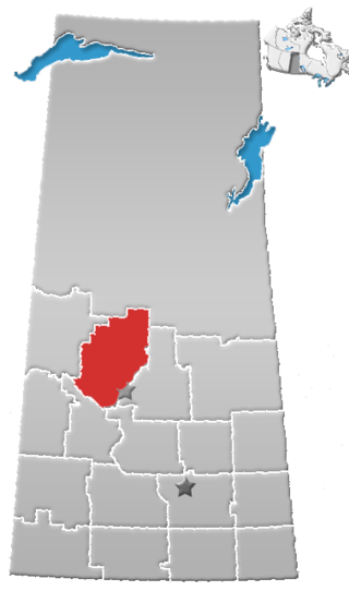
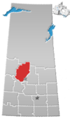
Division No. 16 is one of eighteen census divisions in the province of Saskatchewan, Canada, as defined by Statistics Canada. It is located in the north-central part of the province. The most populous community in this division is North Battleford.
Ahtahkakoop 104 is an Indian reserve of the Ahtahkakoop Cree Nation in Saskatchewan. It is about 72 kilometres (45 mi) northwest of Prince Albert. In the 2016 Canadian Census, it recorded a population of 1,472 living in 386 of its 424 total private dwellings. In the same year, its Community Well-Being index was calculated at 46 of 100, compared to 58.4 for the average First Nations community and 77.5 for the average non-Indigenous community.
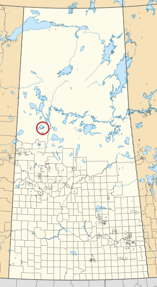
Canoe Lake 165 is an Indian reserve of the Canoe Lake Cree First Nation in the boreal forest of northern Saskatchewan, Canada. Its location is on Canoe Lake approximately thirty miles west of Beauval, within the ancient hunting grounds of the Woodland Cree. In the 2016 Canadian Census, it recorded a population of 912 living in 250 of its 273 total private dwellings. In the same year, its Community Well-Being index was calculated at 53 of 100, compared to 58.4 for the average First Nations community and 77.5 for the average non-Indigenous community. The reserve includes the settlement of Canoe Narrows. The name of the reserve and the settlement in Cree is nêhiyaw-wapâsihk ᓀᐦᐃᔭᐤ ᐘᐹᓯᕽ.

Ahtahkakoop First Nation is a Cree First Nation band government in Shell Lake, Saskatchewan, Canada. The Ahtahkakoop First Nation government and community is located on Ahtahkakoop 104, 72 kilometers northwest of Prince Albert and is 17,347 hectares in size. The community was formerly known as the "Sandy Lake Indian Band", a name which is still used interchangeably when referring to the reserve.
Makaoo 120 is an Indian reserve of the Onion Lake Cree Nation in Alberta and Saskatchewan, located between the County of Vermilion River and the Rural Municipality of Frenchman Butte No. 501. It is about 42 kilometres (26 mi) north of Lloydminster. In the 2016 Canadian Census, it recorded a population of 726 living in 165 of its 179 total private dwellings.
The Montreal Lake Cree Nation is a Woodland Cree First Nation in northern Saskatchewan. The administrative centre of the Montreal Lake Cree Nation is located in the community of Montreal Lake.

The Treaty Four Reserve Grounds 77 are an Indian reserve in Saskatchewan, Canada, shared by 33 band governments from Saskatchewan and Manitoba. The Reserve Grounds are located adjacent to and west of Fort Qu'Appelle. In the 2016 Canadian Census, they recorded a population of 15 living in 6 of their 8 total private dwellings.

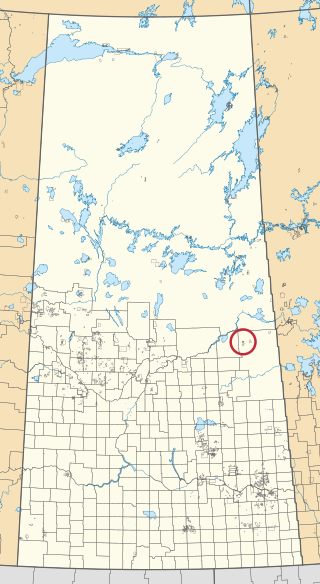
James Smith 100 is an Indian reserve of the James Smith Cree Nation in Saskatchewan. It is about 58 kilometres (36 mi) east of Prince Albert. In the 2016 Canadian Census, it recorded a population of 743 living in 152 of its 152 total private dwellings. In the same year, its Community Well-Being index was calculated at 46 of 100, compared to 58.4 for the average First Nations community and 77.5 for the average non-Indigenous community.
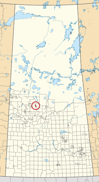
The Lucky Man Cree Nation is a Cree First Nation in Saskatchewan, Canada. After spending more than a hundred years illegally associated by Canada with the Little Pine First Nation, the band was awarded the Lucky Man Reserve, on the eastern border of the RM of Meeting Lake. The re-established nation has the smallest membership in Treaty 6.
Big River 118 is an Indian reserve of the Big River First Nation in Saskatchewan. It is 98 kilometres northwest of Prince Albert. In the 2016 Canadian Census, it recorded a population of 1553 living in 366 of its 407 total private dwellings. In the same year, its Community Well-Being index was calculated at 46 of 100, compared to 58.4 for the average First Nations community and 77.5 for the average non-Indigenous community.
Carrot River 29A is an Indian reserve of the Red Earth Cree Nation in Saskatchewan. It is 48 miles east of Nipawin. In the 2016 Canadian Census, it recorded a population of 829 living in 127 of its 127 total private dwellings. In the same year, its Community Well-Being index was calculated at 40 of 100, compared to 58.4 for the average First Nations community and 77.5 for the average non-Indigenous community.

Chitek Lake 191 is an Indian reserve of the Pelican Lake First Nation in the Canadian province of Saskatchewan. It is located on the southern shore of Chitek Lake about 68 kilometres (42 mi) south-east of Meadow Lake. In the 2016 Canadian Census, it recorded a population of 821 living in 164 of its 300 total private dwellings. In the same year, its Community Well-Being index was calculated at 46 of 100, compared to 58.4 for the average First Nations community and 77.5 for the average non-Indigenous community.
Cumberland 100A is an Indian reserve of the James Smith Cree Nation in Saskatchewan. It is 161 kilometres (100 mi) south-east of Prince Albert. The 2016 Canadian Census, recorded a population of 317 living in 79 of its 82 total private dwellings. In the same year, its Community Well-Being index was calculated at 50 of 100, compared to 58.4 for the average First Nations community and 77.5 for the average non-Indigenous community.

Cumberland House Cree Nation 20 is an Indian reserve of the Cumberland House Cree Nation in Saskatchewan. The reserve is on Cumberland Island in the Saskatchewan River Delta, about 96 kilometres (60 mi) south-west of Flin Flon.

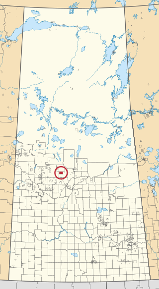
Muskeg Lake 102B is an Indian reserve of the Muskeg Lake Cree Nation in Saskatchewan. It is 67 kilometres northeast of North Battleford. In the 2016 Canadian Census, it recorded a population of 0 living in 0 of its 0 total private dwellings.

Muskeg Lake 102D is an Indian reserve of the Muskeg Lake Cree Nation in Saskatchewan. It is 43 kilometres southwest of Shellbrook. In the 2016 Canadian Census, it recorded a population of 0 living in 0 of its 0 total private dwellings.

Muskeg Lake 102E is an Indian reserve of the Muskeg Lake Cree Nation in Saskatchewan. It is 49 kilometres south of Shellbrook. In the 2016 Canadian Census, it recorded a population of 0 living in 0 of its 0 total private dwellings.