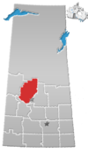
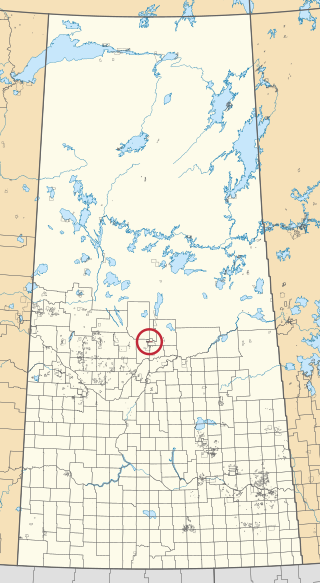
Division No. 16 is one of eighteen census divisions in the province of Saskatchewan, Canada, as defined by Statistics Canada. It is located in the north-central part of the province. The most populous community in this division is North Battleford.

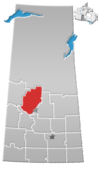
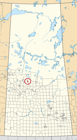
The Rural Municipality of Canwood No. 494 is a rural municipality (RM) in the Canadian province of Saskatchewan within Census Division No. 16 and SARM Division No. 5. The RM is located in the north-central portion of the province, west of the city of Prince Albert.
Ahtahkakoop 104 is an Indian reserve of the Ahtahkakoop Cree Nation in Saskatchewan. It is about 72 kilometres (45 mi) northwest of Prince Albert. In the 2016 Canadian Census, it recorded a population of 1,472 living in 386 of its 424 total private dwellings. In the same year, its Community Well-Being index was calculated at 46 of 100, compared to 58.4 for the average First Nations community and 77.5 for the average non-Indigenous community.
The Lac La Ronge Indian Band is a Woodland Cree First Nation in northern Saskatchewan, it is the largest Cree band government in Canada and the largest First Nation in Saskatchewan. The administrative centre of the Lac La Ronge Indian Band is located in La Ronge.
Makaoo 120 is an Indian reserve of the Onion Lake Cree Nation in Alberta and Saskatchewan, located between the County of Vermilion River and the Rural Municipality of Frenchman Butte No. 501. It is about 42 kilometres (26 mi) north of Lloydminster. In the 2016 Canadian Census, it recorded a population of 726 living in 165 of its 179 total private dwellings.

Beardy's 97 and Okemasis 96 is an Indian reserve of the Beardy's and Okemasis' Cree Nation in Saskatchewan. It is 58 kilometres southwest of Prince Albert. In the 2016 Canadian Census, it recorded a population of 1323 living in 301 of its 311 total private dwellings. In the same year, its Community Well-Being index was calculated at 52 of 100, compared to 58.4 for the average First Nations community and 77.5 for the average non-Indigenous community.
Big River 118 is an Indian reserve of the Big River First Nation in Saskatchewan. It is 98 kilometres northwest of Prince Albert. In the 2016 Canadian Census, it recorded a population of 1553 living in 366 of its 407 total private dwellings. In the same year, its Community Well-Being index was calculated at 46 of 100, compared to 58.4 for the average First Nations community and 77.5 for the average non-Indigenous community.
Carrot River 29A is an Indian reserve of the Red Earth Cree Nation in Saskatchewan. It is 48 miles east of Nipawin. In the 2016 Canadian Census, it recorded a population of 829 living in 127 of its 127 total private dwellings. In the same year, its Community Well-Being index was calculated at 40 of 100, compared to 58.4 for the average First Nations community and 77.5 for the average non-Indigenous community.

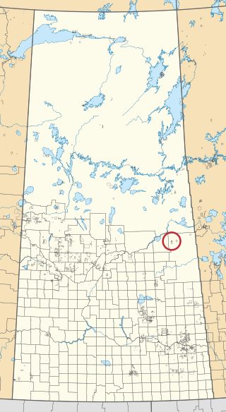
Cumberland House Cree Nation 20 is an Indian reserve of the Cumberland House Cree Nation in Saskatchewan. The reserve is on Cumberland Island in the Saskatchewan River Delta, about 96 kilometres (60 mi) south-west of Flin Flon.
Little Pine 116 is an Indian reserve of the Little Pine First Nation in Saskatchewan. It is about 53 kilometres (33 mi) north-west of North Battleford. In the 2016 Canadian Census, it recorded a population of 700 living in 201 of its 220 total private dwellings. In the same year, its Community Well-Being index was calculated at 50 of 100, compared to 58.4 for the average First Nations community and 77.5 for the average non-Indigenous community.

Little Red River 106C is an Indian reserve of the Lac La Ronge Indian Band in Saskatchewan. It is about 34 kilometres (21 mi) north of Prince Albert. In the 2016 Canadian Census, it recorded a population of 354 living in 88 of its 98 total private dwellings. In the same year, its Community Well-Being index was calculated at 48 of 100, compared to 58.4 for the average First Nations community and 77.5 for the average non-Indigenous community.

The Lucky Man Reserve is an Indian reserve of the Lucky Man Cree Nation in Saskatchewan. It consists of Sections 25 to 36, Township 46, Range 6, west of the Third Meridian. In the 2016 Canadian Census, it recorded a population of 0 living in 0 of its 0 total private dwellings.
Mistawasis 103 is an Indian reserve of the Mistawasis Nêhiyawak in Saskatchewan. It is 68 kilometres west of Prince Albert. In the 2016 Canadian Census, it recorded a population of 681 living in 175 of its 180 total private dwellings. In the same year, its Community Well-Being index was calculated at 42 of 100, compared to 58.4 for the average First Nations community and 77.5 for the average non-Indigenous community.
Montreal Lake 106B is an Indian reserve of the Montreal Lake Cree Nation in Saskatchewan. It is adjacent to Little Red River 106C and 39 kilometres (24 mi) north of Prince Albert. In the 2016 Canadian Census, it recorded a population of 442 living in 113 of its 118 total private dwellings. In the same year, its Community Well-Being index was calculated at 47 of 100, compared to 58.4 for the average First Nations community and 77.5 for the average non-Indigenous community.

Muskeg Lake 102D is an Indian reserve of the Muskeg Lake Cree Nation in Saskatchewan. It is 43 kilometres southwest of Shellbrook. In the 2016 Canadian Census, it recorded a population of 0 living in 0 of its 0 total private dwellings.

Muskeg Lake 102E is an Indian reserve of the Muskeg Lake Cree Nation in Saskatchewan. It is 49 kilometres south of Shellbrook. In the 2016 Canadian Census, it recorded a population of 0 living in 0 of its 0 total private dwellings.

Muskeg Lake 102F is an Indian reserve of the Muskeg Lake Cree Nation in Saskatchewan. It is 41 kilometres southwest of Shellbrook. In the 2016 Canadian Census, it recorded a population of 20 living in 8 of its 8 total private dwellings.

One Arrow 95 is an Indian reserve of the One Arrow First Nation in Saskatchewan. It is 53 kilometres southwest of Prince Albert. In the 2016 Canadian Census, it recorded a population of 680 living in 163 of its 168 total private dwellings. In the same year, its Community Well-Being index was calculated at 49 of 100, compared to 58.4 for the average First Nations community and 77.5 for the average non-Indigenous community.

Sturgeon Lake 101 is an Indian reserve of the Sturgeon Lake First Nation in Saskatchewan. It is 29 kilometres northwest of Prince Albert. In the 2016 Canadian Census, it recorded a population of 1174 living in 287 of its 293 total private dwellings. In the same year, its Community Well-Being index was calculated at 43 of 100, compared to 58.4 for the average First Nations community and 77.5 for the average non-Indigenous community.

Spruce River, also called Little Red River, is a river in the north-central region of the Canadian province of Saskatchewan. It begins in the Waskesiu Hills in Prince Albert National Park and flows generally in a southward direction through boreal forests, glacier carved hills and valleys, muskeg, and prairie en route to the North Saskatchewan River at the east end of the city of Prince Albert.