Borden, Saskatchewan

Last updated
Borden
Village of Borden
Grain Elevator Borden Saskatchewan.jpg
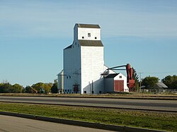
Grain elevator in Borden.
Canada Saskatchewan location map.svg
Red pog.svg
Borden
Canada location map 2.svg
Red pog.svg
Borden
Coordinates: 52°24′47″N107°13′19″W / 52.413°N 107.222°W / 52.413; -107.222
Country Canada
Province Saskatchewan
Region Saskatchewan
Census division 16
Rural Municipality Great Bend
Post office Founded1905
Incorporated (Village)1909
Fire Dept.1941
Government
  Type Municipal
  Governing bodyBorden Village Council
   Mayor Jamie Brandrick
   Administrator Carly Ford
Area
  Total0.76 km2 (0.29 sq mi)
Population
 (2016)
  Total287
  Density378.5/km2 (980/sq mi)
Time zone UTC-6 (CST)
Postal code
S0K 0N0
Area code 306
Highways Saskatchewan Highway 16.svg Hwy 16
Hwy 685
Railways Canadian National Railway
Website Village of Borden
[1] [2] [3] [4]

Borden (2016 population: 287) is a village in the Canadian province of Saskatchewan within the Rural Municipality of Great Bend No. 405 and Census Division No. 16. Borden is named after Sir Frederick William Borden, Minister of Militia in the Laurier Cabinet. [5] An abandoned arch bridge with the same name (Borden Bridge) is located to the southeast and was once used to carry Highway 16 across the North Saskatchewan River.

Contents

History

Borden incorporated as a village on July 19, 1907. [6]

Demographics

Business district, Shepard Street and First Avenue Business District Borden Saskatchewan.jpg
Business district, Shepard Street and First Avenue
Population history
(1981–2016)
YearPop.±%
1981197    
1986191−3.0%
1991215+12.6%
1996 217+0.9%
2001 225+3.7%
2006 223−0.9%
2011 245+9.9%
2016 287+17.1%
Source: Statistics Canada via Saskatchewan Bureau of Statistics [7] [8]

In the 2021 Census of Population conducted by Statistics Canada, Borden had a population of 281 living in 120 of its 131 total private dwellings, a change of

In the 2016 Census of Population, the Village of Borden recorded a population of 287 living in 126 of its 140 total private dwellings, a

Notable people

See also

Related Research Articles

<span class="mw-page-title-main">Aylesbury, Saskatchewan</span> Village in Saskatchewan, Canada

Aylesbury is a village in the Canadian province of Saskatchewan within the Rural Municipality of Craik No. 222 and Census Division No. 7. The village is approximately 60 km north of the City of Moose Jaw.

<span class="mw-page-title-main">Rural Municipality of Craik No. 222</span> Rural Municipality in Saskatchewan, Canada

The Rural Municipality of Craik No. 222 is a rural municipality (RM) in the Canadian province of Saskatchewan within Census Division No. 7 and SARM Division No. 2. The RM is centrally located between the cities of Regina and Saskatoon.

Albertville is a village in the Canadian province of Saskatchewan within the Rural Municipality of Garden River No. 490 and is in Census Division No. 15. It is approximately 25 km northeast of the City of Prince Albert.

<span class="mw-page-title-main">Rural Municipality of Colonsay No. 342</span> Rural Municipality in Saskatchewan, Canada

The Rural Municipality of Colonsay No. 342 is a rural municipality (RM) in the Canadian province of Saskatchewan within Census Division No. 11 and SARM Division No. 5. it is located east of the City of Saskatoon.

<span class="mw-page-title-main">Chaplin, Saskatchewan</span> Village in Saskatchewan, Canada

Chaplin is a village in the Canadian province of Saskatchewan within the Rural Municipality of Chaplin No. 164 and Census Division No. 7. The community is situated on the Trans-Canada Highway approximately 85 km from Moose Jaw and 90 km from Swift Current. The main industries of Chaplin are Saskatchewan Minerals and farming/ranching. Chaplin consists of eight streets, two crescents, and four avenues.

<span class="mw-page-title-main">Fillmore, Saskatchewan</span> Village in Saskatchewan, Canada

Fillmore is a village in the Canadian province of Saskatchewan within the Rural Municipality of Fillmore No. 96 and Census Division No. 2.

<span class="mw-page-title-main">Glenside, Saskatchewan</span> Village in Saskatchewan, Canada

Glenside is a village in the Canadian province of Saskatchewan within the Rural Municipality of Rudy No. 284 and Census Division No. 11. The village is located on Highway 219 approximately 10 km east of the Town of Outlook.

<span class="mw-page-title-main">Kincaid, Saskatchewan</span> Village in Saskatchewan, Canada

Kincaid is a village in the Canadian province of Saskatchewan within the Rural Municipality of Pinto Creek No. 75 and Census Division No. 3.

<span class="mw-page-title-main">Kinley, Saskatchewan</span> Village in Saskatchewan, Canada

Kinley is a village in the Canadian province of Saskatchewan within the Rural Municipality of Perdue No. 346 and Census Division No. 12. The village of Kinley is located about 55 km west of the City of Saskatoon on Highway 14, between the communities of Perdue 10 km west and Asquith 17 km east.

<span class="mw-page-title-main">Krydor, Saskatchewan</span> Village in Saskatchewan, Canada

Krydor is a village in the Canadian province of Saskatchewan within the Rural Municipality of Redberry No. 435 and Census Division No. 16. The community's name is a combination of the names of two early settlers, Petro Krysak and Teodor Lucyk. Petro Krysak also served as the first postmaster, from September 1, 1911, to July 7, 1913.

Leask is a village in the Canadian province of Saskatchewan within the Rural Municipality of Leask No. 464 and Census Division No. 16. This village is 80 km (50 mi) southwest of Prince Albert. It is the administrative centre of the Mistawasis First Nation band government and the Rural Municipality of Leask No. 464.

<span class="mw-page-title-main">Lucky Lake</span> Village in Saskatchewan, Canada

Lucky Lake is a village in the Canadian province of Saskatchewan within the Rural Municipality of Canaan No. 225 and Census Division No. 7. The Village is located at the junction of Highway 42, Highway 45 and Highway 646 approximately 90 km northeast of Swift Current, Saskatchewan.

<span class="mw-page-title-main">Maymont, Saskatchewan</span> Village in Saskatchewan, Canada

Maymont is a village in the Canadian province of Saskatchewan within the Rural Municipality of Mayfield No. 406 and Census Division No. 16. It is 90 kilometres (56 mi) north-west of the city of Saskatoon.

North Portal is a village in the Canadian province of Saskatchewan within the Rural Municipality of Coalfields No. 4 and Census Division No. 1. It is adjacent to the United States border opposite Portal, North Dakota. The border crossing is considered the major entry point to and from the U.S. within Saskatchewan.

Candle Lake is a resort village in the Canadian province of Saskatchewan within Census Division No. 15. It is on the shores of Candle Lake in the Rural Municipality of Paddockwood No. 520.

<span class="mw-page-title-main">Rural Municipality of Glen Bain No. 105</span> Rural Municipality in Saskatchewan, Canada

The Rural Municipality of Glen Bain No. 105 is a rural municipality (RM) in the Canadian province of Saskatchewan within Census Division No. 3 and SARM Division No. 3. It is located in the south-central portion of the province.

<span class="mw-page-title-main">Speers, Saskatchewan</span> Village in Saskatchewan, Canada

Speers is a village in the Canadian province of Saskatchewan within the Rural Municipality of Douglas No. 436 and Census Division No. 16. The village is located approximately 50 minutes southeast of the City of North Battleford on Highway 40.

Weekes is a village in the Canadian province of Saskatchewan within the Rural Municipality of Porcupine No. 395 and Census Division No. 14. The village is located 29 km east of the Town of Porcupine Plain on Highway 23.

Wiseton is a village in the Canadian province of Saskatchewan within the Rural Municipality of Milden No. 286 and Census Division No. 12. The village is located at the junction of Highway 44 and Highway 664 approximately 40 km southwest of Outlook.

<span class="mw-page-title-main">Rural Municipality of Cupar No. 218</span> Rural Municipality in Saskatchewan, Canada

The Rural Municipality of Cupar No. 218 is a rural municipality (RM) in the Canadian province of Saskatchewan within Census Division No. 6 and SARM Division No. 2.

References

  1. National Archives, Archivia Net, Post Offices and Postmasters, archived from the original on 2006-10-06
  2. Government of Saskatchewan, MRD Home, Municipal Directory System, archived from the original on November 21, 2008
  3. Canadian Textiles Institute. (2005), CTI Determine your provincial constituency, archived from the original on 2007-09-11
  4. Commissioner of Canada Elections, Chief Electoral Officer of Canada (2005), Elections Canada On-line, archived from the original on 2007-04-21
  5. "Geographic Names of Saskatchewan", Bill Barry (2005), p 53.
  6. "Urban Municipality Incorporations". Saskatchewan Ministry of Government Relations. Archived from the original on October 15, 2014. Retrieved June 1, 2020.
  7. "Saskatchewan Census Population" (PDF). Saskatchewan Bureau of Statistics. Archived from the original (PDF) on September 24, 2015. Retrieved May 31, 2020.
  8. "Saskatchewan Census Population". Saskatchewan Bureau of Statistics. Retrieved May 31, 2020.
  9. "Population and dwelling counts: Canada, provinces and territories, census divisions and census subdivisions (municipalities), Saskatchewan". Statistics Canada. February 9, 2022. Retrieved April 1, 2022.
  10. "Population and dwelling counts, for Canada, provinces and territories, and census subdivisions (municipalities), 2016 and 2011 censuses – 100% data (Saskatchewan)". Statistics Canada. February 8, 2017. Retrieved May 30, 2020.