Beechy

Last updated

Beechy
Village of Beechy
Canada Saskatchewan location map.svg
Red pog.svg
Beechy
Location of Beechy in Saskatchewan
Canada location map 2.svg
Red pog.svg
Beechy
Beechy (Canada)
Coordinates: 50°54′N107°24′W / 50.9°N 107.4°W / 50.9; -107.4
Country Canada
Province Saskatchewan
Region Southwest
Census division 7
Rural Municipality Victory
Post office Founded1908
Incorporated (Village)1925
Government
  Type Municipal
  Governing bodyBeechy Village Council
Population
 (2006)
  Total243
Time zone CST
Postal code
Area code 306
Website Village of Beechy website

Beechy [1] (2016 population: 228) is a village in the Canadian province of Saskatchewan within the Rural Municipality of Victory No. 226 and Census Division No. 7. The village is located in the Coteau Hills region of the province, at the intersection of Highway 342 and Highway 737. As of 2006, the village's population is 243 (down from the 2001 population of 295). [2]

Contents

History

The Beechy area was first settled by ranchers early in the 20th century, with Robert Cruikshank acknowledged as the first settler in the area. [3] Starting in the 1910s, the large-scale immigration of Europeans to the Canadian prairies resulted in an increase in population for Beechy as well, attracting settlers who started ranching and farming in the area, which remains Beechy's primary activity today.

In 1919 the Canadian National Railway surveyed the Beechy area and determined it to be an ideal place for a marketplace. Work on the railroad was begun; news of the future railroad stop attracted merchants. The train first arrived on December 21, 1921.

The growth in population brought other much-needed services to this rural community, the first grain elevator was constructed in 1922. Beechy incorporated as a village on May 11, 1925. [4]

Climate

Climate data for Beechy, 1981–2010 normals, extremes 1926–present
MonthJanFebMarAprMayJunJulAugSepOctNovDecYear
Record high °C (°F)12.8
(55.0)
15.0
(59.0)
24.0
(75.2)
34.4
(93.9)
36.5
(97.7)
41.1
(106.0)
42.8
(109.0)
39.5
(103.1)
37.8
(100.0)
32.8
(91.0)
25.5
(77.9)
17.2
(63.0)
42.8
(109.0)
Mean daily maximum °C (°F)−7.0
(19.4)
−4.1
(24.6)
2.5
(36.5)
12.3
(54.1)
18.5
(65.3)
22.8
(73.0)
26.4
(79.5)
25.9
(78.6)
19.4
(66.9)
11.6
(52.9)
1.1
(34.0)
−5.1
(22.8)
10.4
(50.7)
Daily mean °C (°F)−12.1
(10.2)
−9.2
(15.4)
−2.8
(27.0)
5.5
(41.9)
11.5
(52.7)
16.2
(61.2)
19.1
(66.4)
18.4
(65.1)
12.4
(54.3)
5.3
(41.5)
−3.8
(25.2)
−10.2
(13.6)
4.2
(39.6)
Mean daily minimum °C (°F)−17.1
(1.2)
−14.3
(6.3)
−8.0
(17.6)
−1.3
(29.7)
4.4
(39.9)
9.5
(49.1)
11.8
(53.2)
10.9
(51.6)
5.3
(41.5)
−1.1
(30.0)
−8.6
(16.5)
−15.2
(4.6)
−2.0
(28.4)
Record low °C (°F)−46.7
(−52.1)
−48.3
(−54.9)
−41.1
(−42.0)
−26.7
(−16.1)
−14.5
(5.9)
−4.4
(24.1)
0.0
(32.0)
−3.3
(26.1)
−17.8
(0.0)
−26.1
(−15.0)
−33.5
(−28.3)
−41.1
(−42.0)
−48.3
(−54.9)
Average precipitation mm (inches)14.7
(0.58)
8.5
(0.33)
16.6
(0.65)
17.5
(0.69)
46.2
(1.82)
73.4
(2.89)
61.5
(2.42)
40.6
(1.60)
33.8
(1.33)
18.2
(0.72)
13.3
(0.52)
14.1
(0.56)
358.4
(14.11)
Source: Environment Canada [5]

Demographics

Population history
(1981–2016)
YearPop.±%
1981279    
1986299+7.2%
1991298−0.3%
1996 281−5.7%
2001 295+5.0%
2006 243−17.6%
2011 239−1.6%
2016 228−4.6%
Source: Statistics Canada via Saskatchewan Bureau of Statistics [6] [7]

In the 2021 Census of Population conducted by Statistics Canada, Beechy had a population of 209 living in 103 of its 112 total private dwellings, a change of

In the 2016 Census of Population, the Village of Beechy recorded a population of 228 living in 116 of its 147 total private dwellings, a

Recreation

One of the first baseball teams in the area was formed in Beechy in 1911. Baseball is still played in the village today by the Beechy Breakers.

Beechy's first organized hockey team played during the winter of 1935–1936. After World War II, those Beechy residents who served overseas, which included the entire hockey team, returned to Beechy and created the Beechy Bombers hockey team. The first skating rink was built in 1952.

The first agricultural fair was held in the area in 1922. The agricultural society was organized in 1936 and granted its charter in 1945. The first racetrack was built in 1948, and the following year the first harness races were held.

The community hall was built in 2000, replacing the much older Legion Hall which was demolished and replaced with a monument.

The biggest event in Beechy is the Beechy Western Days rodeo, first held in 1968.

Sand Castles and Sunken Hill

The Sand Castles and Sunken Hill formations are 7.2 kilometres (4.5 mi) south-west of Beechy, north of Lake Diefenbaker. The scenic giant Sand Castles were formed due to many years of wind and rain erosion. The Sunken Hill was formed from the sudden collapse of a subterranean natural gas pocket. [10] [11] The formations, which are on private land, were closed to the public in 2019 due to "increasing visitation and associated risks". [12]

Health care

Originally, Beechy's health services consisted of just one medical practitioner, and the "hospital" was based out of a private residence, with extra rooms built on for wards. This hospital was used until 1966, when the Beechy Union Hospital was opened. In 1991, the Beechy Union Hospital was closed by the provincial government and the building now serves as a clinic.

Education

Schoolchildren in the RM of Victory No. 226 are bussed to Beechy for their education.

Notable residents

See also

Related Research Articles

Quill Lake is a village in the Canadian province of Saskatchewan within the Rural Municipality of Lakeside No. 338 and Census Division No. 10. It is 170 km east of Saskatoon and 200 km northeast of Regina.

Milden is a village in the Canadian province of Saskatchewan within the Rural Municipality of Milden No. 286 and Census Division No. 12. The village is located at the junction of Highway 15 and Highway 655 approximately 20 km west of Outlook on Highway 15.

Semans is a village in the Canadian province of Saskatchewan within the Rural Municipality of Mount Hope No. 279 and Census Division No. 10. The village is located approximately 125 km north of the City of Regina and 195 km southeast of the City of Saskatoon.

Neudorf is a village in the Canadian province of Saskatchewan within the Rural Municipality of McLeod No. 185 and Census Division No. 5. It is on Highway 22 east of Lemberg, and Abernethy, and west of Killaly.

<span class="mw-page-title-main">Stewart Valley</span> Village in Saskatchewan, Canada

Stewart Valley is a village in the Canadian province of Saskatchewan within the Rural Municipality of Saskatchewan Landing No. 167 and Census Division No. 8. It is on Highway 4, just south of the South Saskatchewan River, approximately 35 km (22 mi) north of the City of Swift Current in southern Saskatchewan. It is along the remains of the historic Swift Current-Battleford Trail.

<span class="mw-page-title-main">Neville, Saskatchewan</span> Village in Prairies, Canada

Neville is a village in the Canadian province of Saskatchewan within the Rural Municipality of Whiska Creek No. 106 and Census Division No. 3. It is located on Highway 43.

BulyeaBUUL-yay is a village in the Canadian province of Saskatchewan within the Rural Municipality of McKillop No. 220 and Census Division No. 6.

<span class="mw-page-title-main">Dinsmore, Saskatchewan</span> Village in Saskatchewan, Canada

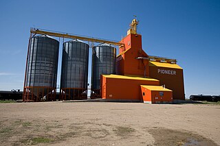
Dinsmore is a village in the Canadian province of Saskatchewan within the Rural Municipality of Milden No. 286 and Census Division No. 12.

<span class="mw-page-title-main">Kincaid, Saskatchewan</span> Village in Saskatchewan, Canada

Kincaid is a village in the Canadian province of Saskatchewan within the Rural Municipality of Pinto Creek No. 75 and Census Division No. 3.

<span class="mw-page-title-main">Krydor, Saskatchewan</span> Village in Saskatchewan, Canada

Krydor is a village in the Canadian province of Saskatchewan within the Rural Municipality of Redberry No. 435 and Census Division No. 16. The community's name is a combination of the names of two early settlers, Petro Krysak and Teodor Lucyk. Petro Krysak also served as the first postmaster, from September 1, 1911, to July 7, 1913.

<span class="mw-page-title-main">Loreburn, Saskatchewan</span> Village in Saskatchewan, Canada

Loreburn is a village in the Canadian province of Saskatchewan within the Rural Municipality of Loreburn No. 254 and Census Division No. 11. The village is 16 km (9.9 mi) north of Elbow and 16 km southeast of Danielson Provincial Park, which is located near Gardiner Dam, Lake Diefenbaker.

Macrorie is a village in the Canadian province of Saskatchewan within the Rural Municipality of Fertile Valley No. 285 and Census Division No. 12. The village contains a Co-op gas and grocery store. Danielson Provincial Park is 20 km southeast on Highway 44.

Pierceland is a village in the Canadian province of Saskatchewan within the Rural Municipality of Beaver River No. 622 and Census Division No. 17. It is north of the Beaver River on Highway 55.

<span class="mw-page-title-main">Conquest, Saskatchewan</span> Village in Saskatchewan, Canada

Conquest is a village in the Canadian province of Saskatchewan within the Rural Municipality of Fertile Valley No. 285 and Census Division No. 12.

<span class="mw-page-title-main">Rural Municipality of Victory No. 226</span> Rural municipality in Saskatchewan, Canada

The Rural Municipality of Victory No. 226 is a rural municipality (RM) in the Canadian province of Saskatchewan within Census Division No. 7 and SARM Division No. 3.

<span class="mw-page-title-main">Speers, Saskatchewan</span> Village in Saskatchewan, Canada

Speers is a village in the Canadian province of Saskatchewan within the Rural Municipality of Douglas No. 436 and Census Division No. 16. The village is located approximately 50 minutes southeast of the City of North Battleford on Highway 40.

<span class="mw-page-title-main">Tessier, Saskatchewan</span> Hamlet in Saskatchewan, Canada

Tessier is a village in the Canadian province of Saskatchewan within the Rural Municipality of Harris No. 316 and Census Division No. 12. The village is located approximately 60 km southwest of the City of Saskatoon on Highway 7.

Windthorst is a village in the Canadian province of Saskatchewan within the Rural Municipality of Chester No. 125 and Census Division No. 5.

Wiseton is a village in the Canadian province of Saskatchewan within the Rural Municipality of Milden No. 286 and Census Division No. 12. The village is located at the junction of Highway 44 and Highway 664 approximately 40 km southwest of Outlook.

<span class="mw-page-title-main">Cando, Saskatchewan</span>

Cando is a hamlet in Rosemount Rural Municipality No. 378, Saskatchewan, Canada. In 2006 the village had a population of 68 people. It previously held the status of village until December 31, 2005. The hamlet is located 48 km south of the City of North Battleford on highway 4. The community was served by Canadian National Railway's Porter Subdivision. The rail line was originally built by the Grand Truck Pacific from Oban to Battleford. The community is situated along the remains of the historic Swift Current-Battleford Trail. The portion of the line from Battleford to Cando was closed in 1974, leaving the portion to Cando from Oban. Once the elevator at Cando closed the remainder of the line was abandoned in the late 1980s.

References

  1. "Beechy". Canadian Geographical Names Database. Government of Canada. Retrieved March 31, 2024.
  2. "Beechy on Statistics Canada" . Retrieved May 20, 2007.
  3. "History page on beechysask.ca". Archived from the original on October 8, 2007. Retrieved May 20, 2007.
  4. "Urban Municipality Incorporations". Saskatchewan Ministry of Government Relations. Archived from the original on October 15, 2014. Retrieved June 1, 2020.
  5. Environment Canada - Canadian Climate Normals 1981-2010—Canadian Climate Normals 1981–2010, accessed 20 July 2016
  6. "Saskatchewan Census Population" (PDF). Saskatchewan Bureau of Statistics. Archived from the original (PDF) on September 24, 2015. Retrieved May 31, 2020.
  7. "Saskatchewan Census Population". Saskatchewan Bureau of Statistics. Retrieved May 31, 2020.
  8. "Population and dwelling counts: Canada, provinces and territories, census divisions and census subdivisions (municipalities), Saskatchewan". Statistics Canada. February 9, 2022. Retrieved April 1, 2022.
  9. "Population and dwelling counts, for Canada, provinces and territories, and census subdivisions (municipalities), 2016 and 2011 censuses – 100% data (Saskatchewan)". Statistics Canada. February 8, 2017. Retrieved May 30, 2020.
  10. "Tourism". Archived from the original on April 16, 2015. Retrieved April 9, 2015.
  11. "Unique Places to visit in Saskatchewan". To Do Canada. July 21, 2023. Retrieved March 31, 2024.
  12. Ruttle, Derek (May 2, 2019). "Beechy Sandcastles Closed to Public in 2019". SaskToday.ca. Glacier Media. Retrieved March 31, 2024.

50°53′00″N107°23′00″W / 50.88333°N 107.38333°W / 50.88333; -107.38333