
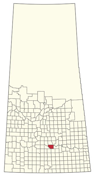
The Rural Municipality of Mariposa No. 350 is a rural municipality (RM) in the Canadian province of Saskatchewan within Census Division No. 13 and SARM Division No. 6.
The Rural Municipality of Dufferin No. 190 is a rural municipality (RM) in the Canadian province of Saskatchewan within Census Division No. 6 and SARM Division No. 2. It is located in the south-central portion of the province.

The Rural Municipality of Sarnia No. 221 is a rural municipality (RM) in the Canadian province of Saskatchewan within Census Division No. 6 and SARM Division No. 2. It is located in the south-central portion of the province.
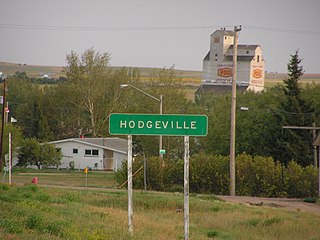
Scott is a town in the Rural Municipality of Tramping Lake No. 380, Saskatchewan, Canada. The population was 74 at the 2021 Canada Census. The town is south of the junction of Highway 14 and Highway 374, approximately 10 km west of the town of Wilkie. Scott was known as Saskatchewan's smallest town, but is now second smallest to Fleming.
Bjorkdale is a village in the Canadian province of Saskatchewan within the Rural Municipality of Bjorkdale No. 426 and Census Division No. 14. The village is at the junctions of Highways 23, 679, and 776, approximately 78 kilometres (48 mi) east of the city of Melfort.

Denholm is a village in the Canadian province of Saskatchewan within the Rural Municipality of Mayfield No. 406 and Census Division No. 16.
Dorintosh is a village in the Canadian province of Saskatchewan within the Rural Municipality of Meadow Lake No. 588 and Census Division No. 17.
Fosston is a village in the Canadian province of Saskatchewan within the Rural Municipality of Ponass Lake No. 367 and Census Division No. 14. The village was named after Fosston, Minnesota, the original home of five Rustad brothers, who homesteaded there.
Lake Lenore is a village in the Canadian province of Saskatchewan within the Rural Municipality of St. Peter No. 369 and Census Division No. 15. The village is located 144 kilometres (89 mi) northeast of the city of Saskatoon. To the north of the village is Lenore Lake, which is designated as a migratory bird sanctuary, an Important Bird Area (IBA) of Canada, and has a National Wildlife Area on Raven Island. Services in Lake Lenore include a school, Co-op Grocery and Agro Service Station, a Credit Union, and Public Library.
Makwa is a village in the Canadian province of Saskatchewan within the Rural Municipality of Loon Lake No. 561 and Census Division No. 17.
Marcelin is a village in the Canadian province of Saskatchewan within the Rural Municipality of Blaine Lake No. 434 and Census Division No. 16. It was named after the first postmaster Antoine Marcelin in 1904.
Medstead is a village in the Canadian province of Saskatchewan within the Rural Municipality of Medstead No. 497 and Census Division No. 16.
Pleasantdale is a village in the Canadian province of Saskatchewan within the Rural Municipality of Pleasantdale No. 398 and Census Division No. 14.
The Rural Municipality of Lawtonia No. 135 is a rural municipality (RM) in the Canadian province of Saskatchewan within Census Division No. 7 and SARM Division No. 3.
St. Benedict is a village in the Canadian province of Saskatchewan within the Rural Municipality of Three Lakes No. 400 and Census Division No. 15. Located in the Carlton Trail Region of the province, it is 56 km (35 mi) north of the City of Humboldt off Highway 20.

Speers is a village in the Canadian province of Saskatchewan within the Rural Municipality of Douglas No. 436 and Census Division No. 16. The village is located approximately 50 kilometres (31 mi)} southeast of the City of North Battleford on Highway 40.
Chorney Beach is a resort village in the Canadian province of Saskatchewan within Census Division No. 10. It is on the shores of Fishing Lake in the Rural Municipality of Foam Lake No. 276.
Tobin Lake is a resort village in the Canadian province of Saskatchewan within Census Division No. 14. It is on the shores of Tobin Lake in the Rural Municipality of Moose Range No. 486. It is approximately 34 km (21 mi) northeast of Nipawin at the end of Highway 255, which is accessed via Highway 55.
Wakaw Lake is a resort village in the Canadian province of Saskatchewan within Census Division No. 15. It is on the shores of Wakaw Lake in the Rural Municipality of Hoodoo No. 401. It is on Highway 41 approximately 86 kilometres (53 mi) north-east of Saskatoon and 63 kilometres (39 mi) south of Prince Albert.

The Rural Municipality of Tramping Lake No. 380 is a rural municipality (RM) in the Canadian province of Saskatchewan within Census Division No. 13 and SARM Division No. 6.


