Related Research Articles

Laura is a hamlet in Montrose Rural Municipality 315, Saskatchewan, Canada. It previously held the status of village until December 31, 1954 and again at an unknown date but was restructured back to hamlet status on December 28, 1978. The hamlet is located southwest of Saskatoon along Highway 7 and Canadian National Railway Saskatoon-Rosetown stub. Prior to the Great Depression, Laura was a bustling active pioneer farming community.

The Rural Municipality of Bone Creek No. 108 is a rural municipality (RM) in the Canadian province of Saskatchewan within Census Division No. 4 and SARM Division No. 3. It is located in the southwest portion of the province.

The Rural Municipality of Winslow No. 319 is a rural municipality (RM) in the Canadian province of Saskatchewan within Census Division No. 13 and SARM Division No. 6.

Scotsguard is an unincorporated community within the Rural Municipality of Bone Creek No. 108, Saskatchewan, Canada. The community is located on Highway 13, also known as the historic Red Coat Trail, about 10 km northeast of the town of Shaunavon.
Vawn is a former village, now a hamlet, in the Canadian province of Saskatchewan. It was dissolved as a village in 2004; its population is now counted as part of the rural municipality of Turtle River. Vawn is located on Highway 26 52 km north west of the City of North Battleford.
Wishart is a hamlet in Emerald Rural Municipality No. 277 in the Canadian province of Saskatchewan. It is listed as a designated place by Statistics Canada. The hamlet had a population of 95 in the Canada 2006 Census. It previously held the status of village until January 1, 2002. The hamlet is located 32 km southwest of the village of Elfros at the intersection of highway 639 and highway 743.
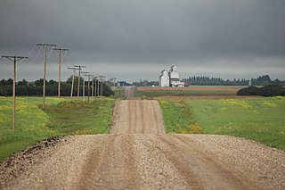
Stornoway is a special service area within the Rural Municipality of Wallace No. 243. In 2006 the community had a population of 10 people. It previously held the status of village until December 31, 2006. The community is located east of the City of Yorkton 10 km north of highway 10. The Community was founded in the late 1890s by Robert MacKay of Stornoway, Scotland.

Cando is a hamlet in Rosemount Rural Municipality No. 378, Saskatchewan, Canada.
Lockwood is a former village in the Canadian province of Saskatchewan. It was dissolved in 2002; its population is now counted as part of the rural municipality of Usborne. Lockwood is located on Highway 20 15 km north of the Town of Nokomis.
Glidden is a hamlet in the Rural Municipality of Newcombe No. 260, Saskatchewan, Canada. In 2001 the community had a population of 40 people. It previously held the status of village until October 19, 2000. The hamlet is located 26 kilometres (16 mi) south of the town of Kindersley at the intersection of highway 21, highway 44 & highway 649.
Evesham is a hamlet in Eye Hill Rural Municipality No. 382, Saskatchewan, Canada. In 2001, the community had a population of 40 people and today fosters 35 citizens. It previously held the status of village until August 3, 2000. The hamlet is located 31 kilometres (19 mi) east of the town of Provost, Alberta, on highway 14.
Madison is an unincorporated community in Newcombe Rural Municipality No. 260, Saskatchewan, Canada. The community had a population of 10 in 2001. It previously held the status of village until February 1, 1998. The hamlet is located 20 km west of the Town of Eston on highway 44 along the Canadian National Railway subdivision.
Lawson is a hamlet in Maple Bush Rural Municipality No. 224, Saskatchewan, Canada. It previously held the status of village until December 31, 1985. The hamlet is located 12 km north-west of the Town of Central Butte on highway 42 along the now defunct Canadian Pacific Railway subdivision.
Leipzig is a hamlet in Reford Rural Municipality No. 379, Saskatchewan, Canada. It previously held the status of a village until February 1, 1984. The hamlet is located 27 km south of the town of Wilkie on highway 657. It is named after the German city of Leipzig. The streets are also named after other German cities.
Summerberry is an organized hamlet in the Rural Municipality of Wolseley No. 155, Saskatchewan, Canada that previously held village status until December 31, 1972. It is located between the towns of Wolseley and Grenfell on Highway 1, 15 km east of Wolseley.
Leney is an unincorporated community in Perdue Rural Municipality No. 346, Saskatchewan, Canada. The community had a population of 30 in 2001. It previously held the status of a village until December 31, 1971. The hamlet is located 68 km west of the City of Saskatoon on highway 655 3 km south the town of Perdue and highway 14 on the Canadian National Railway.
Richlea is a hamlet in Snipe Lake Rural Municipality No. 259, Saskatchewan, Canada. It previously held the status of a village until December 31, 1958.
Readlyn is a hamlet in Excel Rural Municipality No. 71, Saskatchewan, Canada. It previously held the status of a village until December 31, 1955.
Cavell is a hamlet in Reford Rural Municipality No. 379, Saskatchewan, Canada. It previously held the status of a village until January 1, 1943.
References
- ↑ "Restructured Villages". Saskatchewan Ministry of Municipal Affairs. Archived from the original on March 25, 2008. Retrieved February 10, 2008.
Subdivisions of Saskatchewan | |
|---|---|
| Subdivisions | |
| Communities | |
| Cities | |
| Topics | |

51°47′56″N108°48′18″W / 51.799°N 108.805°W
| | This article about a location in the Census Division No. 13 of Saskatchewan is a stub. You can help Wikipedia by expanding it. |