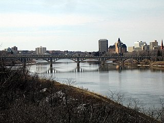
Saskatchewan is a province in Western Canada. It is bordered on the west by Alberta, on the north by the Northwest Territories, on the east by Manitoba, to the northeast by Nunavut, and to the south by the United States. Saskatchewan and Alberta are the only landlocked provinces of Canada. In 2024, Saskatchewan's population was estimated at 1,239,865. Nearly 10% of Saskatchewan's total area of 651,900 km2 (251,700 sq mi) is fresh water, mostly rivers, reservoirs, and lakes.

The South Saskatchewan River is a major river in the Canadian provinces of Alberta and Saskatchewan. The river begins at the confluence of the Bow and Oldman Rivers in southern Alberta and ends at the Saskatchewan River Forks in central Saskatchewan. The Saskatchewan River Forks is the confluence of the South and North Saskatchewan Rivers and is the beginning of the Saskatchewan River.

The premier of Saskatchewan is the first minister and head of government for the Canadian province of Saskatchewan. The current premier of Saskatchewan is Scott Moe, who was sworn in as premier on February 2, 2018, after winning the 2018 Saskatchewan Party leadership election. The first premier of Saskatchewan was Liberal Thomas Walter Scott, who served from 1905 to 1916. Since Saskatchewan was created as a province in 1905, 15 individuals have served as premier.

The North Saskatchewan River is a glacier-fed river that flows from the Canadian Rockies continental divide east to central Saskatchewan, where it joins with the South Saskatchewan River to make up the Saskatchewan River. Its water flows eventually into the Hudson Bay.
The Saskatchewan Association of Rural Municipalities, often abbreviated as SARM, is an independent association that is responsible for representing the governments of the many rural municipalities in the Canadian province of Saskatchewan. It is an official Government of Saskatchewan sanctioned corporation. There are 296 rural municipalities represented by SARM in such areas as dealing with the provincial and federal governments. The members are arranged in divisions in order to elect SARM Directors.

The Legislative Assembly of Saskatchewan is the legislative chamber of the Saskatchewan Legislature in the province of Saskatchewan, Canada. Bills passed by the assembly are given royal assent by the lieutenant governor of Saskatchewan, in the name of the King of Canada. The assembly meets at the Saskatchewan Legislative Building in Regina.
Storthoaks is a village in the Canadian province of Saskatchewan within the Rural Municipality of Storthoaks No. 31 and Census Division No. 1. The village is located approximately 129 km east of the City of Estevan on Highway 361 and 16 km west of the Saskatchewan-Manitoba border.


