
Marengo is a village in the Canadian province of Saskatchewan within the Rural Municipality of Milton No. 292 and Census Division No. 13. It is about 45 km (28 mi) west of Kindersley. It is located within the Sun West School Division.

Consul is a village in the Canadian province of Saskatchewan within the Rural Municipality of Reno No. 51 and Census Division No. 4. The historic Red Coat Trail and Highway 21 pass through the village. The village features one of the last existing grain elevators in the region. It is 211 km southwest of the City of Swift Current.
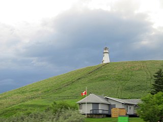
Kannata Valley is a resort village in the Canadian province of Saskatchewan within Census Division No. 6. It is on the shores of Last Mountain Lake in the Rural Municipality of Longlaketon No. 219. It is approximately 52 km (32 mi) northwest of Regina.

The Rural Municipality of Senlac No. 411 is a rural municipality (RM) in the Canadian province of Saskatchewan within Census Division No. 13 and SARM Division No. 6. Located in the west-central portion of the province, it is adjacent to the Alberta boundary.

The Rural Municipality of Shamrock No. 134 is a rural municipality (RM) in the Canadian province of Saskatchewan within Census Division No. 7 and SARM Division No. 2. Located in the south-central portion of the province, it is south of Highway 1.

Belle Plaine is a village in the Canadian province of Saskatchewan within the Rural Municipality of Pense No. 160 and Census Division No. 6. Belle Plaine is located on Highway 1, 21 kilometres east of the City of Moose Jaw in south-central Saskatchewan. Buffalo Pound Provincial Park and Regina Beach are located near Belle Plaine.
Creelman is a village in the Canadian province of Saskatchewan within the Rural Municipality of Fillmore No. 96 and Census Division No. 2. The village lies 118 km southeast of the City of Regina, on Highway 33.
Duff is a village in the Canadian province of Saskatchewan adjacent to both Rural Municipality (RM) of Cana No. 214 and the RM of Stanley No. 215 and within Census Division No. 5. The village is located approximately 122 kilometres (76 mi) northeast of the City of Regina, 66 kilometres (41 mi) southwest of Yorkton and 20 kilometres (12 mi) west of Melville.
Duval is a village in the Canadian province of Saskatchewan within the Rural Municipality of Last Mountain Valley No. 250 and Census Division No. 11. The village is located on Highway 20 approximately 93 km north of the City of Regina.
Flaxcombe is a village in the Canadian province of Saskatchewan within the Rural Municipality of Kindersley No. 290 and Census Division No. 13. The village is located approximately 30 km west of the Town of Kindersley, on Highway 7, and approximately 27 km east of the Alberta-Saskatchewan border.
Fosston is a village in the Canadian province of Saskatchewan within the Rural Municipality of Ponass Lake No. 367 and Census Division No. 14. The village was named after Fosston, Minnesota, the original home of five Rustad brothers, who homesteaded here.

Glenside is a village in the Canadian province of Saskatchewan within the Rural Municipality of Rudy No. 284 and Census Division No. 11. The village is located on Highway 219 approximately 10 km east of the Town of Outlook.
Goodsoil is a village in the Canadian province of Saskatchewan within the Rural Municipality of Beaver River No. 622 and Census Division No. 17. The Goodsoil Historical Museum Site is a municipal heritage property on the Canadian Register of Historic Places. It is the western gateway to Meadow Lake Provincial Park.
Major is a village in the Canadian province of Saskatchewan within the Rural Municipality of Prairiedale No. 321 and Census Division No. 13.

Marsden is a village in the Canadian province of Saskatchewan within the Rural Municipality of Manitou Lake No. 442 and Census Division No. 13. It gained notoriety shortly after the impact of the Buzzard Coulee meteorite near the village in November 2008.

The Rural Municipality of Carmichael No. 109 is a rural municipality (RM) in the Canadian province of Saskatchewan within Census Division No. 4 and SARM Division No. 3.
Torquay is a village in the Canadian province of Saskatchewan within the Rural Municipality of Cambria No. 6 and Census Division No. 2. It was named after Torquay in Devon, England.
Windthorst is a village in the Canadian province of Saskatchewan within the Rural Municipality of Chester No. 125 and Census Division No. 5.
Osage is a village in the Canadian province of Saskatchewan within the Rural Municipality of Fillmore No. 96 and Census Division No. 2. The village is located on Highway 33, that runs southeast from Regina to Stoughton. The village has a single grain elevator, post office, a service station and a two-sheet natural ice curling rink. Children from the area attend school in Fillmore, 13 km away. Osage celebrated its centennial in 2006.
Cochin is a resort village in the Canadian province of Saskatchewan within Census Division No. 17. It is on the shores of Jackfish Lake in the Rural Municipality of Meota No. 468.


