Forget, Saskatchewan

Last updated • 1 min readFrom Wikipedia, The Free Encyclopedia

Forget
Village of Forget
Our Lady of La Salette Church Forget SK.jpg
Our Lady of La Salette Church in Forget
Canada Saskatchewan location map.svg
Red pog.svg
Forget
Canada location map 2.svg
Red pog.svg
Forget
Coordinates: 49°39′13″N102°52′12″W / 49.65361°N 102.87000°W / 49.65361; -102.87000
CountryCanada
Province Saskatchewan
Census division 1
Rural Municipality Tecumseh
Government
  Type Municipal
  Governing bodyForget Village Council
  MayorRick Coderre
   Administrator Zandra Slater
Area
  Total1.39 km2 (0.54 sq mi)
Population
 (2016)
  Total55
  Density39.7/km2 (103/sq mi)
Time zone UTC-6 (CST)
Postal code
S0C 0X0
Area code 306
Highways Saskatchewan Highway 13 (jct).svg Hwy 13
Saskatchewan Rural Municipal Route.svg
Saskatchewan Route 616.svg
Hwy 616
Railways Canadian Pacific Railway
[1] [2] [3] [4]

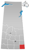
Forget /ˈfɔːrʒ/ [5] is a village in the Canadian province of Saskatchewan within the Rural Municipality of Tecumseh No. 65 and Census Division No. 1. It is located east of Stoughton, near Highway 13.

Contents

Forget incorporated as a village on November 21, 1904. [6] The village is named in honour of Amédée E. Forget, the first Lieutenant Governor of Saskatchewan.

Demographics

Population history
(1981–2016)
YearPop.±%
198170    
198681+15.7%
199168−16.0%
1996 62−8.8%
2001 40−35.5%
2006 40+0.0%
2011 35−12.5%
2016 55+57.1%
2021 35−36.4%
Source: Statistics Canada via Saskatchewan Bureau of Statistics [7] [8] [9] [10]

In the 2021 Census of Population conducted by Statistics Canada, Forget had a population of 35 people living in 18 of its 22 total private dwellings. With a land area of 1.37 km2 (0.53 sq mi), it had a population density of

See also

Related Research Articles

<span class="mw-page-title-main">Glen Ewen</span> Village in Saskatchewan, Canada

Glen Ewen is a village in the Canadian province of Saskatchewan within the Rural Municipality of Enniskillen No. 3 and Census Division No. 1. The village is located on the Canadian Pacific Railway just south of Provincial Highway 18. The towns of Carnduff and Oxbow are nearby.

Atwater is a village in the Canadian province of Saskatchewan within the Rural Municipality of Fertile Belt No. 183 and Census Division No. 5. The village is approximately 45 km southeast of the City of Melville on Highway 629.

<span class="mw-page-title-main">Climax, Saskatchewan</span> Village in Saskatchewan, Canada

Climax is a village in the Canadian province of Saskatchewan within the Rural Municipality of Lone Tree No. 18 and Census Division No. 4. The village is located in the southwestern region of the province, just north of the U.S. border, situated on Highway 18 between Frontier and Canuck and on Highway 37 between Shaunavon and the Port of Climax.

Storthoaks is a village in the Canadian province of Saskatchewan within the Rural Municipality of Storthoaks No. 31 and Census Division No. 1. The village is located approximately 129 km east of the City of Estevan on Highway 361 and 16 km west of the Saskatchewan-Manitoba border.

Bangor is a village in the Canadian province of Saskatchewan within the Rural Municipality of Fertile Belt No. 183 and Census Division No. 5.

BulyeaBUUL-yay is a village in the Canadian province of Saskatchewan within the Rural Municipality of McKillop No. 220 and Census Division No. 6.

Killaly is a village in the Canadian province of Saskatchewan within the Rural Municipality of Grayson No. 184 and Census Division No. 5. The village is located 23 km south of the City of Melville on Highway 47 at the intersection of Highway 22 and 47, and only 17 minutes north of Crooked Lake.

Buchanan is a village in the Canadian province of Saskatchewan within the Rural Municipality of Buchanan No. 304 and Census Division No. 9.
<span class="mw-page-title-main">Creelman, Saskatchewan</span> Village in Saskatchewan, Canada

Creelman is a village in the Canadian province of Saskatchewan within the RM of Fillmore No. 96 and Census Division No. 2. The village lies 118 km southeast of the City of Regina, on Highway 33.

Dilke is a village in the Canadian province of Saskatchewan within the Rural Municipality of Sarnia No. 221 and Census Division No. 6.

Dorintosh is a village in the Canadian province of Saskatchewan within the Rural Municipality of Meadow Lake No. 588 and Census Division No. 17.

Duval is a village in the Canadian province of Saskatchewan within the Rural Municipality of Last Mountain Valley No. 250 and Census Division No. 11. The village is located on Highway 20 approximately 93 km north of the City of Regina.

<span class="mw-page-title-main">Fillmore, Saskatchewan</span> Village in Saskatchewan, Canada

Fillmore is a village in the Canadian province of Saskatchewan within the Rural Municipality of Fillmore No. 96 and Census Division No. 2.

<span class="mw-page-title-main">Frobisher, Saskatchewan</span> Village in Saskatchewan, Canada

Frobisher is a village in the Canadian province of Saskatchewan within the Rural Municipality of Coalfields No. 4 and Census Division No. 1. It has an elevation of 576 metres above sea level.

Hyas is a village in the Canadian province of Saskatchewan within the Rural Municipality of Clayton No. 333 and Census Division No. 9.

Leross or is a village in the Canadian province of Saskatchewan within the Rural Municipality of Kellross No. 247 and Census Division No. 10.

Waldron is a village in the Canadian province of Saskatchewan within the Rural Municipality of Grayson No. 184 and Census Division No. 5.

Weekes is a village in the Canadian province of Saskatchewan within the Rural Municipality of Porcupine No. 395 and Census Division No. 14. The village is located 29 km east of the Town of Porcupine Plain on Highway 23.

Windthorst is a village in the Canadian province of Saskatchewan within the Rural Municipality of Chester No. 125 and Census Division No. 5.

<span class="mw-page-title-main">Rural Municipality of Grandview No. 349</span> Rural Municipality in Saskatchewan, Canada

The Rural Municipality of Grandview No. 349 is a rural municipality (RM) in the Canadian province of Saskatchewan within Census Division No. 13 and SARM Division No. 6.

References

  1. National Archives, Archivia Net, Post Offices and Postmasters, archived from the original on 6 October 2006
  2. Government of Saskatchewan, MRD Home, Municipal Directory System, archived from the original on 21 November 2008
  3. Canadian Textiles Institute. (2005), CTI Determine your provincial constituency, archived from the original on 11 September 2007
  4. Commissioner of Canada Elections, Chief Electoral Officer of Canada (2005), Elections Canada On-line, archived from the original on 21 April 2007
  5. The Canadian Press (2017), The Canadian Press Stylebook (18th ed.), Toronto: The Canadian Press
  6. "Urban Municipality Incorporations". Saskatchewan Ministry of Government Relations. Archived from the original on 15 October 2014. Retrieved 1 June 2020.
  7. "Saskatchewan Census Population" (PDF). Saskatchewan Bureau of Statistics. Archived from the original (PDF) on 24 September 2015. Retrieved 31 May 2020.
  8. "Saskatchewan Census Population". Saskatchewan Bureau of Statistics. Retrieved 31 May 2020.
  9. "Population and dwelling counts, for Canada, provinces and territories, and census subdivisions (municipalities), 2016 and 2011 censuses – 100% data (Saskatchewan)". Statistics Canada. 8 February 2017. Retrieved 30 May 2020.
  10. 1 2 "Population and dwelling counts: Canada, provinces and territories, census divisions and census subdivisions (municipalities), Saskatchewan". Statistics Canada. 9 February 2022. Retrieved 1 April 2022.
Our Lady of La Salette Church, 1918 R.C. Church, Forget, Sask.jpg
Our Lady of La Salette Church, 1918

Further reading

49°39′13″N102°52′12″W / 49.65361°N 102.87000°W / 49.65361; -102.87000