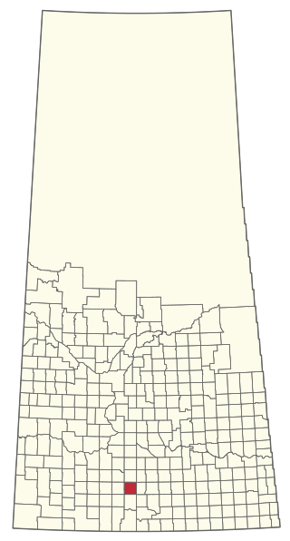
The Rural Municipality of Colonsay No. 342 is a rural municipality (RM) in the Canadian province of Saskatchewan within Census Division No. 11 and SARM Division No. 5. it is located east of the City of Saskatoon.
Arran is a special service area in the Canadian province of Saskatchewan within the Rural Municipality of Livingston No. 331 and Census Division No. 9. It held village status between 1916 and 2022.
Gull Lake is a summer village located on the southern shore of Gull Lake, located approximately 24 km (15 mi)southeast of the Town of Rimbey in central Alberta, Canada.

The Rural Municipality of Argyle No. 1 is a rural municipality (RM) in the Canadian province of Saskatchewan within Census Division No. 1 and SARM Division No. 1. It is located in the southeast corner of the province along Highway 18.
Storthoaks is a village in the Canadian province of Saskatchewan within the Rural Municipality of Storthoaks No. 31 and Census Division No. 1. The village is located approximately 129 km east of the City of Estevan on Highway 361 and 16 km west of the Saskatchewan-Manitoba border.

Neville is a village in the Canadian province of Saskatchewan within the Rural Municipality of Whiska Creek No. 106 and Census Division No. 3. It is located on Highway 43.
BulyeaBUUL-yay is a village in the Canadian province of Saskatchewan within the Rural Municipality of McKillop No. 220 and Census Division No. 6.
Bjorkdale is a village in the Canadian province of Saskatchewan within the Rural Municipality of Bjorkdale No. 426 and Census Division No. 14. The village is located at the junctions of Highway 23, 679 & 776, approximately 78 kilometres (48 mi) east of the City of Melfort.
Dilke is a village in the Canadian province of Saskatchewan within the Rural Municipality of Sarnia No. 221 and Census Division No. 6.

Fillmore is a village in the Canadian province of Saskatchewan within the Rural Municipality of Fillmore No. 96 and Census Division No. 2.
Gerald is a village in the Canadian province of Saskatchewan within the Rural Municipality of Spy Hill No. 152 and Census Division No. 5.
Kelliher is a village in the Canadian province of Saskatchewan within the Rural Municipality of Kellross No. 247 and Census Division No. 10. The village is located about 140 km north of the City of Regina.
Leross or is a village in the Canadian province of Saskatchewan within the Rural Municipality of Kellross No. 247 and Census Division No. 10.

The Rural Municipality of Orkney No. 244 is a rural municipality (RM) in the Canadian province of Saskatchewan within Census Division No. 9 and SARM Division No. 4. It is located in the southeast portion of the province.
Quinton is a village in the Canadian province of Saskatchewan within the Rural Municipality of Mount Hope No. 279 and Census Division No. 10. The village is located on Highway 15 between the Town of Raymore and the Village of Punnichy. It is near the administrative office of the Kawacatoose First Nations.
Spy Hill is a village in the Canadian province of Saskatchewan within the Rural Municipality of Spy Hill No. 152 and Census Division No. 5. It is at the intersection of Highway 8 and Highway 600. The community's school closed due to a lack of students, who are now bused approximately 27 km (17 mi) to Langenburg). The Northland Power - Spy Hill Power Plant is located in the community.
Tantallon is a village in the Canadian province of Saskatchewan within the Rural Municipality of Spy Hill No. 152 and Census Division No. 5. It is in the Qu'Appelle Valley along the Qu'Appelle River about 39 km east of Round Lake (Saskatchewan). The community celebrated its centennial in 2004.
Weekes is a village in the Canadian province of Saskatchewan within the Rural Municipality of Porcupine No. 395 and Census Division No. 14. The village is located 29 km east of the Town of Porcupine Plain on Highway 23.

Young is a village in the Canadian province of Saskatchewan within the Rural Municipality of Morris No. 312. The economy is dominated by local agriculture and the nearby Mosaic Potash mine.

The Rural Municipality of Sutton No. 103 is a rural municipality (RM) in the Canadian province of Saskatchewan within Census Division No. 3 and SARM Division No. 2.


