
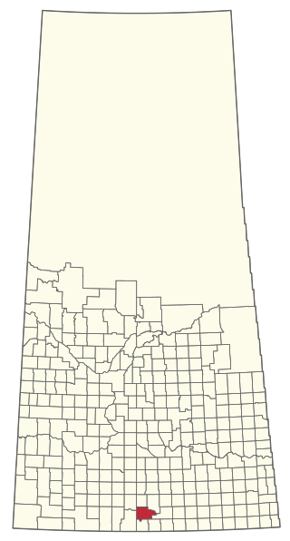
Cannington is a provincial electoral district for the Legislative Assembly of Saskatchewan, Canada. Located in the extreme southeast corner of the province, this constituency was redrawn to include the former district of Souris for the 18th Saskatchewan general election in 1975.

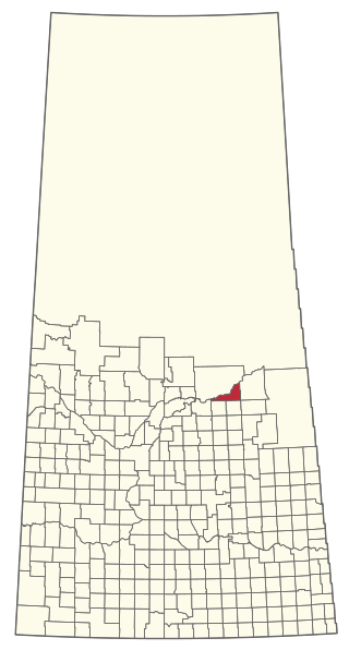
Division No. 1 is one of eighteen census divisions in the province of Saskatchewan, Canada, as defined by Statistics Canada. It is located in the southeast corner of the province, bordering Manitoba and North Dakota. The most populous community in this division is Estevan.

The Rural Municipality of Moose Jaw No. 161 is a rural municipality (RM) in the Canadian province of Saskatchewan within Census Division No. 7 and SARM Division No. 2. It is located in the south-central portion of the province, surrounding the city of Moose Jaw.

Carlyle is a town in the province of Saskatchewan, Canada. Carlyle is the largest town servicing the far south-eastern corner of Saskatchewan and as a result, has become the economic and services centre of the region. Estevan and Weyburn are the closest cities and both are a little over 100 kilometres away. Regina, the provincial capital, lies 200 km to the north-west.

Cannington Manor Provincial Park is an historic park in the RM of Moose Mountain in the south-east corner of the Canadian province of Saskatchewan. An aristocratic English colony was established at the site in 1882 by Captain Edward Michell Pierce. It became a provincial park in 1986. Cannington Manor is located west and north of Highway 603. The Colony is 16 kilometres (9.9 mi) south-east of Moose Mountain Provincial Park, and 60 kilometres (37 mi) south of Moosomin.

Frobisher is a village in the Canadian province of Saskatchewan within the Rural Municipality of Coalfields No. 4 and Census Division No. 1. It has an elevation of 576 metres above sea level.

Kenosee Lake is a village in the Canadian province of Saskatchewan within the Rural Municipality of Wawken No. 93 and Census Division No. 1.
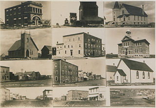
Manor is a village in the Canadian province of Saskatchewan within the RM of Moose Mountain No. 63 and Census Division No. 1. The Manor Museum (1904) is designated a Municipal Heritage Property under the provincial Heritage Property Act.

The Rural Municipality of Fertile Valley No. 285 is a rural municipality (RM) in the Canadian province of Saskatchewan within Census Division No. 12 and SARM Division No. 5. It is located in the southwest portion of the province.

Cannington Lake, also known as Cannington Lake Resort, is a hamlet within the Rural Municipality of Moose Mountain No. 63 in the Canadian province of Saskatchewan at the north-east corner of Cannington Lake. Listed as a designated place by Statistics Canada, the hamlet had a population of 0 in the Canada 2011 Census.

The Rural Municipality of Coalfields No. 4 is a rural municipality (RM) in the Canadian province of Saskatchewan within Census Division No. 1 and SARM Division No. 1. Located in the southeast portion of the province, it is adjacent to the United States, neighbouring Burke County, North Dakota.

The Rural Municipality of Old Post No. 43 is a rural municipality (RM) in the Canadian province of Saskatchewan within Census Division No. 3 and SARM Division No. 2. It is located in the southern portion of the province adjacent to the United States border, neighbouring Valley County and Daniels County in Montana.
The Rural Municipality of Moose Creek No. 33 is a rural municipality (RM) in the Canadian province of Saskatchewan within Census Division No. 1 and SARM Division No. 1.
The Rural Municipality of Willow Bunch No. 42 is a rural municipality (RM) in the Canadian province of Saskatchewan within Census Division No. 3 and SARM Division No. 2. It is located in the south central portion of the province.

The Rural Municipality of Wawken No. 93 is a rural municipality (RM) in the Canadian province of Saskatchewan within Census Division No. 1 and SARM Division No. 1. It is located in the southeast portion of the province.

The Rural Municipality of Hazelwood No. 94 is a rural municipality (RM) in the Canadian province of Saskatchewan within Census Division No. 1 and SARM Division No. 1. It is located in the southeast portion of the province.

The Rural Municipality of Last Mountain Valley No. 250 is a rural municipality (RM) in the Canadian province of Saskatchewan within Census Division No. 11 and SARM Division No. 5.

The Rural Municipality of Moose Range No. 486 is a rural municipality (RM) in the Canadian province of Saskatchewan within Census Division No. 14 and SARM Division No. 4.
The Rural Municipality of Nipawin No. 487 is a rural municipality (RM) in the Canadian province of Saskatchewan within Census Division No. 14 and SARM Division No. 4.
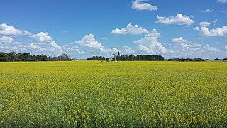
Moose Mountain Upland, Moose Mountain Uplands, or commonly Moose Mountain, is a hilly plateau located in the south-east corner of the Canadian province of Saskatchewan, that covers an area of about 13,000 square kilometres (5,000 sq mi). The upland rises about 200 metres (660 ft) above the broad, flat prairie which is about 600 metres (2,000 ft) above sea level. The highest peak is "Moose Mountain" at 830 metres (2,720 ft) above sea level. The upland was named Moose Mountain because of the large number of moose that lived in the area. When it was originally used by fur traders, Métis, and the Indigenous peoples, the plateau was called Montagne a la Bosse, which is French for "The Mountain of the Bump or Knob".


