Rural Municipality of Fertile Valley No. 285

Last updated

Fertile Valley No. 285
Rural Municipality of Fertile Valley No. 285
SK RM 285 Fertile Valley.svg
Location of the RM of Fertile Valley No. 285 in Saskatchewan
Coordinates: 51°24′04″N107°04′48″W / 51.401°N 107.080°W / 51.401; -107.080 [1]
CountryCanada
Province Saskatchewan
Census division 12
SARM division 5
Formed [2] December 13, 1909
Government
[3]
   Reeve Barry Friesen
  Governing bodyRM of Fertile Valley No. 285 Council
  AdministratorL Jean Jones
  Office location Conquest
Area
 (2016) [4]
  Land1,016.37 km2 (392.42 sq mi)
Population
 (2016) [4]
  Total539
  Density0.5/km2 (1/sq mi)
Time zone CST
  Summer (DST) CST
Postal code
S0L 0L0
Area code(s) 306 and 639
Highway(s) Highway 15
Highway 44
Highway 45
Waterway(s)Anerley Lakes
Coteau Lake
Macdonald Creek
Milden Lake
South Saskatchewan River
Stockwell Lake

The Rural Municipality of Fertile Valley No. 285 (2016 population: 539) is a rural municipality (RM) in the Canadian province of Saskatchewan within Census Division No. 12 and SARM Division No. 5. It is located in the southwest portion of the province.

Contents

History

The RM of Fertile Valley No. 285 incorporated as a rural municipality on December 13, 1909. [2]

Geography

Communities and localities

The following urban municipalities are surrounded by the RM.

Villages

The following unincorporated communities are within the RM.

Localities

Attractions

The eastern boundary of the RM runs along the South Saskatchewan River with the south-east corner at Gardiner Dam on Lake Diefenbaker. A portion of Danielson Provincial Park is within the RM near the dam.

On the RM's eastern boundary, and the western bank of the South Saskatchewan River, is Coldwell Park Recreation Site ( 51°18′35″N106°56′07″W / 51.3098°N 106.9353°W / 51.3098; -106.9353 ). [5] It is a provincial recreation site that has a day-use area, access to the river, a picnic site, and 19 rustic campsites. [6] Access is off Highway 44. [7] [8]

Demographics

Population history
(1981–2016)
YearPop.±%
1981834    
1986770−7.7%
1991657−14.7%
1996 610−7.2%
2001 602−1.3%
2006 609+1.2%
2011 511−16.1%
2016 539+5.5%
Source: Statistics Canada via Saskatchewan Bureau of Statistics [9] [10]

In the 2021 Census of Population conducted by Statistics Canada, the RM of Fertile Valley No. 285 had a population of 604 living in 169 of its 181 total private dwellings, a change of

In the 2016 Census of Population, the RM of Fertile Valley No. 285 recorded a population of 539 living in 170 of its 182 total private dwellings, a

Government

The RM of Fertile Valley No. 285 is governed by an elected municipal council and an appointed administrator that meets on the second Wednesday of every month. [3] The reeve of the RM is Barry Friesen while its administrator is L Jean Jones. [3] The RM's office is located in Conquest. [3]

Transportation

HighwayStarting pointCommunityEnding point
Highway 15 Highway 4 None Highway 20
Highway 44 Highway 9 Macrorie Highway 11
Highway 45 Highway 7 Macrorie Highway 42

See also

Related Research Articles

<span class="mw-page-title-main">Rural Municipality of Sherwood No. 159</span> Rural municipality in Saskatchewan, Canada

The Rural Municipality of Sherwood No. 159 is a rural municipality (RM) in the Canadian province of Saskatchewan within Census Division No. 6 and SARM Division No. 2. In the south-central portion of the province, it surrounds the city of Regina, the provincial capital, and forms part of the Regina census metropolitan area.

<span class="mw-page-title-main">Rural Municipality of Sarnia No. 221</span> Rural municipality in Saskatchewan, Canada

The Rural Municipality of Sarnia No. 221 is a rural municipality (RM) in the Canadian province of Saskatchewan within Census Division No. 6 and SARM Division No. 2. It is located in the south-central portion of the province.

<span class="mw-page-title-main">Rural Municipality of Storthoaks No. 31</span> Rural municipality in Saskatchewan, Canada

The Rural Municipality of Storthoaks No. 31 is a rural municipality (RM) in the Canadian province of Saskatchewan within Census Division No. 1 and SARM Division No. 1.

<span class="mw-page-title-main">Rural Municipality of Blaine Lake No. 434</span> Rural municipality in Saskatchewan, Canada

The Rural Municipality of Blaine Lake No. 434 is a rural municipality (RM) in the Canadian province of Saskatchewan within Census Division No. 16 and SARM Division No. 5. The RM extends east to the North Saskatchewan River and north to the village of Marcelin.

<span class="mw-page-title-main">Rural Municipality of Meadow Lake No. 588</span> Rural municipality in Saskatchewan, Canada

The Rural Municipality of Meadow Lake No. 588 is a rural municipality (RM) in the Canadian province of Saskatchewan within Census Division No. 17 and SARM Division No. 6.

<span class="mw-page-title-main">Rural Municipality of Caron No. 162</span> Rural municipality in Saskatchewan, Canada

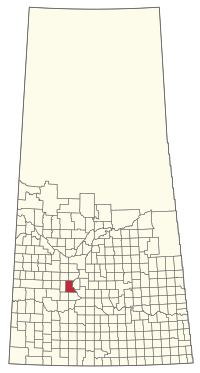
The Rural Municipality of Caron No. 162 is a rural municipality (RM) in the Canadian province of Saskatchewan within Census Division No. 7 and SARM Division No. 2. It is located in the southwest portion of the province.

<span class="mw-page-title-main">Rural Municipality of Wilton No. 472</span> Rural municipality in Saskatchewan, Canada

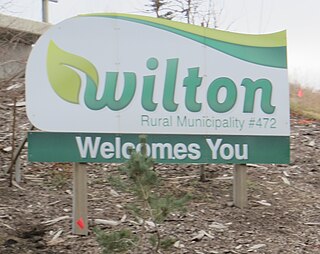
The Rural Municipality of Wilton No. 472 is a rural municipality (RM) in the Canadian province of Saskatchewan within Census Division No. 17 and SARM Division No. 6. It is located in the west-central portion of the province.

<span class="mw-page-title-main">Rural Municipality of Saltcoats No. 213</span> Rural municipality in Saskatchewan, Canada

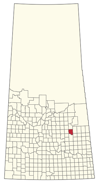
The Rural Municipality of Saltcoats No. 213 is a rural municipality (RM) in the Canadian province of Saskatchewan within Census Division No. 5 and SARM Division No. 1. It is located in the east-central portion of the province.

<span class="mw-page-title-main">Rural Municipality of Happy Valley No. 10</span> Rural municipality in Saskatchewan, Canada

The Rural Municipality of Happy Valley No. 10 is a rural municipality (RM) in the Canadian province of Saskatchewan within Census Division No. 2 and SARM Division No. 2. Located in the southeast portion of the province, it is adjacent to the United States border, neighbouring Daniels County and Sheridan County in Montana.

<span class="mw-page-title-main">Rural Municipality of Laurier No. 38</span> Rural municipality in Saskatchewan, Canada

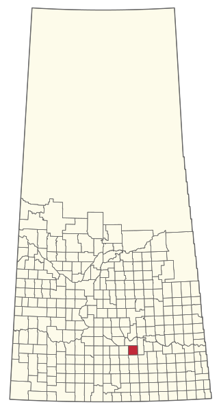
The Rural Municipality of Laurier No. 38 is a rural municipality (RM) in the Canadian province of Saskatchewan within Census Division No. 2 and SARM Division No. 2. it is located in the southeast portion of the province.

<span class="mw-page-title-main">Rural Municipality of Whiska Creek No. 106</span> Rural municipality in Saskatchewan, Canada

The Rural Municipality of Whiska Creek No. 106 is a rural municipality (RM) in the Canadian province of Saskatchewan within Census Division No. 3 and SARM Division No. 3. It is located in the southwest portion of the province.

<span class="mw-page-title-main">Rural Municipality of Big River No. 555</span> Rural municipality in Saskatchewan, Canada

The Rural Municipality of Big River No. 555 is a rural municipality (RM) in the Canadian province of Saskatchewan within Census Division No. 16 and SARM Division No. 5.

<span class="mw-page-title-main">Rural Municipality of Buchanan No. 304</span> Rural municipality in Saskatchewan, Canada

The Rural Municipality of Buchanan No. 304 is a rural municipality (RM) in the Canadian province of Saskatchewan within Census Division No. 9 and SARM Division No. 4.

<span class="mw-page-title-main">Rural Municipality of Enfield No. 194</span> Rural municipality in Saskatchewan, Canada

The Rural Municipality of Enfield No. 194 is a rural municipality (RM) in the Canadian province of Saskatchewan within Census Division No. 7 and SARM Division No. 2.

<span class="mw-page-title-main">Rural Municipality of Coteau No. 255</span> Rural municipality in Saskatchewan, Canada

The Rural Municipality of Coteau No. 255 is a rural municipality (RM) in the Canadian province of Saskatchewan within Census Division No. 7 and SARM Division No. 3.

<span class="mw-page-title-main">Rural Municipality of Mount Hope No. 279</span> Rural municipality in Saskatchewan, Canada

The Rural Municipality of Mount Hope No. 279 is a rural municipality (RM) in the Canadian province of Saskatchewan within Census Division No. 10 and SARM Division No. 5.

<span class="mw-page-title-main">Rural Municipality of Sasman No. 336</span> Rural municipality in Saskatchewan, Canada

The Rural Municipality of Sasman No. 336 is a rural municipality (RM) in the Canadian province of Saskatchewan within Census Division No. 10 and SARM Division No. 4.

<span class="mw-page-title-main">Rural Municipality of Loon Lake No. 561</span> Rural municipality in Saskatchewan, Canada

The Rural Municipality of Loon Lake No. 561 is a rural municipality (RM) in the Canadian province of Saskatchewan within Census Division No. 17 and SARM Division No. 6.

<span class="mw-page-title-main">Rural Municipality of Moose Range No. 486</span> Rural municipality in Saskatchewan, Canada

The Rural Municipality of Moose Range No. 486 is a rural municipality (RM) in the Canadian province of Saskatchewan within Census Division No. 14 and SARM Division No. 4.

<span class="mw-page-title-main">Rural Municipality of Parkdale No. 498</span> Rural municipality in Saskatchewan, Canada

The Rural Municipality of Parkdale No. 498 is a rural municipality (RM) in the Canadian province of Saskatchewan within Census Division No. 17 and SARM Division No. 6.

References

  1. "Pre-packaged CSV files - CGN, Canada/Province/Territory (cgn_sk_csv_eng.zip)". Government of Canada. July 24, 2019. Retrieved May 23, 2020.
  2. 1 2 "Rural Municipality Incorporations (Alphabetical)". Saskatchewan Ministry of Municipal Affairs. Archived from the original on April 21, 2011. Retrieved May 9, 2020.
  3. 1 2 3 4 "Municipality Details: RM of Fertile Valley No. 285". Government of Saskatchewan. Retrieved May 21, 2020.
  4. 1 2 3 "Population and dwelling counts, for Canada, provinces and territories, and census subdivisions (municipalities), 2016 and 2011 censuses – 100% data (Saskatchewan)". Statistics Canada. February 8, 2017. Retrieved May 1, 2020.
  5. "Coldwell Park Recreation Site". Canadian Geographical Names Database. Government of Canada. Retrieved April 29, 2023.
  6. "Coldwell Recreation Site". Tourism Saskatchewan. Government of Saskatchewan. Retrieved May 1, 2023.
  7. "Coldwell Park Recreation Site". BRMB Maps. Mussio Ventures Ltd. Retrieved May 1, 2023.
  8. "30 Free Places to Camp in Saskatchewan". Explore. Explore Magazine. Retrieved April 3, 2024.
  9. "Saskatchewan Census Population" (PDF). Saskatchewan Bureau of Statistics. Archived from the original (PDF) on September 24, 2015. Retrieved May 9, 2020.
  10. "Saskatchewan Census Population". Saskatchewan Bureau of Statistics. Retrieved May 9, 2020.
  11. "Population and dwelling counts: Canada, provinces and territories, census divisions and census subdivisions (municipalities), Saskatchewan". Statistics Canada. February 9, 2022. Retrieved April 13, 2022.