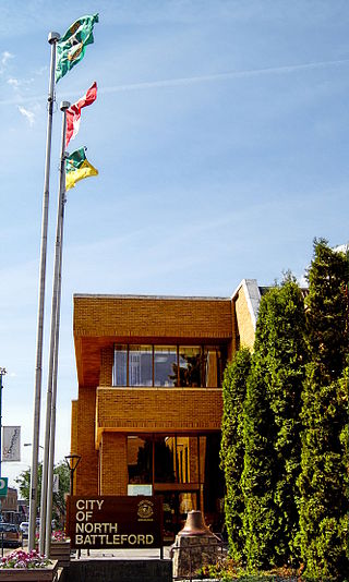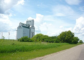
North Battleford is a city in west-central Saskatchewan, Canada. It is the seventh largest city in the province and is directly across the North Saskatchewan River from the Town of Battleford. Together, the two communities are known as "The Battlefords". North Battleford borders the Rural Municipality of North Battleford No. 437, as well as the North Battleford Crown Colony.
Archerwill is a village in the Canadian province of Saskatchewan within the Rural Municipality of Barrier Valley No. 397 and Census Division No. 14. The village is approximately 55 km (30 mi) north of Wadena, 52 km (30 mi) south of Tisdale and 70 km (40 mi) southeast of the city of Melfort. Since 1981 Archerwill has been the administrative centre of the RM of Barrier Valley.

Division No. 12 is one of the eighteen census divisions in the province of Saskatchewan, Canada, as defined by Statistics Canada. It is located in the west-central part of the province. The most populous community in this division is Battleford.

The Rural Municipality of Humboldt No. 370 is a rural municipality (RM) in the Canadian province of Saskatchewan within Census Division No. 15 and SARM Division No. 5. Located in the central portion of the province, it is along Highway 5 and Highway 20 north of Regina and east of Saskatoon.

Turtleford is a town in the Rural Municipality of Mervin No. 499, in the Canadian province of Saskatchewan. Turtleford is located on Highway 26 near the intersection / concurrency with Highway 3 and Highway 303. The nearest cities are North Battleford and Lloydminster. The Turtlelake River runs through Turtleford, and nearby are Brightsand Lake and Turtle Lake.

The Rural Municipality of Bone Creek No. 108 is a rural municipality (RM) in the Canadian province of Saskatchewan within Census Division No. 4 and SARM Division No. 3. It is located in the southwest portion of the province.

The Rural Municipality of Barrier Valley No. 397 is a rural municipality (RM) in the Canadian province of Saskatchewan within Census Division No. 14 and SARM Division No. 4. It is located in the east-central portion of the province.

The Rural Municipality of Battle River No. 438 is a rural municipality (RM) in the Canadian province of Saskatchewan within Census Division No. 12 and SARM Division No. 6.

White Bear is an unincorporated community in the Rural Municipality of Lacadena No. 228, Saskatchewan, Canada. Listed as a designated place by Statistics Canada, the hamlet had a population of 15 in the Canada 2006 Census. The community is approximately 55 mi (89 km) northwest of Swift Current on the north side of the South Saskatchewan River.
Jans Bay is a northern hamlet in the Canadian province of Saskatchewan.

Meota is a village in the Canadian province of Saskatchewan within the Rural Municipality of Meota No. 468 and Census Division No. 17. The village name is derived from the Cree phrase Meotate or Mo-Was-In-Ota, meaning "good place to camp" or "it is good here."

The Rural Municipality of North Battleford No. 437 is a rural municipality (RM) in the Canadian province of Saskatchewan within Census Division No. 16 and SARM Division No. 6. Located in the west-central portion of the province, it comprises the rural area generally to the north and east of the City of North Battleford.
Vawn is a former village, now a hamlet, in the Canadian province of Saskatchewan. It was dissolved as a village in 2004; its population is now counted as part of the rural municipality of Turtle River. Vawn is located on Highway 26 52 km north west of the City of North Battleford.

Delmas is a hamlet in the Rural Municipality of Battle River No. 438, Saskatchewan, Canada. Listed as a designated place by Statistics Canada, the hamlet had a population of 128 in the Canada 2016 Census. The hamlet is located approximately 32.6 kilometres (20.3 mi) west of North Battleford on Highway 16.
Hendon is a hamlet in the Rural Municipality of Lakeview No. 337, Saskatchewan, Canada. Listed as a designated place by Statistics Canada, the hamlet had a population of 20 in the Canada 2016 Census.

Speers is a village in the Canadian province of Saskatchewan within the Rural Municipality of Douglas No. 436 and Census Division No. 16. The village is located approximately 50 kilometres (31 mi)} southeast of the City of North Battleford on Highway 40.

Sunset View Beach is an organized hamlet in the Canadian province of Saskatchewan within the RM of Mervin No. 499 and Census Division No. 17. Part of the RM of Parkdale No. 498 prior to September 1992, it subsequently held resort village status until it dissolved to become part of the RM of Mervin No. 499 in January 2015. Sunset View Beach is on the southeast shore of Turtle Lake, approximately 43 kilometres (27 mi) northeast of the town of Turtleford and 102 kilometres (63 mi) north of the city of North Battleford.

The Rural Municipality of Rosemount No. 378 is a rural municipality (RM) in the Canadian province of Saskatchewan within Census Division No. 12 and SARM Division No. 6.
Rockhaven is a special service area in the Rural Municipality of Cut Knife No. 439, Saskatchewan, Canada. It held village status prior to December 31, 2007. The population was 20 people in 2006. The community is located 56 km west of the City of North Battleford between Highway 40 and Highway 787 southeast of Cut Knife on the Canadian Pacific Railway line.
The North Battleford Crown Colony is an unincorporated community within the Rural Municipality of North Battleford No. 437 in Saskatchewan, Canada that is designated a census subdivision by Statistics Canada. It is adjacent to the City of North Battleford and is home to the Saskatchewan Hospital North Battleford.


