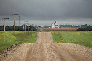
Bounty is an unincorporated community in Fertile Valley No. 285 Saskatchewan, Canada. The population was 5 at the 2001 Census. It previously held the status of village until November 25, 1997. The community is located on Range Road 104 and Township Road 300, about 21 km (13 mi) west of Outlook. At one time Bounty was said to have nobody living in the community.
Wishart is a hamlet in Emerald Rural Municipality No. 277 in the Canadian province of Saskatchewan. It is listed as a designated place by Statistics Canada. The hamlet had a population of 95 in the Canada 2006 Census. It previously held the status of village until January 1, 2002. The hamlet is located 32 km south west of the village of Elfros at the intersection of highway 639 and highway 743.

Lemsford is an unincorporated hamlet in Clinworth Rural Municipality No. 230, Saskatchewan, Canada. It previously held the status of village until January 1, 1951. The hamlet is located 42 km east of the Town of Leader at the intersection of Highway 32 and Highway 649, the hamlet is also serviced by the Great Western Railway.
Glidden is a hamlet in Newcombe Rural Municipality No. 260, Saskatchewan, Canada. In 2001 the community had a population of 40 people. It previously held the status of village until October 19, 2000. The hamlet is located 26 km south of the Town of Kindersley at the intersection of highway 21, highway 44 & highway 649.
Evesham is a hamlet in Eye Hill Rural Municipality No. 382, Saskatchewan, Canada. In 2001, the community had a population of 40 people and today fosters 35 citizens. It previously held the status of village until August 3, 2000. The hamlet is located 31 kilometres (19 mi) east of the town of Provost, Alberta, on highway 14.

Ferland is a fransaskois hamlet in Mankota Rural Municipality No. 45, Saskatchewan, Canada. It previously held the status of village until November 4, 1988. The hamlet is located 10 km east of the Village of Mankota on highway 18.
Colgate is a hamlet in Lomond Rural Municipality No. 37, Saskatchewan, Canada. The community had a population of 34 in 2017. It previously held the status of village until May 16, 2000. The hamlet is located 34 km south of the City of Weyburn 4 km west of highway 35.

Madison is an unincorporated community in Newcombe Rural Municipality No. 260, Saskatchewan, Canada. The community had a population of 10 in 2001. It previously held the status of village until February 1, 1998. The hamlet is located 20 km west of the Town of Eston on highway 44 along the Canadian National Railway subdivision.
Salvador is a hamlet in Grass Lake Rural Municipality No. 381, Saskatchewan, Canada. The community had a population of 35 at the 2001 Census. It previously held the status of village until February 1, 1998. The hamlet is located 38 km north-west of the Towns of Luseland & Kerrobert on highway 31 along the Canadian Pacific Railway subdivision.
Lawson is a hamlet in Maple Bush Rural Municipality No. 224, Saskatchewan, Canada. It previously held the status of village until December 31, 1985. The hamlet is located 12 km north-west of the Town of Central Butte on highway 42 along the now defunct Canadian Pacific Railway subdivision.
Leipzig is a hamlet in Reford Rural Municipality No. 379, Saskatchewan, Canada. It previously held the status of a village until February 1, 1984. The hamlet is located 27 km south of the town of Wilkie on highway 657.

Leney is an unincorporated community in Perdue Rural Municipality No. 346, Saskatchewan, Canada. The community had a population of 30 in 2001. It previously held the status of a village until December 31, 1971. The hamlet is located 68 km west of the City of Saskatoon on highway 655 3 km south the town of Perdue and highway 14 on the Canadian National Railway.
Richlea is a hamlet in Snipe Lake Rural Municipality No. 259, Saskatchewan, Canada. It previously held the status of a village until December 31, 1958.
McGee is a hamlet in Pleasant Valley Rural Municipality No. 288, Saskatchewan, Canada. It previously held the status of a village until December 31, 1955.
Readlyn is a hamlet in Excel Rural Municipality No. 71, Saskatchewan, Canada. It previously held the status of a village until December 31, 1955.
Druid is a hamlet in Winslow Rural Municipality No. 319, Saskatchewan, Canada. It previously held the status of a village until December 31, 1953.
Cavell is a hamlet in Reford Rural Municipality No. 379, Saskatchewan, Canada. It previously held the status of a village until January 1, 1943.
Mitchellton is a hamlet in Lake Johnston Rural Municipality No. 102, Saskatchewan, Canada. It previously held the status of a village until January 1, 1939.
Ettington is a hamlet in Sutton Rural Municipality No. 103, Saskatchewan, Canada. It previously held the status of a village until December 31, 1948.


