
Armley is an unincorporated community in Connaught Rural Municipality No. 457, Saskatchewan, Canada. Approximately halfway between Tisdale and Nipawin, northwest of the intersection of Highway 35 and Highway 335. Armley was the site of the Humboldt Broncos bus crash, killing 16 hockey players and personnel from a team in the city of Humboldt.
Beaufield, previously known as Ednaburg, is an unincorporated community in Oakdale Rural Municipality No. 320, Saskatchewan, Canada. Located at Section 18, Township 32, Range 22, West of the 3rd Meridian. It had its first post office named Ednaburg from 1908-05-01 to 1913-08-01 upon which date it changed name to Beaufield. Ednaburg was located at Section 16, Township 32, Range 22, West of the 3rd Meridian. about 2 km east of Highway 21.
Cedoux is an unincorporated community in the Rural Municipality of Wellington No. 97 in the province of Saskatchewan, Canada. It is held village status prior to July 21, 1913. Cedoux is located on Highway 35, approximately 25 km (16 mi) north of the City of Weyburn and approximately 91 km (57 mi) southeast of Regina.
Debden is a village in the Canadian province of Saskatchewan within the Rural Municipality of Canwood No. 494 and Census Division No. 16. The village is location is on Highway 55 and is 94 km from the City of Prince Albert and 194 km from the City of Saskatoon. It is also the administrative headquarters of the Big River Cree First Nations band government. The village is at the edge of the Prince Albert National Park and with all the lakes nearby it becomes a popular area in the summer months.
Baljennie is an unincorporated community in Glenside Rural Municipality No. 377, Saskatchewan, Canada. Its first post office opened in 1891.

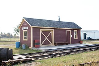
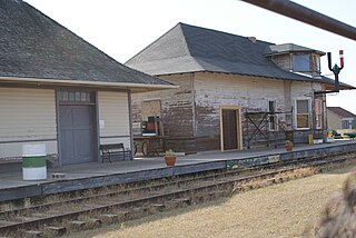
Meyronne is a special service area in the Canadian province of Saskatchewan.

Mantario is a special service area in the Rural Municipality of Chesterfield No. 261 in the Canadian province of Saskatchewan.It held village status prior to June 30, 2007. The population was 5 people in 2011. The community is located 70 km southwest of the Town of Kindersley on Highway 44.
Parkbeg is a hamlet in Wheatlands Rural Municipality No. 163, Saskatchewan, Canada. The hamlet is located at the junction of Highway 1 and Highway 627 approximately 58 km directly west of the City of Moose Jaw on the Trans Canada Highway.
Bryant is an unincorporated community in Benson Rural Municipality No. 35, Saskatchewan, Canada. The community is located on Highway 702, approximately 20 km (12 mi) west of Lampman and 20 km (12 mi) north of Estevan. Bryant gets its name from Quaker poet, journalist, and editor William Cullen Bryant.

Divide is an unincorporated community within the Rural Municipality of Frontier No. 19, Saskatchewan, Canada. The community is located 35 km directly south of the community of Robsart and 85 km southwest of the town of Eastend on Highway 18. Very little remains in Divide. Only a church and post office still stand.
Highgate, Saskatchewan is an unincorporated area in the rural municipality of Battle River No. 438, Saskatchewan, in the Canadian province of Saskatchewan. Highgate is located on Saskatchewan Highway 16, the Yellowhead in north western Saskatchewan. Highgate siding, a railroad siding and post office first opened in 1919 at the legal land description of Sec.17, Twp.45, R.17, W3. The population is smaller than a hamlet, and is counted within the RM. Highgate is located just north west of North Battleford, Saskatchewan.
Argo is an unincorporated community or a siding administered by the rural municipality of Biggar No. 347, in the Canadian province of Saskatchewan. Argo was located on the Dodsland Branch of the Canadian National Railway between Biggar and Duperow. The closest town is Biggar to the northeast. Biggar railway station is a divisional point for the Canadian National Railway (CNR).
Shackleton is a special service area in the Rural Municipality of Miry Creek No. 229, Saskatchewan, Canada. It previously held the status of village until December 31, 2013. The community is located 81 km (50 mi) northwest of the City of Swift Current on Highway 32.
Allan Hills is an unincorporated community in Lost River Rural Municipality No. 313, Saskatchewan, Canada. The community is located on Highway 665, 12 km south of the town of Allan.
Bapaume is an unincorporated community in Spiritwood Rural Municipality No. 496, Saskatchewan, Canada.
Birch Lake is an unincorporated community in Medstead Rural Municipality No. 497, Saskatchewan, Canada. The community is located about 10 km (6.2 mi) north of Highway 3 on Range Road 145, approximately 20 km (12 mi) north of Medstead.
Cummings is an unincorporated community within the Rural Municipality of Maple Creek No. 111, Saskatchewan, Canada. The community is located on Range road 295, 30 km northwest of Maple Creek.
Dunblane is a ghost town in the Canadian province of Saskatchewan.

Feudal is a hamlet in Perdue No. 346, Saskatchewan, Canada. The hamlet is located at the junction of Highway 655 and Township road 340 approximately 15 km north of the Village of Harris.
Corinne, is an unincorporated community in Bratt's Lake Rural Municipality No. 129, Saskatchewan, Canada. The community is located at the intersections of Highway 6, Highway 39 and Highway 334 about 11 km north of Milestone.

