Rural Municipality of Senlac No. 411

Last updated

Senlac No. 411
Rural Municipality of Senlac No. 411
SK RM 411 Senlac.svg
Location of the RM of Senlac No. 411 in Saskatchewan
Coordinates: 52°32′56″N109°41′13″W / 52.549°N 109.687°W / 52.549; -109.687 [1]
Country Canada
Province Saskatchewan
Census division 13
SARM division 6
Formed [2] January 1, 1913
Government
[3]
   Reeve Owen Mawbey
  Governing bodyRM of Senlac No. 411 Council
  AdministratorPaulina Herle
  Office location Senlac
Area
 (2016) [4]
  Land1,026.75 km2 (396.43 sq mi)
Population
 (2016) [4]
  Total216
  Density0.2/km2 (0.5/sq mi)
Time zone CST
  Summer (DST) CST
Postal code
S0N 0P0
Area code(s) 306 and 639
Highway(s) Highway 14
Highway 675
Highway 787

The Rural Municipality of Senlac No. 411 (2016 population: 216) is a rural municipality (RM) in the Canadian province of Saskatchewan within Census Division No. 13 and SARM Division No. 6. Located in the west-central portion of the province, it is adjacent to the Alberta boundary.

Contents

History

The RM of Senlac No. 411 incorporated as a rural municipality on January 1, 1913. [2]

Geography

The RM of Senlac is located along the western border of Saskatchewan in a region called the Prairie Pothole Region of North America, which extends throughout three Canadian provinces and five U.S. states. It is also within Palliser's Triangle and the Great Plains ecoregion. The RM is characterised by potholes, small lakes, rolling hills, and grasslands. Along the very northern edge of the RM are the Manitou Sand Hills. [5]

Communities and localities

The following urban municipalities are surrounded by the RM.

Villages

The following unincorporated communities are within the RM.

Localities

Lakes and rivers

The following is a list of notable lakes and rivers in the RM:

Suffern Lake Regional Park

Suffern Lake Regional Park ( 52°38′26″N109°53′53″W / 52.6405°N 109.898°W / 52.6405; -109.898 ) [7] was established in 1967 on Suffern Lake to commemorate the Canadian Centennial. [8] Suffern Lake was originally named Fish Lake but was renamed Suffern Lake after Jack Suffern, who was the forest ranger for the area from 1914 to 1945. [9] In 1975, a second section of the park was added on the north-west corner of Manitou Lake. In 2019, that section became its own regional park called Big Manitou Regional Park. [10]

The park has a campground with 56 campsites, golf course, volleyball court, horseshoe pits, and a bunnock court. The golf course, built in 2981, is a 9-hole, artificial greens course. [11] It is a par 33 with 2,438 yards. [12]

Demographics

Population history
(1981–2016)
YearPop.±%
1981388    
1986406+4.6%
1991360−11.3%
1996 296−17.8%
2001 238−19.6%
2006 225−5.5%
2011 195−13.3%
2016 216+10.8%
Source: Statistics Canada via Saskatchewan Bureau of Statistics [13] [14]

In the 2021 Census of Population conducted by Statistics Canada, the RM of Senlac No. 411 had a population of 198 living in 83 of its 143 total private dwellings, a change of

In the 2016 Census of Population, the RM of Senlac No. 411 recorded a population of 216 living in 100 of its 155 total private dwellings, a

Government

The RM of Senlac No. 411 is governed by an elected municipal council and an appointed administrator that meets on the second Wednesday of every month. [3] The reeve of the RM is Owen Mawbey while its administrator is Paulina Herle. [3] The RM's office is located in Senlac. [3]

Transportation

The following is a list of Saskatchewan highways in the RM:

See also

Related Research Articles

<span class="mw-page-title-main">Rural Municipality of Lost River No. 313</span> Rural Municipality in Saskatchewan, Canada

The Rural Municipality of Lost River No. 313 is a rural municipality (RM) in the Canadian province of Saskatchewan within Census Division No. 11 and SARM Division No. 5. Located in the central portion of the province, it is adjacent to the South Saskatchewan River.

<span class="mw-page-title-main">Rural Municipality of Leask No. 464</span> Rural municipality in Saskatchewan, Canada

The Rural Municipality of Leask No. 464 is a rural municipality (RM) in the Canadian province of Saskatchewan within Census Division No. 16 and SARM Division No. 5. It is located west of the city of Prince Albert.

<span class="mw-page-title-main">Rural Municipality of Fillmore No. 96</span> Rural Municipality in Saskatchewan, Canada

The Rural Municipality of Fillmore No. 96 is a rural municipality (RM) in the Canadian province of Saskatchewan within Census Division No. 2 and SARM Division No. 1. It is located in the south-east portion of the province along Highway 33.

<span class="mw-page-title-main">Rural Municipality of Canwood No. 494</span> Rural municipality in Saskatchewan, Canada

The Rural Municipality of Canwood No. 494 is a rural municipality (RM) in the Canadian province of Saskatchewan within Census Division No. 16 and SARM Division No. 5. The RM is located in the north-central portion of the province, west of the city of Prince Albert.

<span class="mw-page-title-main">Rural Municipality of Arlington No. 79</span> Rural municipality in Saskatchewan, Canada

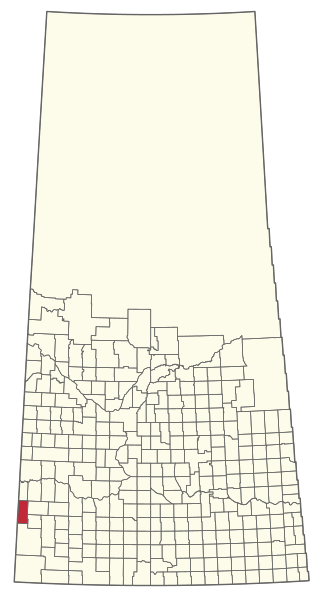
The Rural Municipality of Arlington No. 79 is a rural municipality (RM) in the Canadian province of Saskatchewan within Census Division No. 4 and SARM Division No. 3. It is located in the southwestern region of the province east of Shaunavon.

<span class="mw-page-title-main">Manitou Lake (Saskatchewan)</span> Salt lake in Saskatchewan, Canada

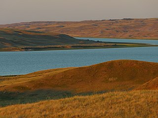
Manitou Lake is a salt lake located mostly in the RM of Manitou Lake No. 422 in the Canadian province of Saskatchewan, about 10 kilometres (6.2 mi) east of the provincial border with Alberta. The eastern shore of the lake is in the RM of Hillsdale No. 440. Manitou Lake is located in a region called the Prairie Pothole Region of North America, which extends throughout three Canadian provinces and five U.S. states. It is also within Palliser's Triangle and the Great Plains ecoregion. Manitou Lake is part of an Important Bird Area (IBA) of Canada that covers 699.66 km2 (270.14 sq mi) of land and serval neighbouring lakes.

<span class="mw-page-title-main">Rural Municipality of Manitou Lake No. 442</span> Rural Municipality in Saskatchewan, Canada

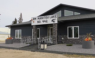
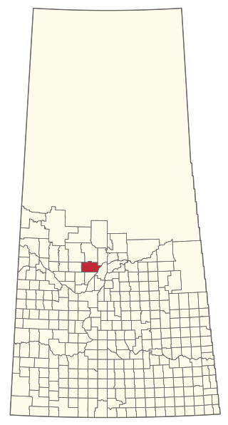
The Rural Municipality of Manitou Lake No. 442 is a rural municipality (RM) in the Canadian province of Saskatchewan within Census Division No. 13 and SARM Division No. 6.

<span class="mw-page-title-main">Rural Municipality of Enterprise No. 142</span> Rural municipality in Saskatchewan, Canada

The Rural Municipality of Enterprise No. 142 is a rural municipality (RM) in the Canadian province of Saskatchewan within Census Division No. 8 and SARM Division No. 3. It is located in the southwest portion of the province.

<span class="mw-page-title-main">Leroy, Saskatchewan</span> Town in Saskatchewan, Canada

Leroy is a town in the province of Saskatchewan, Canada.

<span class="mw-page-title-main">Rural Municipality of Moosomin No. 121</span> Rural Municipality in Saskatchewan, Canada

The Rural Municipality of Moosomin No. 121 is a rural municipality (RM) in the Canadian province of Saskatchewan within Census Division No. 5 and SARM Division No. 1. It is located in the southeast portion of the province.

<span class="mw-page-title-main">Rural Municipality of Britannia No. 502</span> Rural municipality in Saskatchewan, Canada

The Rural Municipality of Britannia No. 502 is a rural municipality (RM) in the Canadian province of Saskatchewan within Census Division No. 17 and SARM Division No. 6. It is located in the west-central portion of the province.

<span class="mw-page-title-main">Rural Municipality of Eldon No. 471</span> Rural municipality in Saskatchewan, Canada

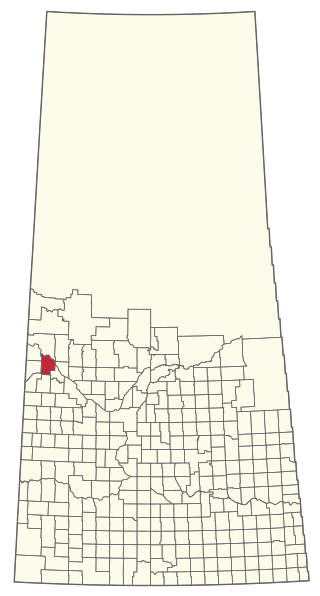
The Rural Municipality of Eldon No. 471 is a rural municipality (RM) in the Canadian province of Saskatchewan within Census Division No. 17 and SARM Division No. 6.

<span class="mw-page-title-main">Rural Municipality of Spy Hill No. 152</span> Rural Municipality in Saskatchewan, Canada

The Rural Municipality of Spy Hill No. 152 is a rural municipality (RM) in the Canadian province of Saskatchewan within Census Division No. 5 and SARM Division No. 1. It is located in the east-central portion of the province.

<span class="mw-page-title-main">Rural Municipality of Snipe Lake No. 259</span> Rural Municipality in Saskatchewan, Canada

The Rural Municipality of Snipe Lake No. 259 is a rural municipality (RM) in the Canadian province of Saskatchewan within Census Division No. 8 and SARM Division No. 3.

<span class="mw-page-title-main">Rural Municipality of Riverside No. 168</span> Rural Municipality in Saskatchewan, Canada

The Rural Municipality of Riverside No. 168 is a rural municipality (RM) in the Canadian province of Saskatchewan within Census Division No. 8 and SARM Division No. 3.

<span class="mw-page-title-main">Rural Municipality of Fish Creek No. 402</span> Rural Municipality in Saskatchewan, Canada

The Rural Municipality of Fish Creek No. 402 is a rural municipality (RM) in the Canadian province of Saskatchewan within Census Division No. 15 and SARM Division No. 5.

<span class="mw-page-title-main">Rural Municipality of Hillsdale No. 440</span> Rural municipality in Saskatchewan, Canada

The Rural Municipality of Hillsdale No. 440 is a rural municipality (RM) in the Canadian province of Saskatchewan within Census Division No. 13 and SARM Division No. 6.

<span class="mw-page-title-main">Rural Municipality of Lake Lenore No. 399</span> Rural Municipality in Saskatchewan, Canada

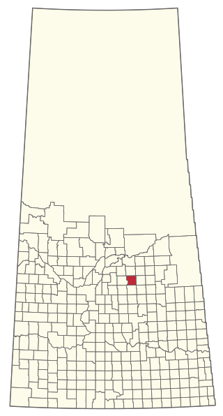
The Rural Municipality of Lake Lenore No. 399 is a rural municipality (RM) in the Canadian province of Saskatchewan within Census Division No. 15 and SARM Division No. 5.

<span class="mw-page-title-main">Rural Municipality of Nipawin No. 487</span> Rural municipality in Saskatchewan, Canada

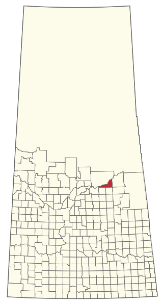
The Rural Municipality of Nipawin No. 487 is a rural municipality (RM) in the Canadian province of Saskatchewan within Census Division No. 14 and SARM Division No. 4.

<span class="mw-page-title-main">Rural Municipality of Pleasantdale No. 398</span> Rural Municipality in Saskatchewan, Canada

The Rural Municipality of Pleasantdale No. 398 is a rural municipality (RM) in the Canadian province of Saskatchewan within Census Division No. 14 and SARM Division No. 4.

References

  1. "Pre-packaged CSV files - CGN, Canada/Province/Territory (cgn_sk_csv_eng.zip)". Government of Canada. July 24, 2019. Retrieved May 23, 2020.
  2. 1 2 "Rural Municipality Incorporations (Alphabetical)". Saskatchewan Ministry of Municipal Affairs. Archived from the original on April 21, 2011. Retrieved May 9, 2020.
  3. 1 2 3 4 "Municipality Details: RM of Senlac No. 411". Government of Saskatchewan. Retrieved May 21, 2020.
  4. 1 2 3 "Population and dwelling counts, for Canada, provinces and territories, and census subdivisions (municipalities), 2016 and 2011 censuses – 100% data (Saskatchewan)". Statistics Canada. February 8, 2017. Retrieved May 1, 2020.
  5. "MINISTERS RELEASE MANITOU SAND HILLS INTEGRATED LAND USE PLAN | News and Media".
  6. Government of Canada, Natural Resources Canada. "Place names - Little Manitou Lake". www4.rncan.gc.ca.
  7. Government of Canada, Natural Resources Canada. "Place names - Suffern Lake Regional Park". www4.rncan.gc.ca.
  8. Government of Canada, Natural Resources Canada. "Place names - Suffern Lake". www4.rncan.gc.ca.
  9. "Suffern Lake". Regional Parks of Saskatchewan. Saskatchewan Regional Parks. Retrieved September 20, 2023.
  10. "Big Manitou". Regional Parks of Saskatchewan. Saskatchewan Regional Parks. Retrieved September 20, 2023.
  11. "Suffern Lake Regional Park". Tourism Saskatchewan. Government of Saskatchewan. Retrieved September 20, 2023.
  12. "Suffern Lake Regional Park Golf Course". GolfPass. GolfPass. Retrieved September 20, 2023.
  13. "Saskatchewan Census Population" (PDF). Saskatchewan Bureau of Statistics. Archived from the original (PDF) on September 24, 2015. Retrieved May 9, 2020.
  14. "Saskatchewan Census Population". Saskatchewan Bureau of Statistics. Retrieved May 9, 2020.
  15. "Population and dwelling counts: Canada, provinces and territories, census divisions and census subdivisions (municipalities), Saskatchewan". Statistics Canada. February 9, 2022. Retrieved April 13, 2022.