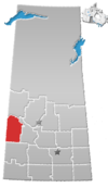
Quill Lake is a village in the Canadian province of Saskatchewan within the Rural Municipality of Lakeside No. 338 and Census Division No. 10. It is 170 km east of Saskatoon and 200 km northeast of Regina.
Wilcox is a village in the Canadian province of Saskatchewan within the Rural Municipality of Bratt's Lake No. 129 and Census Division No. 6. It is approximately 41 kilometres (25 mi) south of the city of Regina.
Neudorf is a village in the Canadian province of Saskatchewan within the Rural Municipality of McLeod No. 185 and Census Division No. 5. It is on Highway 22 east of Lemberg, and Abernethy, and west of Killaly.
Aylsham is a village in the Canadian province of Saskatchewan within the Rural Municipality of Nipawin No. 487 and Census Division No. 14. The village is approximately 65 km (40 mi) northeast of the city of Melfort.

Climax is a village in the Canadian province of Saskatchewan within the Rural Municipality of Lone Tree No. 18 and Census Division No. 4. The village is located in the southwestern region of the province, just north of the U.S. border, situated on Highway 18 between Frontier and Canuck and on Highway 37 between Shaunavon and the Port of Climax.

Stewart Valley is a village in the Canadian province of Saskatchewan within the Rural Municipality of Saskatchewan Landing No. 167 and Census Division No. 8. It is on Highway 4, just south of the South Saskatchewan River, approximately 35 km (22 mi) north of the City of Swift Current in southern Saskatchewan. It is along the remains of the historic Swift Current-Battleford Trail.
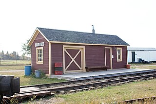
Debden is a village in the Canadian province of Saskatchewan within the Rural Municipality of Canwood No. 494 and Census Division No. 16. The village is located on Highway 55 and is 94 kilometres (58 mi) from the city of Prince Albert and 194 kilometres (121 mi) from the city of Saskatoon. It is also the administrative headquarters of the Big River Cree First Nations band government. The village is at the edge of the Prince Albert National Park and with all the lakes nearby it becomes a popular area in the summer months.
BulyeaBUUL-yay is a village in the Canadian province of Saskatchewan within the Rural Municipality of McKillop No. 220 and Census Division No. 6.

The Rural Municipality of Winslow No. 319 is a rural municipality (RM) in the Canadian province of Saskatchewan within Census Division No. 13 and SARM Division No. 6.
Flaxcombe is a village in the Canadian province of Saskatchewan within the Rural Municipality of Kindersley No. 290 and Census Division No. 13. The village is located approximately 30 km west of the Town of Kindersley, on Highway 7, and approximately 27 km east of the Alberta-Saskatchewan border.

Kisbey is a village in the Canadian province of Saskatchewan within the Rural Municipality of Brock No. 64 and Census Division No. 1. The village took its name from Richard Claude Kisbey, an Irish immigrant who settled in Estevan.

Laird is a village in the Canadian province of Saskatchewan within the Rural Municipality of Laird No. 404 and Census Division No. 15. Laird is located in the Saskatchewan River Valley. The village is named after David Laird, Lieutenant Governor of the Northwest Territories.
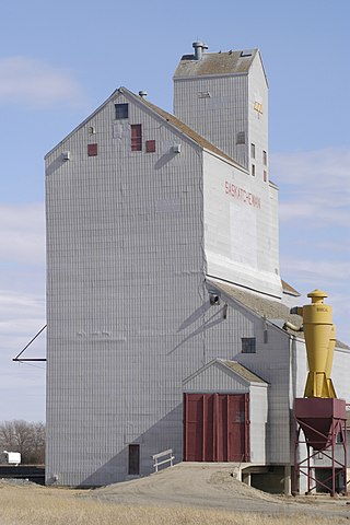
Lang is a village in the Canadian province of Saskatchewan within the Rural Municipality of Scott No. 98 and Census Division No. 2. The village is located approximately 70 km southeast of the City of Regina.
Major is a village in the Canadian province of Saskatchewan within the Rural Municipality of Prairiedale No. 321 and Census Division No. 13.

Netherhill is a village in the Canadian province of Saskatchewan within the Rural Municipality of Kindersley No. 290 and Census Division No. 13. The village is located approximately 20 km east of the Town of Kindersley at the junction of Highway 7 and 658.
Pierceland is a village in the Canadian province of Saskatchewan within the Rural Municipality of Beaver River No. 622 and Census Division No. 17. It is north of the Beaver River on Highway 55.
Smiley is a village in the Canadian province of Saskatchewan within the Rural Municipality of Prairiedale No. 321 and Census Division No. 13. The village is located approximately 20 km northwest of the town of Kindersley at the intersection of Highway 307 and Highway 772. The Grand Trunk Pacific Railway was completed in 1913, bringing an economic boom to the village's early years. On April 26, 1987 the Dodsland subdivision between Dodsland and Smiley was transferred to the Canadian Pacific Railway. Due to the close proximity to major grain centres such as Kindersley, CPR put the line up for abandonment and was granted permission to remove the track by the Canadian Transportation Agency on October 29, 1997.
Spy Hill is a village in the Canadian province of Saskatchewan within the Rural Municipality of Spy Hill No. 152 and Census Division No. 5. It is at the intersection of Highway 8 and Highway 600. The community's school closed due to a lack of students, who are now bused approximately 27 km (17 mi) to Langenburg). The Northland Power - Spy Hill Power Plant is located in the community.
Windthorst is a village in the Canadian province of Saskatchewan within the Rural Municipality of Chester No. 125 and Census Division No. 5. It is accessed from Highway 48.
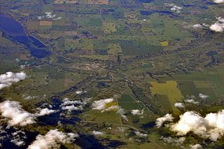
Craven is a village in the Canadian province of Saskatchewan within the Rural Municipality of Longlaketon No. 219 and Census Division No. 6. The village lies north-east of the town of Lumsden in the Qu'Appelle Valley. It sits at the confluence of the Qu'Appelle River and Last Mountain Creek. The Craven Dam is on the east side of the village.


