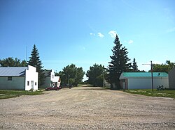
Milden is a village in the Canadian province of Saskatchewan within the Rural Municipality of Milden No. 286 and Census Division No. 12. The village is located at the junction of Highway 15 and Highway 655 approximately 20 km west of Outlook on Highway 15.
Neudorf is a village in the Canadian province of Saskatchewan within the Rural Municipality of McLeod No. 185 and Census Division No. 5. It is on Highway 22 east of Lemberg, and Abernethy, and west of Killaly.
Stewart Valley is a village in the Canadian province of Saskatchewan within the Rural Municipality of Saskatchewan Landing No. 167 and Census Division No. 8. It is on Highway 4, just south of the South Saskatchewan River, approximately 35 km (22 mi) north of the City of Swift Current in southern Saskatchewan. It is along the remains of the historic Swift Current-Battleford Trail.
Shell Lake is a village in the Canadian province of Saskatchewan within the Rural Municipality of Spiritwood No. 496 and Census Division No. 16. This village is 90 kilometres west of the City of Prince Albert. It was formerly part of the Rural Municipality (RM) of Shell Lake No. 495 before it was absorbed by the RM of Spiritwood No. 496. The Shell Lake murders took place on a nearby farm. It is the administrative centre of the Ahtahkakoop Cree First Nation band government.
Neville is a village in the Canadian province of Saskatchewan within the Rural Municipality of Whiska Creek No. 106 and Census Division No. 3. It is located on Highway 43.

Borden is a village in the Canadian province of Saskatchewan within the Rural Municipality of Great Bend No. 405 and Census Division No. 16. Borden is named after Sir Frederick William Borden, Minister of Militia in the Laurier Cabinet. An abandoned arch bridge of the same name is located to the southeast and once carried Highway 16 across the North Saskatchewan River.
Bjorkdale is a village in the Canadian province of Saskatchewan within the Rural Municipality of Bjorkdale No. 426 and Census Division No. 14. The village is located at the junctions of Highway 23, 679 & 776, approximately 78 kilometres (48 mi) east of the City of Melfort.

Denholm is a village in the Canadian province of Saskatchewan within the Rural Municipality of Mayfield No. 406 and Census Division No. 16.
Duff is a village in the Canadian province of Saskatchewan adjacent to both Rural Municipality (RM) of Cana No. 214 and the RM of Stanley No. 215 and within Census Division No. 5. The village is located approximately 122 kilometres (76 mi) northeast of the City of Regina, 66 kilometres (41 mi) southwest of Yorkton and 20 kilometres (12 mi) west of Melville.
Frobisher is a village in the Canadian province of Saskatchewan within the Rural Municipality of Coalfields No. 4 and Census Division No. 1.
Kincaid is a village in the Canadian province of Saskatchewan within the Rural Municipality of Pinto Creek No. 75 and Census Division No. 3.

Kinley is a village in the Canadian province of Saskatchewan within the Rural Municipality of Perdue No. 346 and Census Division No. 12. The village of Kinley is located about 55 km west of the City of Saskatoon on Highway 14, between the communities of Perdue 10 km west and Asquith 17 km east.

Krydor is a village in the Canadian province of Saskatchewan within the Rural Municipality of Redberry No. 435 and Census Division No. 16. The community's name is a combination of the names of two early settlers, Petro Krysak and Teodor Lucyk. Petro Krysak also served as the first postmaster, from September 1, 1911, to July 7, 1913.
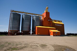
Macrorie is a village in the Canadian province of Saskatchewan within the Rural Municipality of Fertile Valley No. 285 and Census Division No. 12. The village contains a Co-op gas and grocery store. Danielson Provincial Park is 20 km southeast on Highway 44.
Pleasantdale is a village in the Canadian province of Saskatchewan within the Rural Municipality of Pleasantdale No. 398 and Census Division No. 14.

St. Benedict is a village in the Canadian province of Saskatchewan within the Rural Municipality of Three Lakes No. 400 and Census Division No. 15. Located in the Carlton Trail Region of the province, it is 56 km (35 mi) north of the City f Humboldt off Highway 20.
Weekes is a village in the Canadian province of Saskatchewan within the Rural Municipality of Porcupine No. 395 and Census Division No. 14. The village is located 29 km east of the Town of Porcupine Plain on Highway 23.
Wiseton is a village in the Canadian province of Saskatchewan within the Rural Municipality of Milden No. 286 and Census Division No. 12. The village is located at the junction of Highway 44 and Highway 664 approximately 40 km southwest of Outlook.
Thode is a resort village in the Canadian province of Saskatchewan within Census Division No. 11. It is on the shores of Blackstrap Lake in the Rural Municipality of Dundurn No. 314. It is east of the Town of Dundurn.

The Rural Municipality of Douglas No. 436 is a rural municipality (RM) in the Canadian province of Saskatchewan within Census Division No. 16 and SARM Division No. 6.