Armley is an unincorporated community in Connaught Rural Municipality No. 457, Saskatchewan, Canada. Approximately halfway between Tisdale and Nipawin, northwest of the intersection of Highway 35 and Highway 335. Armley was the site of the Humboldt Broncos bus crash, killing 16 hockey players and personnel from a team in the city of Humboldt.

Weldon is a village in the Canadian province of Saskatchewan within the Rural Municipality of Kinistino No. 459 and Census Division No. 15. The area is part of the aspen parkland biome. The village is located 2 km (1.2 mi) north of Highway 3 at the midway point between the cities of Prince Albert and Melfort, Saskatchewan. The village is just 20 km (12 mi) south of the Weldon Ferry linking it to Highway 302 and is often used as an access point to the historic Saskatchewan River Forks where the North and South Saskatchewan rivers join just 25 km (16 mi) to the northeast.
Prud'homme is a village in the Canadian province of Saskatchewan within the Rural Municipality of Bayne No. 371 and Census Division No. 15. It is approximately 60 kilometres northeast of Saskatoon. Prud'homme was first known by the name of Bluebell Ranch, then Lally Siding. In 1905 the Canadian Northern Railway came through and renamed it Marcotte's Crossing; two years later it became known as Howell; and finally, in 1922, it was named after the Suffragan Bishop of Prince-Albert–Saskatoon, Joseph H. Prud'homme. The community is mostly based on agriculture.
Spruce Home is a small farming community north of Saskatchewan's third largest city, Prince Albert. The first post office opened in 1908 at Sec.32, Twp.50, R.26, W2 surviving in this location for 9 years. This unincorporated area had post offices come and go over the years.

Dundurn is a town of 647 residents surrounded by the RM of Dundurn No. 314, in the Canadian province of Saskatchewan. Dundurn is located on Highway 11, or Louis Riel Trail, in central Saskatchewan, about 42 km south of Saskatoon. As well as being an agricultural town, it is a bedroom community for both Saskatoon and Canadian Forces Detachment Dundurn, which is located 6 kilometres (4 mi) north of town and is a detachment of 17 Wing Winnipeg.

Domremy, Saskatchewan is a special service area in the Rural Municipality of St. Louis No. 431, in the Canadian province of Saskatchewan. It held village status prior to December 31, 2006. The population was 124 people in 2006. Domremy is located on Highway 320 near Highway 2 and Highway 225 in central Saskatchewan. Domremy had a post office established as early as May 1, 1896 in the District of Saskatchewan, NWT.

Eyebrow is a village in the Canadian province of Saskatchewan within the Rural Municipality of Eyebrow No. 193 and Census Division No. 7. The community originated at the location that is now the abandoned community of Eskbank several kilometres to the south. Eyebrow is located at the intersection of Highway 367 and Highway 42; 84 km northwest of Moose Jaw, 154 km northwest of Regina and 196 km south of Saskatoon.

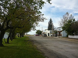
Denholm is a village in the Canadian province of Saskatchewan within the Rural Municipality of Mayfield No. 406 and Census Division No. 16.

Englefeld is a village in the Canadian province of Saskatchewan within the Rural Municipality of St. Peter No. 369 and Census Division No. 15. The village is located 32 kilometres east of the City of Humboldt on Highway 5.

Laird is a village in the Canadian province of Saskatchewan within the Rural Municipality of Laird No. 404 and Census Division No. 15. Laird is located in the Saskatchewan River Valley. The village is named after David Laird, Lieutenant Governor of the Northwest Territories.
Lake Lenore is a village in the Canadian province of Saskatchewan within the Rural Municipality of St. Peter No. 369 and Census Division No. 15. The village is located 144.6 km northeast of the City of Saskatoon. Outside the village is a lake that shares its name, Lake Lenore, renowned for its fishing activity, as well the Rural Municipality of Lake Lenore No. 399 to the north. Lake Lenore possesses a fully operational school, Co-op Grocery and Agro Service Station and also contains a Credit Union and Public Library.

St. Gregor is a village in the Canadian province of Saskatchewan within the Rural Municipality of St. Peter No. 369 and Census Division No. 15. It is approximately 20 km west of the Town of Watson on Highway 5.
Meath Park is a village in the Canadian province of Saskatchewan within the Rural Municipality of Garden River No. 490 and Census Division No. 15.
Highgate, Saskatchewan is an unincorporated area in the rural municipality of Battle River No. 438, Saskatchewan, in the Canadian province of Saskatchewan. Highgate is located on Saskatchewan Highway 16, the Yellowhead in north western Saskatchewan. Highgate siding, a railroad siding and post office first opened in 1919 at the legal land description of Sec.17, Twp.45, R.17, W3. The population is smaller than a hamlet, and is counted within the RM. Highgate is located just north west of North Battleford, Saskatchewan.
Ruddell is a village in the Canadian province of Saskatchewan within the Rural Municipality of Mayfield No. 406 and Census Division No. 16. The village is located on Highway 16, approximately 37 km (23 mi) east of the City of North Battleford and 102 km west of the City of Saskatoon. Ruddell post office first opened in 1906.

Viscount is a village in the Canadian province of Saskatchewan within the Rural Municipality of Viscount No. 341 and Census Division No. 11. Viscount is located on Saskatchewan Highway 16, the Yellowhead Highway, in central Saskatchewan east of Colonsay and west of Lanigan. As of the Canada 2016 Census, Viscount had a population of 232.

Sheho is a village in the Canadian province of Saskatchewan within the Rural Municipality of Insinger No. 275 and Census Division No. 9. Sheho is located on Saskatchewan Highway 16, in southeast Saskatchewan between Foam Lake to the west and the City of Yorkton to the east. Sheho Lake post office first opened in 1891 at the legal land description of Sec.28, Twp.30, R.9, W2 before moving slightly and changing name to Sheho.
Insinger, Saskatchewan is an unincorporated area in the rural municipality of Insinger No. 275, Saskatchewan, in the Canadian province of Saskatchewan. Insinger is located on Saskatchewan Highway 16, the Yellowhead in south eastern Saskatchewan. Lawrie post office first opened in 1898 at the legal land description of Sec.6, Twp.29, R.7, W2. It changed names in 1907 to Insinger and moved to Sec.21, Twp.29, R.8, W2. The population is smaller than a hamlet, and is counted within the Insinger No. 275, Saskatchewan, however it is still listed as a village at Geonames. Insinger is located between Yorkton and Foam Lake. Insinger is located within 14 kilometres (8.7 mi) of Whitesand Regional Park.

Theodore is a village in the Canadian province of Saskatchewan within the Rural Municipality of Insinger No. 275 and Census Division No. 9. Theodore is located on Saskatchewan Highway 16, the Yellowhead Highway, in southeastern Saskatchewan. The Theodore post office first opened in 1893 at the legal land description of Sec.1, Twp.28, R.7, W2. Theodore is located between Yorkton and Foam Lake.
Allan Hills is an unincorporated community in Lost River Rural Municipality No. 313, Saskatchewan, Canada. The community is located on Highway 764, 12 km south of the town of Allan in the heart of the Allan Hills.

