Aylesbury is a village in the Canadian province of Saskatchewan within the Rural Municipality of Craik No. 222 and Census Division No. 7. The village is approximately 60 km north of the City of Moose Jaw.
Chaplin is a village in the Canadian province of Saskatchewan within the Rural Municipality of Chaplin No. 164 and Census Division No. 7. The community is situated on the Trans-Canada Highway approximately 85 km from Moose Jaw and 90 km from Swift Current. The main industries of Chaplin are Saskatchewan Minerals and farming/ranching. Chaplin consists of eight streets, two crescents, and four avenues.
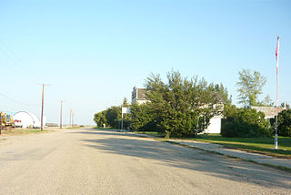
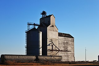
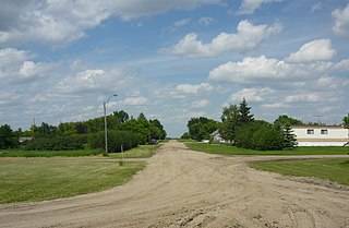
Marquis is a village in the Canadian province of Saskatchewan within the Rural Municipality of Marquis No. 191 and Census Division No. 7. It is on Highway 42 about 32 km northwest of Moose Jaw.
Zelma is a village in the Canadian province of Saskatchewan within the Rural Municipality of Morris No. 312 and Census Division No. 11. The village is located along Saskatchewan Highway 763.

Carievale is a village in the Canadian province of Saskatchewan within the Rural Municipality of Argyle No. 1 and Census Division No. 1. The village lies at the intersection of Highway 8 and Highway 18.

The Rural Municipality of Pense No. 160 is a rural municipality (RM) in the Canadian province of Saskatchewan within Census Division No. 6 and SARM Division No. 2. It is located in the southeast portion of the province.

Pense is a town of 603 residents in the southern part of Saskatchewan, Canada. Heading west from Regina on the Trans Canada Highway, Pense is the first community with services. Other communities in the area include Grand Coulee, Belle Plaine, Disley, and Rouleau. Pense is approximately 30 kilometres (19 mi) from the city of Regina.

Disley is a village in the Canadian province of Saskatchewan within the Rural Municipality of Lumsden No. 189 and Census Division No. 6. It is located 18 km (11 mi) west of Lumsden just south of the Louis Riel Trail and 48 km (30 mi) northwest of the City of Regina.

Fairlight is a village in the Canadian province of Saskatchewan within the Rural Municipality of Maryfield No. 91 and Census Division No. 1. The village lies just south of Provincial Highway 48 and the Canadian National Railway, about a kilometre west of Highway 8.

Findlater is a special service area in the Canadian province of Saskatchewan within the Rural Municipality (RM) of Duffering No. 190 and Census Division No. 6. It is 75 km northwest of Regina, Saskatchewan's capital, on Highway 11, and 15 km from the Town of Chamberlain. The original settlers had been looking for the neighbouring community of Chamberlain but, due to fatigue amongst the tribesmen, decided to rest at the site. They quickly settled and developed basic living amenities despite promises from the tribe leaders that they would soon move on and "find the new village". This continued for several months as the settlement evolved – tribesmen receiving the same responses to questions of the new community; "We'll find it later", or simply, "findlater". After a year the community was a well established populous and the name "Findlater" had been adopted fondly as homage to the promised community that had brought them there. It is believed (inaccurately) by some that the name comes from Findlater Castle in Banffshire, Scotland.

Holdfast is a village in the Canadian province of Saskatchewan within the Rural Municipality of Sarnia No. 221 and Census Division No. 6. The village is located 2 km east of Highway 2 on Highway 732, about 97.6 km northwest of the City of Regina.

Invermay is a village in the Canadian province of Saskatchewan within the Rural Municipality of Invermay No. 305 and Census Division No. 9. Invermay is about 50 km west of Canora or about 50 km east of Wadena on Highway 5.

Meacham is a village in the Canadian province of Saskatchewan within the Rural Municipality of Colonsay No. 342 and Census Division No. 11. It is located 69 kilometres east of the City of Saskatoon on Highway 2.
Meath Park is a village in the Canadian province of Saskatchewan within the Rural Municipality of Garden River No. 490 and Census Division No. 15.
Plunkett is a special service area in the Canadian province of Saskatchewan within the Rural Municipality of Viscount No. 341 and Census Division No. 11. It held village status between 1921 and 2022.

Sheho is a village in the Canadian province of Saskatchewan within the Rural Municipality of Insinger No. 275 and Census Division No. 9. Sheho is located on Highway 16, in southeast Saskatchewan between Foam Lake to the west and Yorkton to the east. Sheho Lake post office first opened in 1891 at the legal land description of Sec.28, Twp.30, R.9, W2 before moving slightly and changing name to Sheho.
St. Benedict is a village in the Canadian province of Saskatchewan within the Rural Municipality of Three Lakes No. 400 and Census Division No. 15. Located in the Carlton Trail Region of the province, it is 56 km (35 mi) north of the City of Humboldt off Highway 20.
Weirdale is a village in the Canadian province of Saskatchewan within the Rural Municipality of Garden River No. 490 and Census Division No. 15. Weirdale is about 48 km northeast of the City of Prince Albert along Highway 55.

Speers is a village in the Canadian province of Saskatchewan within the Rural Municipality of Douglas No. 436 and Census Division No. 16. The village is located approximately 50 kilometres (31 mi)} southeast of the City of North Battleford on Highway 40.

Tuxford is a village in the Canadian province of Saskatchewan within the Rural Municipality of Marquis No. 191 and Census Division No. 7. Moose Jaw is 14 kilometres (8.7 mi) south and Buffalo Pound Lake is 16 kilometres (9.9 mi) north. Highway 2, Highway 42 and Highway 202 all intersect in the community. Highway 202 connects the community to Buffalo Pound Provincial Park 11 kilometres (6.8 mi) to the east.


