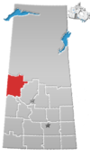
Brock is a village in the Canadian province of Saskatchewan within the Rural Municipality of Kindersley No. 290 and Census Division No. 13. The village is located 165 km southwest of the City of Saskatoon.

Fox Valley is a village in the Canadian province of Saskatchewan within the Rural Municipality of Fox Valley No. 171 and Census Division No. 8. Fox Valley is located just off Highway 21, approximately 64 kilometres north of Maple Creek and 51 kilometres south of Leader in the southwest region of the province. The early settlers of the village and surrounding area included many Germans from Russia. The local economy is heavily dependent on agriculture and natural gas.

The Rural Municipality of Shamrock No. 134 is a rural municipality (RM) in the Canadian province of Saskatchewan within Census Division No. 7 and SARM Division No. 2. Located in the south-central portion of the province, it is south of Highway 1.

The Rural Municipality of Meadow Lake No. 588 is a rural municipality (RM) in the Canadian province of Saskatchewan within Census Division No. 17 and SARM Division No. 6.
Storthoaks is a village in the Canadian province of Saskatchewan within the Rural Municipality of Storthoaks No. 31 and Census Division No. 1. The village is located approximately 129 km east of the City of Estevan on Highway 361 and 16 km west of the Saskatchewan-Manitoba border.

The Rural Municipality of Bone Creek No. 108 is a rural municipality (RM) in the Canadian province of Saskatchewan within Census Division No. 4 and SARM Division No. 3. It is located in the southwest portion of the province.

Bracken is a village in the Canadian province of Saskatchewan within the Rural Municipality of Lone Tree No. 18 and Census Division No. 4. The village is named after John Bracken, Premier of Manitoba and leader of the Progressive Conservative Party of Canada, who was a professor at the University of Saskatchewan. The small village is located approximately 160 km south of the City of Swift Current on Highway 18, directly north of Grasslands National Park, and approximately 20 km north of the Montana-Saskatchewan border.
Bjorkdale is a village in the Canadian province of Saskatchewan within the Rural Municipality of Bjorkdale No. 426 and Census Division No. 14. The village is located at the junctions of Highway 23, 679 & 776, approximately 78 kilometres (48 mi) east of the City of Melfort.

Denholm is a village in the Canadian province of Saskatchewan within the Rural Municipality of Mayfield No. 406 and Census Division No. 16.
Edenwold is a village in the Canadian province of Saskatchewan within the Rural Municipality of Edenwold No. 158 and Census Division No. 6. It is located 45 km (28 mi) north of the City of Regina.
Glaslyn is a village in the Canadian province of Saskatchewan within the Rural Municipality of Parkdale No. 498 and Census Division No. 17. The village is located 67 km north of the City of North Battleford and 91 km south of Meadow Lake at the intersection of Highway 4 and Highway 3.
Goodsoil is a village in the Canadian province of Saskatchewan within the Rural Municipality of Beaver River No. 622 and Census Division No. 17. The Goodsoil Historical Museum Site is a municipal heritage property on the Canadian Register of Historic Places. It is the western gateway to Meadow Lake Provincial Park.
Tramping Lake is a village in the Canadian province of Saskatchewan within the Rural Municipality of Tramping Lake No. 380 and Census Division No. 13. The village gets its name from nearby Tramping Lake, which is a lake along the course of Eagle Creek.
Hubbard is a village in the Canadian province of Saskatchewan within the Rural Municipality of Ituna Bon Accord No. 246 and Census Division No. 10.
Lancer is a special service area in the Canadian province of Saskatchewan within the Rural Municipality of Miry Creek No. 229 and Census Division No. 8. It held village status between 1913 and 2022.
Makwa is a village in the Canadian province of Saskatchewan within the Rural Municipality of Loon Lake No. 561 and Census Division No. 17.
Medstead is a village in the Canadian province of Saskatchewan within the Rural Municipality of Medstead No. 497 and Census Division No. 16.
Shamrock is a village in the Canadian province of Saskatchewan within the Rural Municipality of Shamrock No. 134 and Census Division No. 7.
Greig Lake is a resort village in the Canadian province of Saskatchewan within Census Division No. 17. It is on the eastern shore of Greig Lake in the Rural Municipality of Meadow Lake No. 588. The community is surrounded by Meadow Lake Provincial Park.
Wakaw Lake is a resort village in the Canadian province of Saskatchewan within Census Division No. 15. It is on the shores of Wakaw Lake in the Rural Municipality of Hoodoo No. 401. It is on Highway 41 approximately 86 km (53 mi) northeast of Saskatoon and 63 km (39 mi) south of Prince Albert.


