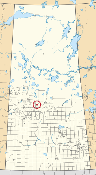
Ahtahkakoop 104 is an Indian reserve of the Ahtahkakoop Cree Nation in Saskatchewan. It is about 72 kilometres (45 mi) northwest of Prince Albert. In the 2016 Canadian Census, it recorded a population of 1,472 living in 386 of its 424 total private dwellings. In the same year, its Community Well-Being index was calculated at 46 of 100, compared to 58.4 for the average First Nations community and 77.5 for the average non-Indigenous community.

Assiniboine 76 is an Indian reserve of the Carry the Kettle Nakoda First Nation in Saskatchewan. It is 80 kilometers east of Regina. In the 2016 Canadian Census, it recorded a population of 443 living in 182 of its 214 total private dwellings. In the same year, its Community Well-Being index was calculated at 54 of 100, compared to 58.4 for the average First Nations community and 77.5 for the average non-Indigenous community.

Buffalo River Dene Nation 193 is an Indian reserve of the Buffalo River Dene Nation in Saskatchewan. It is 84 kilometres northwest of Île-à-la-Crosse. In the 2016 Canadian Census, it recorded a population of 783 living in 233 of its 260 total private dwellings. In the same year, its Community Well-Being index was calculated at 54 of 100, compared to 58.4 for the average First Nations community and 77.5 for the average non-Indigenous community.

Chicken 224 is an Indian reserve of the Black Lake Denesuline First Nation in Saskatchewan. It is 170 kilometres southeast of Uranium City. In the 2016 Canadian Census, it recorded a population of 1379 living in 263 of its 280 total private dwellings. In the same year, its Community Well-Being index was calculated at 42 of 100, compared to 58.4 for the average First Nations community and 77.5 for the average non-Indigenous community.

Cote 64 is an Indian reserve of the Cote First Nation in Saskatchewan. It is 16 kilometres (9.9 mi) west of the Manitoba border. In the 2016 Canadian Census, it recorded a population of 748 living in 220 of its 269 total private dwellings. In the same year, its Community Well-Being index was calculated at 51 of 100, compared to 58.4 for the average First Nations community and 77.5 for the average non-Indigenous community.

Cumberland House Cree Nation 20 is an Indian reserve of the Cumberland House Cree Nation in Saskatchewan. The reserve is on Cumberland Island in the Saskatchewan River Delta, about 96 kilometres (60 mi) south-west of Flin Flon.

Fond du Lac 227 is an Indian reserve of the Fond du Lac Denesuline First Nation in Saskatchewan. It is at the east end of Lake Athabasca. In the 2016 Canadian Census, it recorded a population of 903 living in 206 of its 231 total private dwellings. In the same year, its Community Well-Being index was calculated at 52 of 100, compared to 58.4 for the average First Nations community and 77.5 for the average non-Indigenous community.

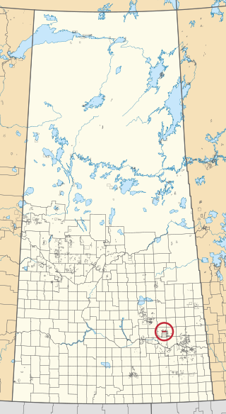
Kahkewistahaw 72 is an Indian reserve of the Kahkewistahaw First Nation in Saskatchewan. It is about 13 kilometres (8.1 mi) north of Broadview. In the 2016 Canadian Census, it recorded a population of 502 living in 146 of its 184 total private dwellings. In the same year, its Community Well-Being index was calculated at 58 of 100, compared to 58.4 for the average First Nations community and 77.5 for the average non-Indigenous community.
Little Black Bear 84 is an Indian reserve of the Little Black Bear First Nation in Saskatchewan. It is about 19 kilometres (12 mi) east of Fort Qu'Appelle. In the 2016 Canadian Census, it recorded a population of 137 living in 34 of its 43 total private dwellings. In the same year, its Community Well-Being index was calculated at 51 of 100, compared to 58.4 for the average First Nations community and 77.5 for the average non-Indigenous community.

Little Red River 106C is an Indian reserve of the Lac La Ronge Indian Band in Saskatchewan. It is about 34 kilometres (21 mi) north of Prince Albert. In the 2016 Canadian Census, it recorded a population of 354 living in 88 of its 98 total private dwellings. In the same year, its Community Well-Being index was calculated at 48 of 100, compared to 58.4 for the average First Nations community and 77.5 for the average non-Indigenous community.

Morin Lake 217 is an Indian reserve of the Lac La Ronge Indian Band in Saskatchewan. It is about 24 kilometres (15 mi) east of Lac la Ronge. In the 2016 Canadian Census, it recorded a population of 577 living in 135 of its 155 total private dwellings. In the same year, its Community Well-Being index was calculated at 45 of 100, compared to 58.4 for the average First Nations community and 77.5 for the average non-Indigenous community.
The Muskoday Reserve is an Indian reserve of the Muskoday First Nation in Saskatchewan. It is about 19 kilometres (12 mi) south-east of Prince Albert. In the 2016 Canadian Census, it recorded a population of 647 living in 205 of its 217 total private dwellings. In the same year, its Community Well-Being index was calculated at 64 of 100, compared to 58.4 for the average First Nations community and 77.5 for the average non-Indigenous community.

Okanese 82 is an Indian reserve of the Okanese First Nation in Saskatchewan. It is about 16 kilometres (9.9 mi) north-east of Fort Qu'Appelle. In the 2016 Canadian Census, it recorded a population of 175 living in 56 of its 69 total private dwellings. In the same year, its Community Well-Being index was calculated at 57 of 100, compared to 58.4 for the average First Nations community and 77.5 for the average non-Indigenous community.

Pasqua 79 is an Indian reserve of the Pasqua First Nation in Saskatchewan. It is about 16 kilometres (9.9 mi) west of Fort Qu'Appelle. In the 2016 Canadian Census, it recorded a population of 517 living in 173 of its 200 total private dwellings. In the same year, its Community Well-Being index was calculated at 56 of 100, compared to 58.4 for the average First Nations community and 77.5 for the average non-Indigenous community.

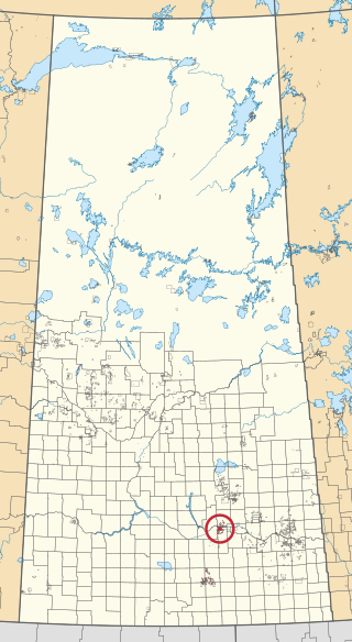
Peepeekisis 81 is an Indian reserve of the Peepeekisis Cree Nation in Saskatchewan. It is about 14 kilometres (8.7 mi) east of Fort Qu'Appelle. In the 2016 Canadian Census, it recorded a population of 491 living in 135 of its 146 total private dwellings. In the same year, its Community Well-Being index was calculated at 53 of 100, compared to 58.4 for the average First Nations community and 77.5 for the average non-Indigenous community.
Piapot 75 is an Indian reserve of the Piapot Cree Nation in Saskatchewan. It is about 43 kilometres (27 mi) west of Fort Qu'Appelle. In the 2016 Canadian Census, it recorded a population of 516 living in 143 of its 171 total private dwellings. In the same year, its Community Well-Being index was calculated at 55 of 100, compared to 58.4 for the average First Nations community and 77.5 for the average non-Indigenous community.

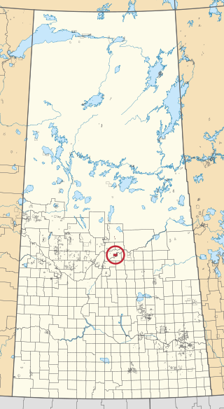
Poorman 88 is an Indian reserve of the Kawacatoose First Nation in Saskatchewan. It is about 87 kilometres (54 mi) north-west of Fort Qu'Appelle. In the 2016 Canadian Census, it recorded a population of 729 living in 172 of its 196 total private dwellings. In the same year, its Community Well-Being index was calculated at 47 of 100, compared to 58.4 for the average First Nations community and 77.5 for the average non-Indigenous community.

Sucker River 156C is an Indian reserve of the Lac La Ronge Indian Band in Saskatchewan. It is at the mouth of the Nemeiben River on Lac la Ronge, about 230 kilometres (140 mi) north of Prince Albert. In the 2016 Canadian Census, it recorded a population of 416 living in 109 of its 124 total private dwellings. In the same year, its Community Well-Being index was calculated at 49 of 100, compared to 58.4 for the average First Nations community and 77.5 for the average non-Indigenous community.

Thunderchild 115B is an Indian reserve of the Thunderchild First Nation in Saskatchewan. It is 85 kilometres northwest of North Battleford. In the 2016 Canadian Census, it recorded a population of 706 living in 172 of its 200 total private dwellings. In the same year, its Community Well-Being index was calculated at 42 of 100, compared to 58.4 for the average First Nations community and 77.5 for the average non-Indigenous community.

Wahpaton 94A is an Indian reserve of the Wahpeton Dakota Nation in Saskatchewan. It is about 10 kilometres (6.2 mi) north of Prince Albert. In the 2016 Canadian Census, it recorded a population of 309 living in 70 of its 80 total private dwellings. In the same year, its Community Well-Being index was calculated at 58 of 100, compared to 58.4 for the average First Nations community and 77.5 for the average non-Indigenous community.

