
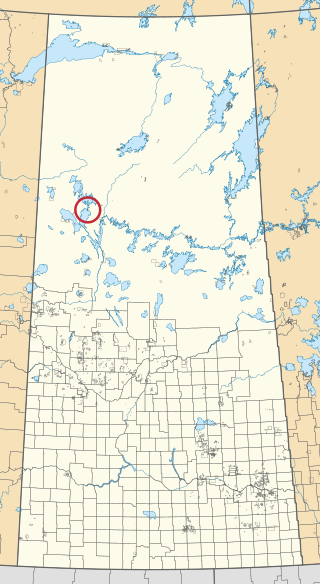
The Flying Dust First Nation is a Cree First Nation band government located adjacent to the city of Meadow Lake in Saskatchewan, Canada. Highway 55 goes through the band's reserve community.
Highway 943 is a provincial highway in the north-west region of the Canadian province of Saskatchewan. It runs from the Flying Dust 105F Indian reserve near the junctions of Highway 698 and Highway 799 to Highway 942 north-west of Big River. It is about 85 kilometres (53 mi) long.

Waterhen 130 is an Indian reserve of the Waterhen Lake First Nation in Saskatchewan. It is 39 kilometers north of Meadow Lake. In the 2016 Canadian Census, it recorded a population of 672 living in 196 of its 213 total private dwellings. In the same year, its Community Well-Being index was calculated at 51 of 100, compared to 58.4 for the average First Nations community and 77.5 for the average non-Indigenous community.

Canoe Lake 165A is an Indian reserve of the Canoe Lake Cree First Nation in Saskatchewan. It is 30 miles southwest of Île-à-la-Crosse.

Canoe Lake 165B is an Indian reserve of the Canoe Lake Cree First Nation in Saskatchewan. It is 22 miles southwest of Île-à-la-Crosse.
Churchill Lake 193A is an Indian reserve of the Birch Narrows Dene Nation in Saskatchewan. It is 50 mi (80 km) northwest of Île-à-la-Crosse.
Eagles Lake 165C is an Indian reserve of the Canoe Lake Cree First Nation in Saskatchewan. It consists of all that portion of Township 59, Range 14, west of the Third Meridian. In the 2016 Canadian Census, it recorded a population of 92 living in 29 of its 32 total private dwellings. In the same year, its Community Well-Being index was calculated at 72 of 100, compared to 58.4 for the average First Nations community and 77.5 for the average non-Indigenous community.

Flying Dust 105 is an Indian reserve of the Flying Dust First Nation in Saskatchewan. It is less than a kilometre north-west of Meadow Lake. In the 2016 Canadian Census, it recorded a population of 577 living in 169 of its 187 total private dwellings. In the same year, its Community Well-Being index was calculated at 63 of 100, compared to 58.4 for the average First Nations community and 77.5 for the average non-Indigenous community.

Flying Dust 105D is an Indian reserve of the Flying Dust First Nation in Saskatchewan.
Flying Dust 105E is an Indian reserve of the Flying Dust First Nation in Saskatchewan.

Flying Dust 105H is an Indian reserve of the Flying Dust First Nation in Saskatchewan.

Flying Dust 105I is an Indian reserve of the Flying Dust First Nation in Saskatchewan.
Flying Dust 105L is an Indian reserve of the Flying Dust First Nation in Saskatchewan.

Flying Dust 105O is an Indian reserve of the Flying Dust First Nation in Saskatchewan.

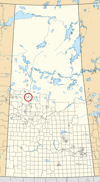
Gladue Lake 105B is an Indian reserve of the Flying Dust First Nation in Saskatchewan, Canada. It is in Township 63, Range 15, west of the Third Meridian, in the Jarvis Lake area.

The Gold Eagle Reserve is an Indian reserve of the Mosquito, Grizzly Bear's Head, Lean Man First Nations in Saskatchewan. It is an urban reserve in the city of North Battleford.

Meadow Lake 105A is an Indian reserve of the Flying Dust First Nation in Saskatchewan. It is 7 miles southwest of Meadow Lake. In the 2016 Canadian Census, it recorded a population of 0 living in 0 of its 1 total private dwellings.

Meadow Lake 105C is an Indian reserve of the Flying Dust First Nation in Saskatchewan. It is Lots 12, 13, and 14, Block 14, northeast quarter of Section 26, Township 59, Range 17, west of the Third Meridian.

Wepuskow Sahgaiechan 165D is an Indian reserve of the Canoe Lake Cree First Nation in Saskatchewan. It is 85 kilometres north of Meadow Lake, and on the west shore of Keeley Lake.
