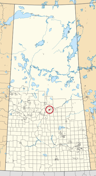
Thunderchild First Nation is an independent Cree First Nations band government in Turtleford, Saskatchewan, Canada with no affiliation with any Tribal Council. It is located approximately 113 kilometers northwest of North Battleford. European settlement in 1909 caused the reserve to be moved by the Government of Canada from its original location near Delmas, Saskatchewan to where it now currently resides near Turtleford, Saskatchewan.
Ahtahkakoop 104 is an Indian reserve of the Ahtahkakoop Cree Nation in Saskatchewan. It is about 72 kilometres (45 mi) northwest of Prince Albert. In the 2016 Canadian Census, it recorded a population of 1,472 living in 386 of its 424 total private dwellings. In the same year, its Community Well-Being index was calculated at 46 of 100, compared to 58.4 for the average First Nations community and 77.5 for the average non-Indigenous community.
Canoe Lake 165 is an Indian reserve of the Canoe Lake Cree First Nation in the boreal forest of northern Saskatchewan, Canada. Its location is on Canoe Lake approximately thirty miles west of Beauval, within the ancient hunting grounds of the Woodland Cree. In the 2016 Canadian Census, it recorded a population of 912 living in 250 of its 273 total private dwellings. In the same year, its Community Well-Being index was calculated at 53 of 100, compared to 58.4 for the average First Nations community and 77.5 for the average non-Indigenous community. The reserve includes the settlement of Canoe Narrows. The name of the reserve and the settlement in Cree is nêhiyaw-wapâsihk ᓀᐦᐃᔭᐤ ᐘᐹᓯᕽ.

Seekaskootch 119 is an Indian reserve of the Onion Lake Cree Nation in Saskatchewan. It is about 142 kilometres (88 mi) north-west of North Battleford. In the 2016 Canadian Census, it recorded a population of 2574 living in 578 of its 639 total private dwellings. In the same year, its Community Well-Being index was calculated at 53 of 100, compared to 58.4 for the average First Nations community and 77.5 for the average non-Indigenous community.

Waterhen 130 is an Indian reserve of the Waterhen Lake First Nation in Saskatchewan. It is about 39 kilometres (24 mi) north of the community of Meadow Lake on Waterhen Lake. In the 2016 Canadian Census, it recorded a population of 672 living in 196 of its 213 total private dwellings. In the same year, its Community Well-Being index was calculated at 51 of 100, compared to 58.4 for the average First Nations community and 77.5 for the average non-Indigenous community.

Red Pheasant 108 is an Indian reserve of the Red Pheasant Cree Nation in Saskatchewan. It is about 33 kilometres (21 mi) south of North Battleford. In the 2016 Canadian Census, it recorded a population of 519 living in 136 of its 163 total private dwellings. In the same year, its Community Well-Being index was calculated at 46 of 100, compared to 58.4 for the average First Nations community and 77.5 for the average non-Indigenous community.

Cumberland House Cree Nation 20 is an Indian reserve of the Cumberland House Cree Nation in Saskatchewan. The reserve is on Cumberland Island in the Saskatchewan River Delta, about 96 kilometres (60 mi) south-west of Flin Flon.
Eagles Lake 165C is an Indian reserve of the Canoe Lake Cree First Nation in Saskatchewan. It consists of all that portion of Township 59, Range 14, west of the Third Meridian. In the 2016 Canadian Census, it recorded a population of 92 living in 29 of its 32 total private dwellings. In the same year, its Community Well-Being index was calculated at 72 of 100, compared to 58.4 for the average First Nations community and 77.5 for the average non-Indigenous community.

Flying Dust 105 is an Indian reserve of the Flying Dust First Nation in Saskatchewan. It is less than a kilometre north-west of Meadow Lake. In the 2016 Canadian Census, it recorded a population of 577 living in 169 of its 187 total private dwellings. In the same year, its Community Well-Being index was calculated at 63 of 100, compared to 58.4 for the average First Nations community and 77.5 for the average non-Indigenous community.

Grizzly Bear's Head 110 & Lean Man's 111 is an Indian reserve of the Mosquito, Grizzly Bear's Head, Lean Man First Nations in Saskatchewan. It is about 24 kilometres (15 mi) south of North Battleford. In the 2016 Canadian Census, it recorded a population of 67 living in 17 of its 19 total private dwellings. In the same year, its Community Well-Being index was calculated at 50 of 100, compared to 58.4 for the average First Nations community and 77.5 for the average non-Indigenous community.
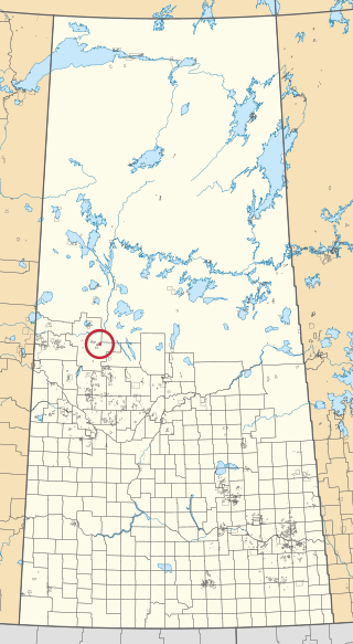
Little Pine 116 is an Indian reserve of the Little Pine First Nation in Saskatchewan. It is about 53 kilometres (33 mi) north-west of North Battleford. In the 2016 Canadian Census, it recorded a population of 700 living in 201 of its 220 total private dwellings. In the same year, its Community Well-Being index was calculated at 50 of 100, compared to 58.4 for the average First Nations community and 77.5 for the average non-Indigenous community.

Moosomin 112B is an Indian reserve of the Moosomin First Nation in Saskatchewan. It is about 32 kilometres (20 mi) north of North Battleford. In the 2016 Canadian Census, it recorded a population of 724 living in 183 of its 195 total private dwellings. In the same year, its Community Well-Being index was calculated at 48 of 100, compared to 58.4 for the average First Nations community and 77.5 for the average non-Indigenous community.

Mosquito 109 is an Indian reserve of the Mosquito, Grizzly Bear's Head, Lean Man First Nations in Saskatchewan. It is about 27 kilometres (17 mi) south of North Battleford. In the 2016 Canadian Census, it recorded a population of 478 living in 107 of its 113 total private dwellings. In the same year, its Community Well-Being index was calculated at 42 of 100, compared to 58.4 for the average First Nations community and 77.5 for the average non-Indigenous community.
The Muskoday Reserve is an Indian reserve of the Muskoday First Nation in Saskatchewan. It is about 19 kilometres (12 mi) south-east of Prince Albert. In the 2016 Canadian Census, it recorded a population of 647 living in 205 of its 217 total private dwellings. In the same year, its Community Well-Being index was calculated at 64 of 100, compared to 58.4 for the average First Nations community and 77.5 for the average non-Indigenous community.

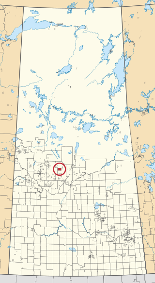
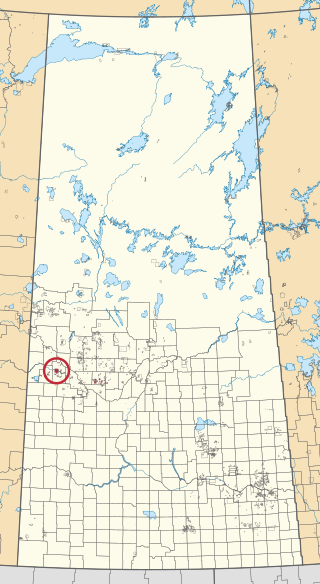
Poundmaker 114 is an Indian reserve of the Poundmaker Cree Nation in Saskatchewan. It is about 40 kilometres (25 mi) west of North Battleford. In the 2016 Canadian Census, it recorded a population of 547 living in 176 of its 201 total private dwellings. In the same year, its Community Well-Being index was calculated at 53 of 100, compared to 58.4 for the average First Nations community and 77.5 for the average non-Indigenous community.

Saulteaux 159 is an Indian reserve of the Saulteaux First Nation in Saskatchewan. It is about 43 kilometres (27 mi) north of North Battleford. In the 2016 Canadian Census, it recorded a population of 473 living in 133 of its 142 total private dwellings. In the same year, its Community Well-Being index was calculated at 50 of 100, compared to 58.4 for the average First Nations community and 77.5 for the average non-Indigenous community.

Saulteaux 159A is an Indian reserve of the Saulteaux First Nation in Saskatchewan. It is about 77 kilometres (48 mi) north of North Battleford, on the northern shore of Birch Lake and eastern shore of Helene Lake. In the 2016 Canadian Census, it recorded a population of 26 living in 7 of its 10 total private dwellings.

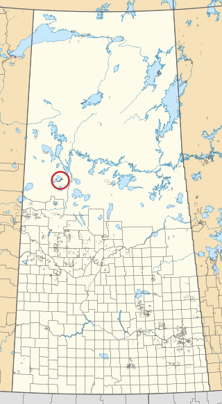
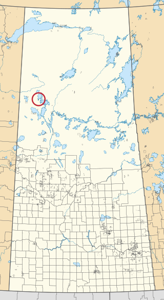
Thunderchild 115C is an Indian reserve of the Thunderchild First Nation in Saskatchewan. In the 2016 Canadian Census, it recorded a population of 34 living in 14 of its 16 total private dwellings. The reserve is on the western shore of Turtle Lake adjacent to Horseshoe Bay.
Turnor Lake 193B is an Indian reserve of the Birch Narrows Dene Nation in Saskatchewan on the southern shore of Turnor Lake at the mouth of the Mikikwan River. It is about 124 kilometres (77 mi) north-west of Île-à-la-Crosse. In the 2016 Canadian Census, it recorded a population of 476 living in 131 of its 146 total private dwellings. In the same year, its Community Well-Being index was calculated at 58 of 100, compared to 58.4 for the average First Nations community and 77.5 for the average non-Indigenous community.

Wahpaton 94A is an Indian reserve of the Wahpeton Dakota Nation in Saskatchewan. It is about 10 kilometres (6.2 mi) north of Prince Albert. In the 2016 Canadian Census, it recorded a population of 309 living in 70 of its 80 total private dwellings. In the same year, its Community Well-Being index was calculated at 58 of 100, compared to 58.4 for the average First Nations community and 77.5 for the average non-Indigenous community.

