Earl Grey, Saskatchewan

Last updated
Earl Grey
Village of Earl Grey
Canada Saskatchewan location map.svg
Red pog.svg
Earl Grey
Location of Earl Grey
Canada location map 2.svg
Red pog.svg
Earl Grey
Earl Grey (Canada)
Coordinates: 50°56′08″N104°42′40″W / 50.935556°N 104.711111°W / 50.935556; -104.711111
Country Flag of Canada (Pantone).svg  Canada
Province Flag of Saskatchewan.svg  Saskatchewan
Region Central
Census division 6
Rural Municipality Longlaketon No. 219
Post office Founded1905-10-16
Incorporated (Village)1906
Government
  Type Municipal
  Governing body Earl Grey Village Council
   Mayor Debbie Hupka-Butz
   Administrator Courtney Wiers
Population
 (2006)
  Total246
  Density187.7/km2 (486/sq mi)
Time zone UTC-6 (CST)
Postal code
S0G 1J0
Area code 306
Highways Saskatchewan Highway 22 (jct).svg Hwy 22
Saskatchewan Rural Municipal Route.svg
Saskatchewan Route 641.svg
Hwy 641
Railways Canadian Pacific Railway
(abandoned)

Earl Grey (2016 population: 246) is a village in the Canadian province of Saskatchewan within the Rural Municipality of Longlaketon No. 219 and Census Division No. 6. The village is located approximately 67 kilometres north of the City of Regina.

Contents

The area was first settled in 1901 by Paul Henderson, younger brother of Jack Henderson, hangman of Louis Riel. [1] Subsequent to Paul Henderson's death from exposure in 1903, other settlers followed; in 1906 the village was incorporated and named "Earl Grey" after Albert Grey, 4th Earl Grey, Canada's Governor General at the time. [2]

Currently, the town has two churches (Christ Lutheran Church [ELCIC] and a United Church), one Kingdom Hall of Jehovah's Witnesses, several old-age homes, a hotel, a curling rink, and a veterinary clinic. A small statue of a grain elevator is displayed in the downtown area, a commemorative tribute to the village's once-thriving grain economy.

The public school was downsized to a Kindergarten-Grade 8 school in the 2003–2004 school year, before closing completely in 2007. [3]

History

Earl Grey incorporated as a village on July 27, 1906. [4]

Demographics

Population history
(1981–2016)
YearPop.±%
1981303    
1986320+5.6%
1991289−9.7%
1996 268−7.3%
2001 292+9.0%
2006 264−9.6%
2011 239−9.5%
2016 246+2.9%
Source: Statistics Canada via Saskatchewan Bureau of Statistics [5] [6]

In the 2021 Census of Population conducted by Statistics Canada, Earl Grey had a population of 229 living in 120 of its 134 total private dwellings, a change of

In the 2016 Census of Population, the Village of Earl Grey recorded a population of 246 living in 118 of its 121 total private dwellings, a

See also

Related Research Articles

Marengo is a village in the Canadian province of Saskatchewan within the Rural Municipality of Milton No. 292 and Census Division No. 13. It is about 45 km (28 mi) west of Kindersley. It is located within the Sun West School Division.

Albertville is a village in the Canadian province of Saskatchewan within the Rural Municipality of Garden River No. 490 and is in Census Division No. 15. It is approximately 25 km northeast of the City of Prince Albert.

<span class="mw-page-title-main">Rural Municipality of Lomond No. 37</span> Rural Municipality in Saskatchewan, Canada

The Rural Municipality of Lomond No. 37 is a rural municipality (RM) in the Canadian province of Saskatchewan within Census Division No. 2 and SARM Division No. 1. Located in the southeast portion of the province, it is south of the city of Weyburn.

Arran is a special service area in the Canadian province of Saskatchewan within the Rural Municipality of Livingston No. 331 and Census Division No. 9. It held village status between 1916 and 2022.

<span class="mw-page-title-main">Consul, Saskatchewan</span> Village in Saskatchewan, Canada

Consul is a village in the Canadian province of Saskatchewan within the Rural Municipality of Reno No. 51 and Census Division No. 4. The historic Red Coat Trail and Highway 21 pass through the village. The village features one of the last existing grain elevators in the region. It is 211 km southwest of the City of Swift Current.

<span class="mw-page-title-main">Rural Municipality of Prairiedale No. 321</span> Rural Municipality in Saskatchewan, Canada

The Rural Municipality of Prairiedale No. 321 is a rural municipality (RM) in the Canadian province of Saskatchewan within Census Division No. 13 and SARM Division No. 6. Located in the west-central portion of the province, it is adjacent to the Alberta boundary.

Cadillac is a village in the Canadian province of Saskatchewan within the Rural Municipality of Wise Creek No. 77 and Census Division No. 4. It is at the intersection of Highway 13, the Red Coat Trail, and Highway 4 in the southwest portion of the province. Located 40 mi/62 km south of the City of Swift Current, The three largest buildings remaining in the community are the former Cadillac School, the Cadillac Skating and Curling Rink, and the former Saskatchewan Wheat Pool grain elevator.

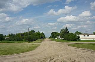
Marquis is a village in the Canadian province of Saskatchewan within the Rural Municipality of Marquis No. 191 and Census Division No. 7. It is on Highway 42 about 32 km northwest of Moose Jaw.

<span class="mw-page-title-main">Zelma, Saskatchewan</span> Village in Saskatchewan, Canada

Zelma is a village in the Canadian province of Saskatchewan within the Rural Municipality of Morris No. 312 and Census Division No. 11. The village is located along Saskatchewan Highway 763.

Grayson is a village in the Canadian province of Saskatchewan within the Rural Municipality of Grayson No. 184 and Census Division No. 5.

Hubbard is a village in the Canadian province of Saskatchewan within the Rural Municipality of Ituna Bon Accord No. 246 and Census Division No. 10.

Kendal is a village in the Canadian province of Saskatchewan within the Rural Municipality of Montmartre No. 126 and Census Division No. 6. The village is located 77 km southeast of the City of Regina on Highway 48.

<span class="mw-page-title-main">Rural Municipality of Langenburg No. 181</span> Rural Municipality in Saskatchewan, Canada

The Rural Municipality of Langenburg No. 181 is a rural municipality (RM) in the Canadian province of Saskatchewan within Census Division No. 5 and SARM Division No. 1. It is located in the east-central portion of the province.

<span class="mw-page-title-main">Rural Municipality of Victory No. 226</span> Rural Municipality in Saskatchewan, Canada

The Rural Municipality of Victory No. 226 is a rural municipality (RM) in the Canadian province of Saskatchewan within Census Division No. 7 and SARM Division No. 3.

Osage is a village in the Canadian province of Saskatchewan within the Rural Municipality of Fillmore No. 96 and Census Division No. 2. The village is located on Highway 33, that runs south-east from Regina to Stoughton. The village has a grain elevator, post office, service station, and a two-sheet natural ice curling rink. Children from the area attend school in Fillmore, 13 km away. Osage celebrated its centennial in 2006.

<span class="mw-page-title-main">Rural Municipality of Bengough No. 40</span> Rural Municipality in Saskatchewan, Canada

The Rural Municipality of Bengough No. 40 is a rural municipality (RM) in the Canadian province of Saskatchewan within Census Division No. 2 and SARM Division No. 2. It is located in the southeast portion of the province.

<span class="mw-page-title-main">Rural Municipality of Laurier No. 38</span> Rural Municipality in Saskatchewan, Canada

The Rural Municipality of Laurier No. 38 is a rural municipality (RM) in the Canadian province of Saskatchewan within Census Division No. 2 and SARM Division No. 2. it is located in the southeast portion of the province.

<span class="mw-page-title-main">Rural Municipality of Hazelwood No. 94</span> Rural Municipality in Saskatchewan, Canada

The Rural Municipality of Hazelwood No. 94 is a rural municipality (RM) in the Canadian province of Saskatchewan within Census Division No. 1 and SARM Division No. 1. It is located in the southeast portion of the province.

<span class="mw-page-title-main">Rural Municipality of Cupar No. 218</span> Rural Municipality in Saskatchewan, Canada

The Rural Municipality of Cupar No. 218 is a rural municipality (RM) in the Canadian province of Saskatchewan within Census Division No. 6 and SARM Division No. 2.

<span class="mw-page-title-main">Rural Municipality of Longlaketon No. 219</span> Rural Municipality in Saskatchewan, Canada

The Rural Municipality of Longlaketon No. 219 is a rural municipality (RM) in the Canadian province of Saskatchewan within Census Division No. 6 and SARM Division No. 2.

References

  1. Black, Norman Fergus (1913). A HISTORY OF SASKATCHEWAN AND THE OLD NORTH WEST.
  2. Shortt, Adam & Doughty, Arthur G., editors (1914). Canada and Its Provinces: Volume 19: The Prairie Provinces Part One
  3. Sask. school divisions announce 14 closures May 8, 2007 - CBC News. Retrieved July 29, 2019
  4. "Urban Municipality Incorporations". Saskatchewan Ministry of Government Relations. Archived from the original on October 15, 2014. Retrieved June 1, 2020.
  5. "Saskatchewan Census Population" (PDF). Saskatchewan Bureau of Statistics. Archived from the original (PDF) on September 24, 2015. Retrieved May 31, 2020.
  6. "Saskatchewan Census Population". Saskatchewan Bureau of Statistics. Retrieved May 31, 2020.
  7. "Population and dwelling counts: Canada, provinces and territories, census divisions and census subdivisions (municipalities), Saskatchewan". Statistics Canada. February 9, 2022. Retrieved April 1, 2022.
  8. "Population and dwelling counts, for Canada, provinces and territories, and census subdivisions (municipalities), 2016 and 2011 censuses – 100% data (Saskatchewan)". Statistics Canada. February 8, 2017. Retrieved May 30, 2020.