
Nipawin is a town in Saskatchewan, Canada, on the Saskatchewan River portion of Tobin Lake. The town lies between Codette Lake, created by the Francois-Finlay Dam and Tobin Lake, created by the E.B. Campbell Dam built in 1963, renamed from Squaw Rapids. The construction of Francois-Finlay Dam earned Nipawin the nickname the "Town of Two Lakes".

Wolseley is a town in southeast Saskatchewan, Canada, approximately 100 kilometres (62 mi) east of Regina on the Trans-Canada Highway.

Melville is a city in the east-central portion of Saskatchewan, Canada. The city is about 145 kilometres (90 mi) northeast of the provincial capital of Regina and 45 kilometres (28 mi) southwest of Yorkton. Melville is bordered by the rural municipalities of Cana No. 214 and Stanley No. 215. Its population at the 2016 census was 4,562, making it Saskatchewan's smallest city. It is also home of hockey's Melville Millionaires, who compete in the Saskatchewan Junior Hockey League, and baseball's Melville Millionaires, who competed in the Western Canadian Baseball League until 2019.
Melfort is a city in Saskatchewan, Canada, located approximately 95 kilometres (59 mi) southeast of Prince Albert, 172 kilometres (107 mi) northeast of Saskatoon and 280 kilometres (170 mi) north of Regina.
Lumsden is a town in the Qu'Appelle Valley in south central Saskatchewan, Canada, 31 km northwest of the city of Regina. It is surrounded by the Rural Municipality of Lumsden No. 189. The town functions as both a farming community and an unofficial suburb of Regina. Lumsden has an active artistic community, which consists of many writers, painters, and sculptors.

Meadow Lake is a city in the boreal forest of northwestern Saskatchewan, Canada. Its location is about 246 kilometres (153 mi) northeast of Lloydminster and 156 kilometres (97 mi) north of North Battleford. Founded as a trading post in 1799, it became a village in 1931 and a town in 1936. On November 9, 2009, it officially became Saskatchewan's 14th city.

Radville is a town in the Canadian province of Saskatchewan, in the RM of Laurier No. 38. It was incorporated in 1911 after being settled in 1895. Highway 28 and Highway 377 pass through the town. Nearby communities include the village of Ceylon, 23 km to the west, and the city of Weyburn, 51 km to the north-east. Major nearby urban centres include Regina, which is 148 km to the north, and Moose Jaw, which is 143 km north-west.

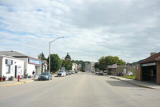
Outlook is a town in west central Saskatchewan, Canada about 80 kilometres (50 mi) south-southwest of Saskatoon. It is located along the South Saskatchewan River, downstream from Gardiner Dam and the Coteau Creek Hydroelectric Station.

Macklin is a town in the Rural Municipality of Eye Hill No. 382, Saskatchewan, Canada. The population was 1,247 at the 2021 Canadian census. The town is located on Highway 14 and Highway 31 about 5 kilometres (3.1 mi) east of the provincial border with Alberta, and is situated near one of the most productive oil and natural gas producing fields in the province.

Carrot River is a town located in east-central Saskatchewan in Canada. The administration office for the Rural Municipality of Moose Range No. 486 is located in Carrot River.

Lanigan is a town in south-central Saskatchewan, Canada, at the intersection of Trans-Canada Yellowhead Highway 16 and Highway 20, approximately 117 kilometres (73 mi) east of Saskatoon and 170 kilometres (110 mi) north of Regina.

The Rural Municipality of Lumsden No. 189 is a rural municipality (RM) in the Canadian province of Saskatchewan within Census Division No. 6 and SARM Division No. 2. It is located in the south-east portion of the province.

Division No. 6 is one of eighteen census divisions in the province of Saskatchewan, Canada, as defined by Statistics Canada. It is located in the south-central part of the province. The most populous community in this division is Regina, the provincial capital.

Watson is a town of 777 residents in the Rural Municipality of Lakeside No. 338, in the Canadian province of Saskatchewan. Watson is located on the intersection of Highway 5 and Highway 6, the Canam Highway. Watson is approximately the same distance from Saskatoon which is to the west, and Regina to the south, which gives rise to its town motto, "Industrial Crossroads of Saskatchewan".

Carlyle is a town in the province of Saskatchewan, Canada. Carlyle is the largest town servicing the far south-eastern corner of Saskatchewan and as a result, has become the economic and services centre of the region. Estevan and Weyburn are the closest cities and both are a little over 100 kilometres away. Regina, the provincial capital, lies 200 km to the north-west.

Bethune is a village in the Canadian province of Saskatchewan within the Rural Municipality of Dufferin No. 190 and Census Division No. 6. The village is 56 kilometres (35 mi) north-west of Regina on Highway 11. Arm River flows along a river valley north of Bethune, which features camping sites, and the Qu'Appelle River is a short way south. Last Mountain Lake or Long Lake is north-east of Bethune whereas Buffalo Pound Lake is just south-west.

Carnduff is a small agricultural town in southeast Saskatchewan, Canada.

St. Brieux is a town in the Canadian province of Saskatchewan. It is located near Highway 368 and Highway 779. St. Brieux is located north of the village of Lake Lenore on the eastern shore of St. Brieux Lake. St. Brieux Regional Park and Golf Course is adjacent to the west side of the town.

Bredenbury is a town in the Rural Municipality of Saltcoats No. 213, in the Canadian province of Saskatchewan. Bredenbury is located on Highway 16 in eastern Saskatchewan. As of the 2016 Canadian Census, the population of Bredenbury was 372. The main industries in the area are farming and potash mining near Esterhazy. The community is known in the area for its enthusiastic Christmas light displays which have won national awards.
The Battlefords Provincial Park is a recreational provincial park in the Canadian Province of Saskatchewan. It is about 39 kilometres (24 mi) north of the city of North Battleford in the RM of Meota No. 468 on Jackfish Lake. Highway 4 runs north from North Battleford to the park and Highway 204 runs through the park providing access to the amenities.


