
The Qu'Appelle River is a river in the Canadian provinces of Saskatchewan and Manitoba that flows 430 kilometres (270 mi) east from Lake Diefenbaker in south-western Saskatchewan to join the Assiniboine River in Manitoba, just south of Lake of the Prairies, near the village of St. Lazare. It is in a region called the Prairie Pothole Region of North America, which extends throughout three Canadian provinces and five U.S. states. It is also within Palliser's Triangle and the Great Plains ecoregion.

Gordon 86 is a Cree reserve in Saskatchewan, Canada located 61 kilometres (38 mi) northwest of Fort Qu'Appelle. Also known as the George Gordon Reserve, it is one of three territories of the George Gordon First Nation, as arranged by the signing of Treaty 4. The reserve has an area of 14,438.3 hectares. In the 2016 Canadian Census, it recorded a population of 837 living in 218 of its 238 total private dwellings. In the same year, its Community Well-Being index was calculated at 52 of 100, compared to 58.4 for the average First Nations community and 77.5 for the average non-Indigenous community. It is almost completely surrounded by the rural municipality of Touchwood No. 248.

The Fishing Lakes, also called the Calling Lakes or the Qu'Appelle Lakes, are a chain of four lakes in the Qu'Appelle Valley cottage country about 40 miles (64 km) to the north-east of Regina in the Canadian province of Saskatchewan. The lakes are in a region called the Prairie Pothole Region of North America, which extends throughout three Canadian provinces and five U.S. states. It is also within Palliser's Triangle and the Great Plains ecoregion. The Fishing Lakes all follow the course of the Qu'Appelle River, which flows from the west to the east and is part of the Hudson Bay drainage basin. The lakes sit in the deep-cut Qu'Appelle Valley that was formed about 14,000 years ago during the last ice age. Meltwater from the glaciers carved out the valley and as water levels rose and fell, alluvium was left in the wake. These piles of alluvium are what created the separations between the lakes.

Division No. 6 is one of eighteen census divisions in the province of Saskatchewan, Canada, as defined by Statistics Canada. It is located in the south-central part of the province. The most populous community in this division is Regina, the provincial capital.

The Rural Municipality of North Qu'Appelle No. 187 is a rural municipality (RM) in the Canadian province of Saskatchewan within Census Division No. 6 and SARM Division No. 1. It is located in the south-east portion of the province.
Muskowekwan First Nation is a Saulteaux (Ojibway) First Nation who inhabit approximately 100 km northwest of Melville, Saskatchewan, Canada. As of May, 2008, the First Nation has 1,517 registered people, of which their on-reserve population was 400.

Shesheep 74A is an Indian reserve of the Zagime Anishinabek in Saskatchewan. It is on the left bank of the Qu'Appelle River, at the west end of Crooked Lake. In the 2016 Canadian Census, it recorded a population of 111 living in 56 of its 179 total private dwellings. In the same year, its Community Well-Being index was calculated at 81 of 100, compared to 58.4 for the average First Nations community and 77.5 for the average non-Indigenous community.

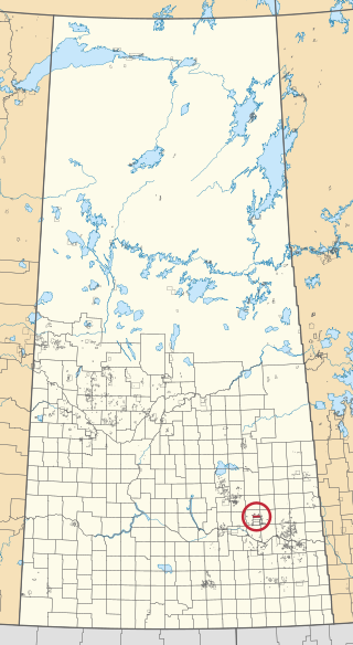
Star Blanket 83 is an Indian reserve of the Star Blanket Cree Nation in Saskatchewan. It is 18 kilometres northeast of Fort Qu'Appelle. In the 2016 Canadian Census, it recorded a population of 175 living in 48 of its 59 total private dwellings. In the same year, its Community Well-Being index was calculated at 50 of 100, compared to 58.4 for the average First Nations community and 77.5 for the average non-Indigenous community.

Fishing Lake 89 is an Indian reserve of the Fishing Lake First Nation in Saskatchewan. It is 119 kilometres north of Fort Qu'Appelle. In the 2016 Canadian Census, it recorded a population of 406 living in 128 of its 161 total private dwellings. In the same year, its Community Well-Being index was calculated at 54 of 100, compared to 58.4 for the average First Nations community and 77.5 for the average non-Indigenous community.

Day Star 87 is an Indian reserve of the Day Star First Nation in Saskatchewan. It is 87 kilometres northwest of Fort Qu'Appelle. In the 2016 Canadian Census, it recorded a population of 148 living in 42 of its 62 total private dwellings. In the same year, its Community Well-Being index was calculated at 65 of 100, compared to 58.4 for the average First Nations community and 77.5 for the average non-Indigenous community.
Little Black Bear 84 is an Indian reserve of the Little Black Bear First Nation in Saskatchewan. It is 19 kilometres east of Fort Qu'Appelle. In the 2016 Canadian Census, it recorded a population of 137 living in 34 of its 43 total private dwellings. In the same year, its Community Well-Being index was calculated at 51 of 100, compared to 58.4 for the average First Nations community and 77.5 for the average non-Indigenous community.

Muscowpetung 80 is an Indian reserve of the Muscowpetung First Nation in Saskatchewan. It is 31 kilometres west of Fort Qu'Appelle along the south-west shore of Pasqua Lake, which is one of four Fishing Lakes. In the 2016 Canadian Census, it recorded a population of 275 living in 87 of its 112 total private dwellings. In the same year, its Community Well-Being index was calculated at 54 of 100, compared to 58.4 for the average First Nations community and 77.5 for the average non-Indigenous community.

Muskowekwan 85 is an Indian reserve of the Muskowekwan First Nation in Saskatchewan. It is 64 kilometres northwest of Fort Qu'Appelle. In the 2016 Canadian Census, it recorded a population of 436 living in 150 of its 170 total private dwellings. In the same year, its Community Well-Being index was calculated at 52 of 100, compared to 58.4 for the average First Nations community and 77.5 for the average non-Indigenous community.

Okanese 82 is an Indian reserve of the Okanese First Nation in Saskatchewan. It is 16 kilometres northeast of Fort Qu'Appelle. In the 2016 Canadian Census, it recorded a population of 175 living in 56 of its 69 total private dwellings. In the same year, its Community Well-Being index was calculated at 57 of 100, compared to 58.4 for the average First Nations community and 77.5 for the average non-Indigenous community.

Peepeekisis 81 is an Indian reserve of the Peepeekisis Cree Nation in Saskatchewan. It is 14 kilometres east of Fort Qu'Appelle. In the 2016 Canadian Census, it recorded a population of 491 living in 135 of its 146 total private dwellings. In the same year, its Community Well-Being index was calculated at 53 of 100, compared to 58.4 for the average First Nations community and 77.5 for the average non-Indigenous community.
Piapot 75 is an Indian reserve of the Piapot Cree Nation in Saskatchewan. It is 43 kilometres west of Fort Qu'Appelle. In the 2016 Canadian Census, it recorded a population of 516 living in 143 of its 171 total private dwellings. In the same year, its Community Well-Being index was calculated at 55 of 100, compared to 58.4 for the average First Nations community and 77.5 for the average non-Indigenous community.

Poorman 88 is an Indian reserve of the Kawacatoose First Nation in Saskatchewan. It is 87 kilometres northwest of Fort Qu'Appelle. In the 2016 Canadian Census, it recorded a population of 729 living in 172 of its 196 total private dwellings. In the same year, its Community Well-Being index was calculated at 47 of 100, compared to 58.4 for the average First Nations community and 77.5 for the average non-Indigenous community.

Standing Buffalo 78 is an Indian reserve of the Standing Buffalo Dakota Nation in Saskatchewan. It is 8 kilometres north-west of Fort Qu'Appelle. In the 2016 Canadian Census, it recorded a population of 569 living in 184 of its 198 total private dwellings. In the same year, its Community Well-Being index was calculated at 59 of 100, compared to 58.4 for the average First Nations community and 77.5 for the average non-Indigenous community.

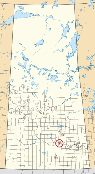
Wa-pii-moos-toosis 83A is an Indian reserve of the Star Blanket Cree Nation in Saskatchewan. In 2016, its Community Well-Being index was calculated at 61 of 100, compared to 58.4 for the average First Nations community and 77.5 for the average non-Indigenous community. The name of the locality means "White Calf".

Pasqua Lake is a lake along the course of the Qu'Appelle River in the Canadian province of Saskatchewan. Pasqua Lake was named after Chief Joseph Pasqua who formed what became the Pasqua First Nation. It is one of four lakes that make up the Fishing Lakes, which are all nestled in the Qu'Appelle Valley. The deep-cut Qu'Appelle Valley was formed about 14,000 years ago during the last ice age as meltwater from the glaciers carved out the valley. As water levels rose and fell, alluvium was left in the wake. These piles of alluvium are what created the separations between the lakes.

