Buena Vista is a village in the Canadian province of Saskatchewan within the Rural Municipality of Lumsden No. 189 and Census Division No. 6. The village is located 40 km (25 mi) north-west of Regina, on the southern shore of Last Mountain Lake just off Highway 54. It is bounded to the west by Regina Beach, demarcated by 16 Street.

Annaheim is a village in the Canadian province of Saskatchewan within the Rural Municipality of St. Peter No. 369 and Census Division No. 15. The village is located about 125 km east of the City of Saskatoon, at the junction of provincial Highway 756 and Highway 779. Annaheim hosts the offices of the Rural Municipality of St. Peter No. 369.

Simpson is a village in the Canadian province of Saskatchewan within the Rural Municipality of Wood Creek No. 281 and Census Division No. 11. It is between the cities of Regina and Saskatoon on Highway 2. The administrative office for the Rural Municipality of Wood Creek No. 281 is located in the village. The post office was founded in 1911 by Herman Bergren and Joseph Newman during construction of the Canadian Pacific Railway. It is named after George Simpson, a governor of the Hudson's Bay Company.

The Rural Municipality of Craik No. 222 is a rural municipality (RM) in the Canadian province of Saskatchewan within Census Division No. 7 and SARM Division No. 2. The RM is centrally located between the cities of Regina and Saskatoon.

The Rural Municipality of Arm River No. 252 is a rural municipality (RM) in the Canadian province of Saskatchewan within Census Division No. 11 and SARM Division No. 5. It is located along Highway 11 between Saskatoon and Regina.

The Rural Municipality of Lumsden No. 189 is a rural municipality (RM) in the Canadian province of Saskatchewan within Census Division No. 6 and SARM Division No. 2. It is located in the south-east portion of the province.
Arran is a special service area in the Canadian province of Saskatchewan within the Rural Municipality of Livingston No. 331 and Census Division No. 9. It held village status between 1916 and 2022.

Avonlea is a village in the Canadian province of Saskatchewan within the RM of Elmsthorpe No. 100 and Census Division No. 2. The village is approximately 82 kilometres (51 mi) south-west of the city of Regina. The Southern Rails Cooperative maintains its head office in the village.
Semans is a village in the Canadian province of Saskatchewan within the Rural Municipality of Mount Hope No. 279 and Census Division No. 10. The village is located approximately 125 km north of the City of Regina and 195 km southeast of the City of Saskatoon.

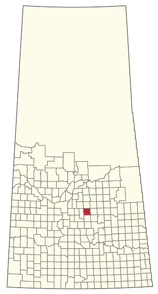
The Rural Municipality of Rosedale No. 283 is a rural municipality (RM) in the Canadian province of Saskatchewan within Census Division No. 11 and SARM Division No. 5. It is located in the central portion of the province along Highway 11 between Saskatoon and Regina.
The Rural Municipality of Wolverine No. 340 is a rural municipality (RM) in the Canadian province of Saskatchewan within Census Division No. 11 and SARM Division No. 5. It is located in the central portion of the province east of Saskatoon.
Debden is a village in the Canadian province of Saskatchewan within the Rural Municipality of Canwood No. 494 and Census Division No. 16. The village is located on Highway 55 and is 94 kilometres (58 mi) from the city of Prince Albert and 194 kilometres (121 mi) from the city of Saskatoon. It is also the administrative headquarters of the Big River Cree First Nations band government. The village is at the edge of the Prince Albert National Park and with all the lakes nearby it becomes a popular area in the summer months.

Bradwell is a village in the Canadian province of Saskatchewan within the Rural Municipality of Blucher No. 343 and Census Division No. 11. The village is located about 36 kilometres (22 mi) southeast of the city of Saskatoon on Highway 763. In 1936, during gravel excavations for a highway, the partial skeleton of a neolithic human male were discovered and named "Bradwell Man". A stone scraper and some eagle talons were found nearby.

Eyebrow is a village in the Canadian province of Saskatchewan within the Rural Municipality of Eyebrow No. 193 and Census Division No. 7. The community originated at the location that is now the abandoned community of Eskbank several kilometres to the south. Eyebrow is located at the intersection of Highway 367 and Highway 42; 84 km northwest of Moose Jaw, 154 km northwest of Regina and 196 km south of Saskatoon.

Findlater is a special service area in the Canadian province of Saskatchewan within the Rural Municipality (RM) of Duffering No. 190 and Census Division No. 6. It is 75 km northwest of Regina, Saskatchewan's capital, on Highway 11, and 15 km from the Town of Chamberlain. The original settlers had been looking for the neighbouring community of Chamberlain but, due to fatigue amongst the tribesmen, decided to rest at the site. They quickly settled and developed basic living amenities despite promises from the tribe leaders that they would soon move on and "find the new village". This continued for several months as the settlement evolved – tribesmen receiving the same responses to questions of the new community; "We'll find it later", or simply, "findlater". After a year the community was a well established populous and the name "Findlater" had been adopted fondly as homage to the promised community that had brought them there. It is believed (inaccurately) by some that the name comes from Findlater Castle in Banffshire, Scotland.
McLean is a village in the Canadian province of Saskatchewan within the Rural Municipality of South Qu'Appelle No. 157 and Census Division No. 6. It is on Highway 1 between Qu'Appelle and Balgonie. The village of McLean is located in South Central Saskatchewan on the Trans-Canada Highway and is the highest point on the Canadian Pacific Railway mainline east of the Rockies. It is about 37 kilometres (23 mi) east of the Regina. The population of McLean is 405.

Meacham is a village in the Canadian province of Saskatchewan within the Rural Municipality of Colonsay No. 342 and Census Division No. 11. It is located 69 kilometres east of the City of Saskatoon on Highway 2.
Ruddell is a village in the Canadian province of Saskatchewan within the Rural Municipality of Mayfield No. 406 and Census Division No. 16. The village is located on Highway 16, approximately 37 km (23 mi) east of the City of North Battleford and 102 km west of the City of Saskatoon. Ruddell post office first opened in 1906.
Riverhurst is a village in the Canadian province of Saskatchewan within the Rural Municipality of Maple Bush No. 224 and Census Division No. 7. It is in the southwest Coteau Hills area of the province, north of the Vermillion Hills. The community is located on Highway 42 east of Riverhurst Ferry. The village is primarily a farming community.

Tessier is a village in the Canadian province of Saskatchewan within the Rural Municipality of Harris No. 316 and Census Division No. 12. The village is located approximately 60 km southwest of the City of Saskatoon on Highway 7.


