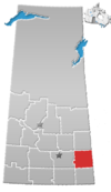
Quill Lake is a village in the Canadian province of Saskatchewan within the Rural Municipality of Lakeside No. 338 and Census Division No. 10. It is 170 km east of Saskatoon and 200 km northeast of Regina on Highway 5.

Glen Ewen is a village in the Canadian province of Saskatchewan within the Rural Municipality of Enniskillen No. 3 and Census Division No. 1. The village is located on the Canadian Pacific Railway just south of Provincial Highway 18. The towns of Carnduff and Oxbow are nearby.
Atwater is a village in the Canadian province of Saskatchewan within the Rural Municipality of Fertile Belt No. 183 and Census Division No. 5. The village is approximately 45 km southeast of the City of Melville on Highway 629.
BulyeaBUUL-yay is a village in the Canadian province of Saskatchewan within the Rural Municipality of McKillop No. 220 and Census Division No. 6.
Killaly is a village in the Canadian province of Saskatchewan within the Rural Municipality of Grayson No. 184 and Census Division No. 5. The village is located 23 km south of the City of Melville on Highway 47 at the intersection of Highway 22 and 47, and only 17 minutes north of Crooked Lake.
Buchanan is a village in the Canadian province of Saskatchewan within the Rural Municipality of Buchanan No. 304 and Census Division No. 9.
Dubuc is a village in the Canadian province of Saskatchewan within the Rural Municipality of Grayson No. 184 and Census Division No. 5. The village is located 55 kilometres south of the City of Yorkton and 30 km west of Esterhazy.

Fairlight is a village in the Canadian province of Saskatchewan within the Rural Municipality of Maryfield No. 91 and Census Division No. 1. The village lies just south of Provincial Highway 48 and the Canadian National Railway, about a kilometre west of Highway 8.
Hyas is a village in the Canadian province of Saskatchewan within the Rural Municipality of Clayton No. 333 and Census Division No. 9.
Keeler is a special service area in the Canadian province of Saskatchewan within the Rural Municipality of Marquis No. 191 and Census Division No. 7. It held village status prior to 2021.
Stenen is a village in the Canadian province of Saskatchewan within the Rural Municipality of Clayton No. 333 and Census Division No. 9.
Medstead is a village in the Canadian province of Saskatchewan within the Rural Municipality of Medstead No. 497 and Census Division No. 16.
Larkspur is a summer village in Alberta, Canada. It is located north of Westlock and south of Athabasca, east of Highway 44 and west of Highway 2.
Ruddell is a village in the Canadian province of Saskatchewan within the Rural Municipality of Mayfield No. 406 and Census Division No. 16. The village is located on Highway 16, approximately 37 km (23 mi) east of the City of North Battleford and 102 km west of the City of Saskatoon. Ruddell post office first opened in 1906.
Waldron is a village in the Canadian province of Saskatchewan within the Rural Municipality of Grayson No. 184 and Census Division No. 5.
Weekes is a village in the Canadian province of Saskatchewan within the Rural Municipality of Porcupine No. 395 and Census Division No. 14. The village is located 29 km east of the Town of Porcupine Plain on Highway 23.
Windthorst is a village in the Canadian province of Saskatchewan within the Rural Municipality of Chester No. 125 and Census Division No. 5.
Yarbo is a village in the Canadian province of Saskatchewan within the Rural Municipality of Langenburg No. 181 and Census Division No. 5. The village is located 24 km south of the Town of Churchbridge on Highway 80.
Bird's Point is a resort village in the Canadian province of Saskatchewan within Census Division No. 5. It is on the shores of Round Lake in the Rural Municipality of Fertile Belt No. 183. It is in the eastern portion of the Qu'Appelle Valley.
Leslie Beach is a resort village in the Canadian province of Saskatchewan within Census Division No. 10. It is on the shores of Fishing Lake in the Rural Municipality of Foam Lake No. 276.


