Eyebrow | |
|---|---|
| Village of Eyebrow | |
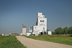 Former Saskatchewan Wheat Pool grain elevator | |
 Location of Eyebrow in Saskatchewan  Eyebrow, Saskatchewan (Canada) | |
| Coordinates: 50°43′55″N106°11′06″W / 50.732°N 106.185°W | |
| Country | |
| Province | |
| Region | South-central |
| Census division | 7 |
| Rural Municipality | Eyebrow |
| Post office Founded | 1908 |
| Government | |
| • Type | Municipal |
| • Governing body | Eyebrow Village Council |
| • Mayor | Orlando Bueckert |
| • Administrator | Deanne Hartell |
| Area | |
• Total | 2.70 km2 (1.04 sq mi) |
| Population (2016) | |
• Total | 119 |
| • Density | 50.0/km2 (129/sq mi) |
| Time zone | UTC-6 (CST) |
| Postal code | S0H 1L0 |
| Area code | 306 |
| Highways | |
| Railways | Canadian Pacific Railway |
| [1] [2] [3] [4] | |
Eyebrow (2016 population: 119) is a village in the Canadian province of Saskatchewan within the Rural Municipality of Eyebrow No. 193 and Census Division No. 7. The community originated at the location that is now the abandoned community of Eskbank several kilometres to the south. Eyebrow is located at the intersection of Highway 367 and Highway 42; 84 km northwest of Moose Jaw, 154 km northwest of Regina and 196 km south of Saskatoon.
