
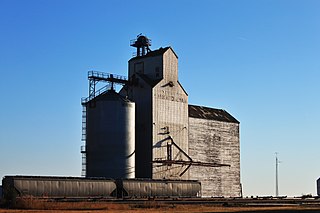
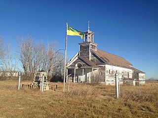
Boharm
Location of Boharm in Saskatchewan
Boharm is an unincorporated community in Saskatchewan along the course of Thunder Creek.
Boharm is an unincorporated community in Saskatchewan along the course of Thunder Creek.
Tulsa Community College is a public community college in Tulsa, Oklahoma. It was founded in 1970 and is the largest two-year college in Oklahoma. It serves approximately 23,000 students per year in classes. TCC consists of four main campuses, two community campuses, and a conference center situated throughout the Tulsa metropolitan area with an annual budget of approximately $112 million. The college employs about 2,270 people, including 280 full-time faculty and 536 adjunct faculty.

The Saskatchewan Transportation Company (STC) was a Crown corporation in the Canadian province of Saskatchewan responsible for operating intercity bus routes in the province from 1946 to 2017. Created in 1946 by an Order in Council giving the company a mandate to provide service between major urban centres and to as much of the rural population as possible, STC was a wholly owned subsidiary of the Crown Investments Corporation of Saskatchewan.

Highway 316 is a highway in the Canadian province of Saskatchewan. It runs from Highway 16 near Clavet to Highway 5. Highway 316 is about 17 km (11 mi.) long. This area is an industrial commercial area along Highway #316 which extends from Clavet north to the PCS Patience Lake Mine which is just 10 miles from the city of Saskatoon. Highway 316 is a primary weight highway, and also runs near the Canadian National Railway line which goes from Saskatoon through Clavet. In 1941, the Canadian Pacific Railway ran from Saskatoon through Cheviot and on south eastward.
Chaplin is a village in the Canadian province of Saskatchewan within the Rural Municipality of Chaplin No. 164 and Census Division No. 7. The community is situated on the Trans-Canada Highway approximately 85 km from Moose Jaw and 90 km from Swift Current. The main industries of Chaplin are Saskatchewan Minerals and farming/ranching. Chaplin consists of eight streets, two crescents, and four avenues.
Coderre ) is a village in the Canadian province of Saskatchewan within the Rural Municipality of Rodgers No. 133 and Census Division No. 7. The village is located approximately 85 km southwest of the City of Moose Jaw on Highway 627.
Brownlee is a village in the Canadian province of Saskatchewan within the Rural Municipality of Eyebrow No. 193 and Census Division No. 7. The village is located approximately 58 km northwest of the City of Moose Jaw on Highway 42.

Eyebrow is a village in the Canadian province of Saskatchewan within the Rural Municipality of Eyebrow No. 193 and Census Division No. 7. The community originated at the location that is now the abandoned community of Eskbank several kilometres to the south. Eyebrow is located at the intersection of Highway 367 and Highway 42; 84 km northwest of Moose Jaw, 154 km northwest of Regina and 196 km south of Saskatoon.
Parkbeg is a hamlet in Wheatlands Rural Municipality No. 163, Saskatchewan, Canada. The hamlet is located at the junction of Highway 1 and Highway 627 approximately 58 km directly west of the City of Moose Jaw on the Trans Canada Highway.
Courval is an unincorporated community in the Rural Municipality of Rodgers No. 133 in the Canadian province of Saskatchewan. Recognized as a designated place by Statistics Canada, Courval had a population of 5 in the Canada 2006 Census.
Vantage is a hamlet in Sutton Rural Municipality No. 103, Saskatchewan, Canada. Listed as a designated place by Statistics Canada, the hamlet had a reported population of zero in the Canada 2006 Census.
Bodmin is an unincorporated community in Saskatchewan.
Mawer is a locality in the Rural Municipality of Eyebrow No. 193, Saskatchewan, Canada. It previously held the status of village until December 31, 1967. The community is located about 5 km (3.1 mi) south of Highway 42 on Range Road 35, approximately 10 km (6.2 mi) southeast of Central Butte. It is located on the former Grand Trunk Pacific rail line.
Handsworth is a hamlet in Golden West Rural Municipality 95, Saskatchewan, Canada. The hamlet is located about 20 km east of the town of Creelman on Highway 701, along a former Canadian Pacific Railway branch line.

Lake Valley is an unincorporated community in the Rural Municipality of Eyebrow No. 193, Saskatchewan, Canada. The community is located about 10 km (6.2 mi) south of Highway 42 on Range Road 11, approximately 40 km (25 mi) northwest of the City of Moose Jaw. It is located on a former Canadian Pacific Railway line from Moose Jaw to Riverhurst.
Eskbank is an unincorporated community in the Rural Municipality of Eyebrow No. 193, Saskatchewan, Canada. The community is located about 15 km (9.3 mi) south of Highway 42 on Range Road 20, approximately 50 km (31 mi) northwest of the City of Moose Jaw. It is located on the former Grand Trunk Pacific Central Butte Subdivision from Moose Jaw to Riverhurst.
Lawson is a hamlet in Maple Bush Rural Municipality No. 224, Saskatchewan, Canada. It previously held the status of village until December 31, 1985. The hamlet is located 12 km north-west of the Town of Central Butte on highway 42 along the now defunct Canadian Pacific Railway subdivision.
Darmody is an unincorporated community in Eyebrow Rural Municipality No. 193, Saskatchewan, Canada. It previously held the status of a village until December 31, 1967. Darmody is located 87 km (54 mi) northwest of the City of Moose Jaw on highway 627.
Calderbank is a hamlet in the Canadian province of Saskatchewan located in Morse No. 165.
RCAF Station Caron was a Second World War British Commonwealth Air Training Plan (BCATP) station located near Caron, Saskatchewan, Canada. It was operated and administered by the Royal Canadian Air Force (RCAF).
Coordinates: 50°23′48″N106°59′10″W / 50.39667°N 106.98611°W
| | This Saskatchewan location article is a stub. You can help Wikipedia by expanding it. |
