Aylesbury is a village within the Rural Municipality of Craik No. 222, Saskatchewan, Canada. The village is approximately 60 km north of the city of Moose Jaw. Incorporated as a town in 1910 with the arrival of many settlers, Aylesbury's population boomed. After the Great Depression Aylesbury suffered a decline and had been dissolved to a village at an unknown date.
Highway 1 is the Saskatchewan section of the Trans-Canada Highway mainland route. The total distance of the Trans-Canada Highway in Saskatchewan is 647.9 kilometres (402.6 mi). The highway traverses Saskatchewan from the western border with Alberta, from Highway 1, to the Manitoba border where it continues as PTH 1. The Trans–Canada Highway Act was passed on December 10, 1949. The Saskatchewan segment was completed August 21, 1957. The speed limit along the majority of the route is 110 kilometres per hour (70–mph) with urban area thoroughfares slowing to a speed of 90–100 kilometres per hour (55–65 mph). Portions of the highway—the section through Swift Current, an 8-kilometer section east of Moose Jaw, and the Regina Ring Road—are controlled-access. Highway 1 serves as a major east-west transport route for commercial traffic. It is the main link between southern Saskatchewan's largest cities, and also serves as the province's main link to the neighbouring provinces of Alberta and Manitoba.

Arbuthnot is an unincorporated community located in Glen Bain Rural Municipality No. 105, Saskatchewan, Canada east of Route 19. It was located in census Division No. 2. It was on mile 63 of the Canadian Pacific Railway right of way, southeast of Swift Current and in the NW section 9- township 10- range 7 west of the third meridian.
Highway 2 is a provincial highway in the Canadian province of Saskatchewan. It is the longest Saskatchewan Highway, at 809 km (503 mi). The highway is partially divided and undivided. However, only about 18 kilometres (11 mi) near Moose Jaw, 11 kilometres (7 mi) near Chamberlain, and 21 kilometres (13 mi) near Prince Albert are divided highway. Highway 2 is a major north-south route, beginning at the Canada–US border at the Port of West Poplar River, and Opheim, Montana customs checkpoints. Montana Highway 24 continues south. The town of La Ronge delimits the northern terminus with Highway 102 continuing north. It passes through the major cities of Moose Jaw in the south and Prince Albert in the north. Highway 2 overlaps Highway 11 between the towns of Chamberlain and Findlater. This 11 kilometres (7 mi) section of road is a wrong-way concurrency. The highway ends at La Ronge, where it becomes Highway 102.
Chaplin is a village within the Rural Municipality of Chaplin No. 164, Saskatchewan, Canada. The village had a population of 229 in the 2016 Census, (a % crease from the __ in the 2011 Census. The community is situated on the Trans-Canada Highway approximately 85 km from Moose Jaw and 90 km from Swift Current. The main industries of Chaplin are Saskatchewan Minerals and farming/ranching. Chaplin consists of eight streets, two crescents, and four avenues.
Hallonquist is a hamlet in Coulee Rural Municipality No. 136, Saskatchewan, Canada. The hamlet is located on Highway 363 about 21 km (13 mi) west of Hodgeville.
Marquis, Saskatchewan is a village located on the highway 42 about 32 km northwest of Moose Jaw. It was incorporated in 1910 and in 2001 had 94 residents.
Coderre is a village within the Rural Municipality of Rodgers No. 133 Saskatchewan, Canada. The village had a population of 30 in the 2016 Census, (a 0.0 change from 30 in the 2011 Census. The village is located approximately 85 km southwest of the city of Moose Jaw on Highway 627.
Brownlee is a village within the Rural Municipality of Eyebrow No. 193, Saskatchewan, Canada. The village is located approximately 58 km northwest of the city of Moose Jaw on Highway 42.

Eyebrow is a village in the Canadian province of Saskatchewan. The community originated at the location that is now the abandoned village of Eskbank several kilometers south. Eyebrow is located at the intersection of Highway 367 and Highway 42. The village is 84 km northwest of Moose Jaw, 154 km northwest of Regina and 196 km south of Saskatoon.

Mortlach is a village within the Rural Municipality of Wheatlands No. 163, in the province of Saskatchewan, Canada. Mortlach had a population of 261 at the 2016 Canada Census. The village is located on the Trans Canada Highway about 40 km west of the city of Moose Jaw. Thunder Creek passes the town to the north where it is joined by Sandy Creek. Mortlach became a village on April 19, 1906 and is one of two towns in Saskatchewan to have been incorporated as a town to then be reverted to village status on January 1, 1949, the other is the village of Alsask.
Parkbeg is a hamlet in Wheatlands Rural Municipality No. 163, Saskatchewan, Canada. The hamlet is located at the junction of Highway 1 and Highway 627 approximately 58 km directly west of the City of Moose Jaw on the Trans Canada Highway.
St. Boswells is a hamlet in Glen Bain Rural Municipality No. 105, Saskatchewan, Canada. The hamlet is about 8 km east of Highway 19, about 25 km northwest of the town of Gravelbourg. Very little remains of the former village except a well known as the best water around, and sidewalks which mark the once prosperous business section of St. Boswells.
Truax is an unincorporated community in the Rural Municipality of Elmsthorpe No. 100, Saskatchewan, Canada. It held village status prior to December 30, 1970. Truax is located 80 km (50 mi) southwest of Regina and approximately 75 km (47 mi) southeast of Moose Jaw.
Mawer is a locality in the Rural Municipality of Eyebrow No. 193, Saskatchewan, Canada. It previously held the status of village until December 31, 1967. The community is located about 5 km (3.1 mi) south of Highway 42 on Range Road 35, approximately 10 km (6.2 mi) southeast of Central Butte. It is located on the former Grand Trunk Pacific rail line.

Lake Valley is an unincorporated community in the Rural Municipality of Eyebrow No. 193, Saskatchewan, Canada. The community is located about 10 km (6.2 mi) south of Highway 42 on Range Road 11, approximately 40 km (25 mi) northwest of the City of Moose Jaw. It is located on a former Canadian Pacific Railway line from Moose Jaw to Riverhurst.
Darmody is an unincorporated community in Eyebrow Rural Municipality No. 193, Saskatchewan, Canada. It previously held the status of a village until December 31, 1967. Darmody is located 87 km (54 mi) northwest of the City of Moose Jaw on highway 627.
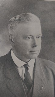
William Paris MacLachlan was a farmer and political figure in Saskatchewan. He represented Morse from 1925 to 1927 in the Legislative Assembly of Saskatchewan as a Liberal.
Froude is an unincorporated community in the Canadian province of Saskatchewan, located in the Rural Municipality of Griffin No. 66, along the historic Ghost Town Trail, also known as the Red Coat Trail or Highway 13. The community is located approximately 42 km east of the city of Weyburn and 137 km southeast of the provincial capital city of Regina.