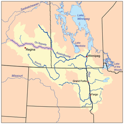
Thunder Creek (Saskatchewan)

Last updated

Thunder Creek
Quappellerivermap.png
The Red River drainage basin, with the Qu'Appelle River highlighted
Canada Saskatchewan relief location map.jpg
Red pog.svg
Location of the mouth in Saskatchewan
Canada relief map 2.svg
Red pog.svg
Thunder Creek (Saskatchewan) (Canada)
Location
CountryFlag of Canada (Pantone).svg  Canada
Provinces
Physical characteristics
SourceMan-made reservoir
  location RM of Enfield No. 194
  coordinates 50°47′10″N106°48′06″W / 50.7861°N 106.8017°W / 50.7861; -106.8017
Mouth Moose Jaw River
  location
City of Moose Jaw
  coordinates
50°23′14″N105°31′46″W / 50.3871°N 105.5295°W / 50.3871; -105.5295 Coordinates: 50°23′14″N105°31′46″W / 50.3871°N 105.5295°W / 50.3871; -105.5295
  elevation
557 m (1,827 ft)
Basin features
River system Qu'Appelle River
Tributaries 
  rightSandy Creek

Thunder Creek [1] is a river in the Canadian province of Saskatchewan. The watershed of Thunder Creek is within the semi-arid Palliser's Triangle in south-central Saskatchewan. It begins at small, man-made reservoir near Lake Diefenbaker and flows in a south-easterly direction towards the city of Moose Jaw and the Moose Jaw River. The Moose Jaw River is a major tributary of the Qu'Appelle River [2] For most of its course, Thunder Creek follows a valley called the Thunder Creek meltwater channel that was formed over 10,000 years ago near the end of the last ice age. [3]

Contents

During the drought of the 1980s, the river, and the marshes and lakes along its course, almost ran dry. To stabilise water levels, a reservoir was built at the head of the river. The reservoir is supplied by pumping in water from nearby Lake Diefenbaker.

Description

Thunder Creek begins at the man-made reservoir and flows into the Thunder Creek meltwater channel. Once in the valley, the river meanders its way along the valley floor. Along the way, it is joined by several creeks flowing in from the coulees. The western tributaries of upper Thunder Creek watershed drain a hilly plateau called the Vermilion Hills. [4] [5] There are four small lakes in a chain along the course that are part of two Important Bird Areas, including Paysen (Horfield) Lake, [6] Williams Lake, Kettlehut Lake, [7] and Pelican Lake. [8] As the water level of Pelican Lake–the last lake in the chain of lakes–isn't always high enough to provide an outflow, Sandy Creek, which is about one kilometre downstream from Pelican Lake, becomes the primary water source for the last leg of Thunder Creek.

Communities found along the river's course include Moose Jaw, Boharm, and Caron. Highways 1, 19, 627, and 643 cross Thunder Creek.

Tributaries

Thunder Creek tributaries include:

Important Bird Areas

There are two Important Bird Areas (IBA) of Canada [10] along the course of Thunder Creek. In 1990, the Riverhurst Management Plan, which was developed by Ducks Unlimited through the North American Waterfowl Management Plan, was initiated to stabilise water levels in the lakes and marshes by pumping in water from Lake Diefenbaker. Stable water levels provide habitat for birds and other wildlife.

Paysen /Kettlehut Lake

Paysen/Kettlehut Lake IBA SK 057 encompasses Paysen, Williams, and Kettlehut Lakes and the surrounding river valley. The IBA site totals 204.3 km2 (78.9 sq mi) with an elevation range of 640 m (2,100 ft) to 682 m (2,238 ft). It is Crown land that is composed of grasslands, ponds, marshes, and creeks. Birds found in the lakes and protected area include the western grebe, black-necked grebe, Franklin's gull, Forster's tern, marsh wren, sedge wren, common yellowthroat, LeConte's sparrow, and Nelson's sparrow. [11]

Pelican Lake

Pelican Lake IBA SK 059 is about 26 kilometres (16 mi) downstream and south-east of SK 057 Paysen/Kettlehut Lake IBA and encompasses all of Pelican Lake [12] and much of the surrounding landscape. Pelican Lake is the largest of the four lakes along the course of Thunder Creek and is recognised as a regional Western Hemisphere Shorebird Reserve Network (WHSRN) site. The IBA covers an area of 208.56 km2 (80.53 sq mi) with an elevation range of 570 m (1,870 ft) to 630 m (2,070 ft). Ducks Unlimited built three cross-dykes on Pelican Lake in 1964, 1973, and 1989 to help maintain water levels. [13]

Some of the birds commonly found at the IBA include the American avocet, marbled godwit, Wilson's phalarope, grey plover, tundra swan, mallard duck, gadwall duck, western grebe, blue-winged teal, northern pintail, and the American white pelican.

Besant Recreation Site

Besant Recreation Site ( 50°27′49″N105°57′42″W / 50.4636°N 105.9617°W / 50.4636; -105.9617 ) [14] is a 300-acre provincial recreation site along the course of Sandy Creek in the RM of Caron No. 162. Access to the park is off the Trans-Canada Highway, 7 kilometres (4.3 mi) east of Mortlach. [15]

Besant Recreation Site is well treed and has about 100 campsites, sandhills, a spring-fed pond, a swimming area, and access to Sandy Creek. The pond is stocked with fish. The park was home to the Sandy Creek Gospel Jamboree. [16]

Fish species

The most commonly found fish in the Thunder Creek river system is the northern pike. Other species include the common carp, burbot, largemouth bass, yellow perch, and walleye. [17]

See also

Related Research Articles

<span class="mw-page-title-main">Lake Winnipeg</span> Large glacial lake in Manitoba, Canada

Lake Winnipeg is a very large, relatively shallow 24,514-square-kilometre (9,465 sq mi) lake in North America, in the province of Manitoba, Canada. Its southern end is about 55 kilometres (34 mi) north of the city of Winnipeg. Lake Winnipeg is Canada's sixth-largest freshwater lake and the third-largest freshwater lake contained entirely within Canada, but it is relatively shallow excluding a narrow 36 m (118 ft) deep channel between the northern and southern basins. It is the eleventh-largest freshwater lake on Earth. The lake's east side has pristine boreal forests and rivers that were in 2018 inscribed as Pimachiowin Aki, a UNESCO World Heritage Site. The lake is 416 km (258 mi) from north to south, with remote sandy beaches, large limestone cliffs, and many bat caves in some areas. Manitoba Hydro uses the lake as one of the largest reservoirs in the world. There are many islands, most of them undeveloped.

<span class="mw-page-title-main">South Saskatchewan River</span> River in Western Canada

The South Saskatchewan River is a major river in the Canadian provinces of Alberta and Saskatchewan. The river begins at the confluence of the Bow and Oldman Rivers in southern Alberta and ends at the Saskatchewan River Forks in central Saskatchewan. The Saskatchewan River Forks is the confluence of the South and North Saskatchewan Rivers and is the beginning of the Saskatchewan River.

<span class="mw-page-title-main">Battle Creek (Milk River tributary)</span> River in central North America

Battle Creek is a river that begins in the south-eastern region of the Canadian province of Alberta, near the border with Saskatchewan, in the Cypress Hills Interprovincial Park. From Alberta, Battle Creek flows east and across the border into Saskatchewan. It flows south out of Saskatchewan across the Canada–United States border into Montana, where it joins the Milk River in Blaine County, Montana.

<span class="mw-page-title-main">Qu'Appelle River</span> River in Western Canada

The Qu'Appelle River is a river in the Canadian provinces of Saskatchewan and Manitoba that flows 430 kilometres (270 mi) east from Lake Diefenbaker in south-western Saskatchewan to join the Assiniboine River in Manitoba, just south of Lake of the Prairies, near the village of St. Lazare. It is located in a region called the Prairie Pothole Region of North America, which extends throughout three Canadian provinces and five U.S. states. It is also within Palliser's Triangle and the Great Plains ecoregion.

<span class="mw-page-title-main">Lake Diefenbaker</span> Lake in Saskatchewan, Canada

Lake Diefenbaker is a reservoir and bifurcation lake in southern part of the Canadian province of Saskatchewan. It was formed by the construction of Gardiner Dam and the Qu'Appelle River Dam across the South Saskatchewan and Qu'Appelle Rivers respectively. Construction began in 1959 and the lake was filled in 1967. The lake is 225 kilometres (140 mi) long with approximately 800 kilometres (500 mi) of shoreline. It has a maximum depth of 66 metres (217 ft), while the water levels regularly fluctuate 3–9 metres (9–27 feet) each year. Lake Diefenbaker provides water for domestic irrigation and town water supplies. The flow of the two rivers is now regulated with a considerable portion of the South Saskatchewan diverted into the Qu'Appelle. Prior to the dams' construction, high water levels in the South Saskatchewan would frequently cause dangerous ice conditions downstream in Saskatoon while the Qu'Appelle would frequently dry up in the summer months.

<span class="mw-page-title-main">Last Mountain Lake</span> Lake in Saskatchewan

Last Mountain Lake, also known as Long Lake, is a prairie lake formed from glaciation 11,000 years ago. It is located in south central Saskatchewan, Canada, about 40 kilometres (25 mi) north-west of the city of Regina. It flows into the Qu'Appelle River via Last Mountain Creek, which flows past Craven. It is approximately 93 km (58 mi) long, and 3 km (1.9 mi) wide at its widest point. It is the largest naturally occurring body of water in southern Saskatchewan. Only Lake Diefenbaker, which is man-made, is larger. The lake is a popular resort area for residents of south-eastern Saskatchewan.

<span class="mw-page-title-main">Buffalo Pound Provincial Park</span> Provincial park in Saskatchewan, Canada

Buffalo Pound Provincial Park is a provincial park located in southern Saskatchewan, Canada, about 30 km (19 mi) north-east of downtown Moose Jaw and 86 km (53 mi) north-west of the city of Regina.

<span class="mw-page-title-main">Tobin Lake</span> Reservoir in Saskatchewan, Canada

Tobin Lake is a reservoir along the course of the Saskatchewan River in the Canadian province of Saskatchewan. Tobin Lake was formed by the building of the E.B. Campbell Dam on the Saskatchewan River in 1963. The dam was originally named Squaw Rapids Dam, but was renamed E.B. Campbell Dam in 1988 as the term squaw is derogatory. The town of Nipawin is near the western end of the lake and upstream from Nipawin along the Saskatchewan River is Codette Lake, which was formed by the construction of the Francois Finlay Dam in 1986. Situated between these two man-made lakes, Nipawin earned the nickname The Town of Two Lakes.

<span class="mw-page-title-main">Blackstrap Lake</span> Reservoir in Saskatchewan, Canada

Blackstrap Lake is a man-made reservoir in central Saskatchewan, Canada, south of Saskatoon in the Rural Municipality of Dundurn No. 314. The lake was created as a reservoir in 1967, as part of the Saskatoon South East Water Supply System. Blackstrap Lake has an area of 1,200 ha and is generally used to support irrigation, and the industrial and municipal water supply.

Greenwater Lake Provincial Park is a provincial park in the Canadian province of Saskatchewan. It is located on the eastern side of the province in the Porcupine Hills on Highway 38. The closest town, Porcupine Plain, is about 28 kilometres (17 mi) to the north-east of the park visitor centre. Founded on 19 February 1932, Greenwater is one of the oldest provincial parks in Saskatchewan. The original six parks were established in 1931 and Greenwater Provincial Park was added one year later. In 1964, the park was expanded to its current size.

<span class="mw-page-title-main">Lanigan Creek</span> River in Saskatchewan, Canada

Lanigan Creek is a river in the Canadian province of Saskatchewan. It is located in the south central part of the province in a region called the Prairie Pothole Region of North America, which extends throughout three Canadian provinces and five U.S. states. It is also within Palliser's Triangle and the Great Plains ecoregion.

<span class="mw-page-title-main">Moose Jaw River</span> River in Saskatchewan, Canada

Moose Jaw River is a river in the Canadian province of Saskatchewan. It is located in the southern part of the province in a region called the Prairie Pothole Region of North America, which extends throughout three Canadian provinces and five U.S. states. It is also within Palliser's Triangle and the Great Plains ecoregion.

<span class="mw-page-title-main">Avonlea Creek</span> River in Saskatchewan

Avonlea Creek is a river in the southern part of the Canadian province of Saskatchewan. It is in a region called the Prairie Pothole Region of North America, which extends throughout three Canadian provinces and five U.S. states. It is also within Palliser's Triangle and the Great Plains ecoregion. Avonlea Creek is a main tributary of the Moose Jaw River, which is part of the Upper Qu'Appelle Watershed and the Hudson Bay drainage basin.

Eyebrow Lake is a man-made marshy lake that parallels the Qu'Appelle River in the southern region of the Canadian province of Saskatchewan. Located in the RM of Huron No. 223, it is the first lake in a series of lakes along the Qu'Appelle River after Qu'Appelle River Dam and Lake Diefenbaker. The next lake downstream is Buffalo Pound Lake. The closest community is the village of Tugaske and while there are no public recreation sites at the lake, it can be accessed by Highway 627. The lake gets its name from the nearby Eyebrow Hills, which are shaped like an eyebrow. The nearby town of Eyebrow and RM of Eyebrow No. 193 are also named after these hills.

<span class="mw-page-title-main">Foam Lake (Saskatchewan)</span> Lake in Saskatchewan, Canada

Foam Lake is a shallow lake in the aspen parkland ecoregion of the Canadian Province of Saskatchewan. It was named "Foam Lake" in 1882 by the Milligans because of the large amount of froth that forms on it. The lake and surrounding marsh are a protected area and important wildlife habitat. The primary inflows for the lake, Milligan Creek and Beckett Brook, originate to the south in the Touchwood Hills. From the north shore of the lake, Milligan Creek flows north-west into the salty Quill Lakes. The Quill Lakes are endorheic lakes as they have no outlet.

Waskesiu Upland is a hilly plateau in the central region of the Canadian province of Saskatchewan. Waskesiu means red deer or elk in the Cree language. The plateau is just south-west of the geographical centre of the province and consists of two main ranges – the Waskesiu Hills to the south and the Thunder Hills to the north The Thunder Hills cover an area of about 225,000 acres. Several notable rivers begin from the upland with ones headed south flowing into the North Saskatchewan River and ones headed north flowing into the Churchill River. Much of the plateau is carpeted in boreal forests and most of the Waskesiu Hills range is within Prince Albert National Park. Besides the national park, there are several provincial recreation sites in and around the upland. The northern part of the upland is part of the Northern Saskatchewan Administration District and is sparsely populated.

Fife Lake is a fresh water prairie lake in the Canadian province of Saskatchewan. It is located in the south-central part of the province at the eastern end of the Wood Mountain Hills. The entire lake and its shoreline is designated an Important Bird Area (IBA) of Canada to protect the nationally endangered piping plover. While there are no communities along the lake's shore, there is a park and campground at the southern end. Nearby communities include Fife Lake, Rockglen, and Lisieux. Access is from Highway 18.

Bigstick Lake is a shallow endorheic alkali lake in the south-west region of the Canadian province of Saskatchewan. The lake was named after the Big Stick Trail that ran between the town of Maple Creek and the South Saskatchewan River. The trail was notable for a large, solitary tree along its route. The lake and its drainage basin are in a semi-arid region known as Palliser's Triangle.

Ponass Lakes are made up of six shallow, marshy lake basins ranging in size from 98 ha to 1,631 ha in the central part of the Canadian province of Saskatchewan. The lakes and marsh are in the aspen parkland ecoregion and are surrounded by groves of trembling aspen and farmland. Water levels are controlled by a series of dams operated by Ducks Unlimited Canada. The outflow for the lakes and marsh is from a short creek at the north end. The creek flows into George Williams Lake, which is within the Red Deer River drainage basin. The lakes and marsh are in the RM of Ponass Lake No. 367 and access is from Highway 35.

Basin Lake is an endorheic salt lake in the Canadian province of Saskatchewan. The lake is in the RM of Three Lakes No. 400 in the Boreal Transition ecoregion and is within an Important Bird Area (IBA) of Canada and part of the Basin and Middle Lakes Bird Sanctuary. There are no communities along the lake's shore and the closest highway is Highway 20. At 40 kilometres (25 mi) to the south, Humbolt is the closest city.

References

  1. "Thunder Creek". Canadian Geographical Names Database. Government of Canada. Retrieved 30 December 2022.
  2. "Our Watershed". Moose Jaw River. Moose Jaw River Watershed Stewards. Retrieved 30 December 2022.
  3. "Thunder Creek". Geoview.info. Geoview.info. Retrieved 30 December 2022.
  4. "Map of Vermilion Hills in Saskatchewan". Cartographic. Cartographic. Retrieved 30 December 2022.
  5. "Vermilion Hills". Canadian Geographical Names Database. Government of Canada. Retrieved 30 December 2022.
  6. "Paysen (Horfield) Lake". Canadian Geographical Names Database. Government of Canada. Retrieved 30 December 2022.
  7. "Kettlehut Lake". Canadian Geographical Names Database. Government of Canada. Retrieved 30 December 2022.
  8. "Pelican Lake". Canadian Geographical Names Database. Government of Canada. Retrieved 30 December 2022.
  9. "Sandy Creek". Canadian Geographical Names Database. Government of Canada. Retrieved 30 December 2022.
  10. "Important Bird and Biodiversity Areas". Nature Saskatchewan. Nature Saskatchewan. Retrieved 31 December 2022.
  11. "Paysen/Kettlehut Lake". IBA Canada. Birds Canada. Retrieved 30 December 2022.
  12. "Pelican Lake". Canadian Geographical Names Database. Government of Canada. Retrieved 31 December 2022.
  13. "Pelican Lake". IBA Canada. Birds Canada. Retrieved 30 December 2022.
  14. "Besant Recreation Site". Canadian Geographical Names Database. Government of Canada. Retrieved 30 December 2022.
  15. "Besant Trans-Canada Campground". Tourism Saskatchewan. Government of Saskatchewan. Retrieved 30 December 2022.
  16. Walter, Ron (14 June 2020). "Park west of Moose Jaw always a special place". Moose Jaw Today. Glacier Media Group. Retrieved 30 December 2022.
  17. "Thunder Creek". Fishbrain. Fishbrain. Retrieved 30 December 2022.