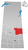
Ridgedale is a village in the Canadian province of Saskatchewan within the Rural Municipality of Connaught No. 457 and Census Division No. 14. It is situated on the banks of the Carrot River.

Annaheim is a village in the Canadian province of Saskatchewan within the Rural Municipality of St. Peter No. 369 and Census Division No. 15. The village is located about 125 km east of the City of Saskatoon, at the junction of provincial Highway 756 and Highway 779. Annaheim hosts the offices of the Rural Municipality of St. Peter No. 369.
Quill Lake is a village in the Canadian province of Saskatchewan within the Rural Municipality of Lakeside No. 338 and Census Division No. 10. It is 170 km east of Saskatoon and 200 km northeast of Regina.

Chaplin is a village in the Canadian province of Saskatchewan within the Rural Municipality of Chaplin No. 164 and Census Division No. 7. The community is situated on the Trans-Canada Highway approximately 85 km from Moose Jaw and 90 km from Swift Current. The main industries of Chaplin are Saskatchewan Minerals and farming/ranching. Chaplin consists of eight streets, two crescents, and four avenues.

Borden is a village in the Canadian province of Saskatchewan within the Rural Municipality of Great Bend No. 405 and Census Division No. 16. Borden is named after Sir Frederick William Borden, Minister of Militia in the Laurier Cabinet. An abandoned arch bridge with the same name is located to the southeast and was once used to carry Highway 16 across the North Saskatchewan River.
BulyeaBUUL-yay is a village in the Canadian province of Saskatchewan within the Rural Municipality of McKillop No. 220 and Census Division No. 6.

Denholm is a village in the Canadian province of Saskatchewan within the Rural Municipality of Mayfield No. 406 and Census Division No. 16.
Dilke is a village in the Canadian province of Saskatchewan within the Rural Municipality of Sarnia No. 221 and Census Division No. 6.
Edenwold is a village in the Canadian province of Saskatchewan within the Rural Municipality of Edenwold No. 158 and Census Division No. 6. It is located 45 km (28 mi) north of the City of Regina.
Fosston is a village in the Canadian province of Saskatchewan within the Rural Municipality of Ponass Lake No. 367 and Census Division No. 14. The village was named after Fosston, Minnesota, the original home of five Rustad brothers, who homesteaded there.

Glenside is a village in the Canadian province of Saskatchewan within the Rural Municipality of Rudy No. 284 and Census Division No. 11. The village is located on Highway 219 approximately 20 km east of the Town of Outlook.
Lake Lenore is a village in the Canadian province of Saskatchewan within the Rural Municipality of St. Peter No. 369 and Census Division No. 15. The village is located 144 kilometres (89 mi) northeast of the city of Saskatoon. To the north of the village is Lenore Lake, which is designated as a migratory bird sanctuary, an Important Bird Area (IBA) of Canada, and has a National Wildlife Area on Raven Island. Services in Lake Lenore include a school, Co-op Grocery and Agro Service Station, a Credit Union, and Public Library.
Lintlaw is a village in the Canadian province of Saskatchewan within the Rural Municipality of Hazel Dell No. 335 and Census Division No. 9. The village is located at the intersection of Highway 49 and Highway 617, 142 km northwest of the City of Yorkton.
Marcelin is a village in the Canadian province of Saskatchewan within the Rural Municipality of Blaine Lake No. 434 and Census Division No. 16. It was named after the first postmaster Antoine Marcelin in 1904.

Meacham is a village in the Canadian province of Saskatchewan within the Rural Municipality of Colonsay No. 342 and Census Division No. 11. It is located 69 kilometres east of the City of Saskatoon on Highway 2.
Quinton is a village in the Canadian province of Saskatchewan within the Rural Municipality of Mount Hope No. 279 and Census Division No. 10. The village is located on Highway 15 between the Town of Raymore and the Village of Punnichy. It is near the administrative office of the Kawacatoose First Nations.
Silton is a village in the Canadian province of Saskatchewan within the Rural Municipality of McKillop No. 220 and Census Division No. 6.
Valparaiso is a village in the Canadian province of Saskatchewan within the Rural Municipality of Star City No. 428 and Census Division No. 14. The village is located at the junction of Highway 3 and Range Road No. 160, approximately 20 km east of the City of Melfort. The name comes from that of Valparaíso in Chile.
Codette is a village in the Canadian province of Saskatchewan within the Rural Municipality of Nipawin No. 487 and Census Division No. 14. The village is located 10 km south of Nipawin at the junction of Highway 35 and Highway 789.

The Rural Municipality of Pleasantdale No. 398 is a rural municipality (RM) in the Canadian province of Saskatchewan within Census Division No. 14 and SARM Division No. 4.


