
Alvena is a village in the Canadian province of Saskatchewan within the Rural Municipality of Fish Creek No. 402 and Census Division No. 15. It is approximately 60 kilometres (37 mi) northeast of Saskatoon.

The Rural Municipality of Colonsay No. 342 is a rural municipality (RM) in the Canadian province of Saskatchewan within Census Division No. 11 and SARM Division No. 5. it is located east of the City of Saskatoon.
Pelly is a village in the Canadian province of Saskatchewan within the Rural Municipality of St. Philips No. 301 and Census Division No. 9.
Prud'homme is a village in the Canadian province of Saskatchewan within the Rural Municipality of Bayne No. 371 and Census Division No. 15. It is approximately 60 kilometres northeast of Saskatoon. Prud'homme was first known by the name of Bluebell Ranch, then Lally Siding. In 1905 the Canadian Northern Railway came through and renamed it Marcotte's Crossing; two years later it became known as Howell; and finally, in 1922, it was named after the Suffragan Bishop of Prince-Albert–Saskatoon, Joseph H. Prud'homme. The community is mostly based on agriculture.
Chaplin is a village in the Canadian province of Saskatchewan within the Rural Municipality of Chaplin No. 164 and Census Division No. 7. The community is situated on the Trans-Canada Highway approximately 85 km from Moose Jaw and 90 km from Swift Current. The main industries of Chaplin are Saskatchewan Minerals and farming/ranching. Chaplin consists of eight streets, two crescents, and four avenues.
Debden is a village in the Canadian province of Saskatchewan within the Rural Municipality of Canwood No. 494 and Census Division No. 16. The village is located on Highway 55 and is 94 kilometres (58 mi) from the city of Prince Albert and 194 kilometres (121 mi) from the city of Saskatoon. It is also the administrative headquarters of the Big River Cree First Nations band government. The village is at the edge of the Prince Albert National Park and with all the lakes nearby it becomes a popular area in the summer months.

Belle Plaine is a village in the Canadian province of Saskatchewan within the Rural Municipality of Pense No. 160 and Census Division No. 6. Belle Plaine is located on Highway 1, 21 kilometres east of the City of Moose Jaw in south-central Saskatchewan. Buffalo Pound Provincial Park and Regina Beach are located near Belle Plaine.
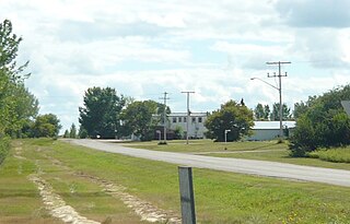
Zelma is a village in the Canadian province of Saskatchewan within the Rural Municipality of Morris No. 312 and Census Division No. 11. The village is located along Saskatchewan Highway 763.
Coderre ) is a village in the Canadian province of Saskatchewan within the Rural Municipality of Rodgers No. 133 and Census Division No. 7. The village is located approximately 85 km southwest of the City of Moose Jaw on Highway 627.

Bladworth is a village in the Canadian province of Saskatchewan within the Rural Municipality of McCraney No. 282 and Census Division No. 11. The village is located 99 kilometres (62 mi) south of the City of Saskatoon on Highway 11.
Brownlee is a village in the Canadian province of Saskatchewan within the Rural Municipality of Eyebrow No. 193 and Census Division No. 7. The village is located approximately 58 km northwest of the City of Moose Jaw on Highway 42.

Glenside is a village in the Canadian province of Saskatchewan within the Rural Municipality of Rudy No. 284 and Census Division No. 11. The village is located on Highway 219 approximately 20 km east of the Town of Outlook.
Hawarden is a village in the Canadian province of Saskatchewan within the Rural Municipality of Loreburn No. 254 and Census Division No. 11. The village is located on Highway 19 north of Strongfield, Loreburn, and Elbow.
Marcelin is a village in the Canadian province of Saskatchewan within the Rural Municipality of Blaine Lake No. 434 and Census Division No. 16. It was named after the first postmaster Antoine Marcelin in 1904.
Middle Lake is a village in the Canadian province of Saskatchewan within the Rural Municipality of Three Lakes No. 400 and Census Division No. 15. The village has a public K-12 school, a nursing home, and a regional park. It is adjacent to Lucien Lake and accessed from Highway 20. The surrounding area is largely agricultural.
St. Benedict is a village in the Canadian province of Saskatchewan within the Rural Municipality of Three Lakes No. 400 and Census Division No. 15. Located in the Carlton Trail Region of the province, it is 56 km (35 mi) north of the City of Humboldt off Highway 20.
Primate is a special service area within the Rural Municipality of Eye Hill No. 382, Saskatchewan, Canada that held village status prior to 2016.
Shamrock is a village in the Canadian province of Saskatchewan within the Rural Municipality of Shamrock No. 134 and Census Division No. 7.

Speers is a village in the Canadian province of Saskatchewan within the Rural Municipality of Douglas No. 436 and Census Division No. 16. The village is located approximately 50 kilometres (31 mi)} southeast of the City of North Battleford on Highway 40.
Tugaske is a village in the Canadian province of Saskatchewan within the Rural Municipality of Huron No. 223 and Census Division No. 7. It is nicknamed Gateway to Lake Diefenbaker. It is near Eyebrow Lake, a prairie lake in the Qu'Appelle Valley. It was named after an eyebrow-shaped hill also in the Qu'Appelle Valley above Eyebrow Lake. The lake, which is 9 km long and 1 km wide, is a bird sanctuary and is near Highway 627.


