Demographics
In the 2021 Census of Population conducted by Statistics Canada, Lang had a population of 176 living in 84 of its 98 total private dwellings, a change of -6.9% from its 2016 population of 189. With a land area of 0.65 km2 (0.25 sq mi), it had a population density of 270.8/km2 (701.3/sq mi) in 2021. [9]
In the 2016 Census of Population, the Village of Lang recorded a population of 189 living in 81 of its 96 total private dwellings, a -5.8% change from its 2011 population of 200. With a land area of 0.64 km2 (0.25 sq mi), it had a population density of 295.3/km2 (764.9/sq mi) in 2016. [10]
Ridgedale is a village in the Canadian province of Saskatchewan within the Rural Municipality of Connaught No. 457 and Census Division No. 14. It is situated on the banks of the Carrot River.
Beatty is a village in the Canadian province of Saskatchewan within the Rural Municipality of Flett's Springs No. 429 and Census Division No. 15. The village is located approximately 13 km (8 mi) northwest of the City of Melfort. It is at the junction of Highway 3 and Highway 368. In 1925, Beatty was a Canadian National Railways (CNR) rail station on the Swan River - Prince Albert branch line. The area surrounding Beatty is predominantly farmland and the main source of employment is agriculture.

The Rural Municipality of Lumsden No. 189 is a rural municipality (RM) in the Canadian province of Saskatchewan within Census Division No. 6 and SARM Division No. 2. It is located in the south-east portion of the province.
Chaplin is a village in the Canadian province of Saskatchewan within the Rural Municipality of Chaplin No. 164 and Census Division No. 7. The community is situated on the Trans-Canada Highway approximately 85 km from Moose Jaw and 90 km from Swift Current. The main industries of Chaplin are Saskatchewan Minerals and farming/ranching. Chaplin consists of eight streets, two crescents, and four avenues.
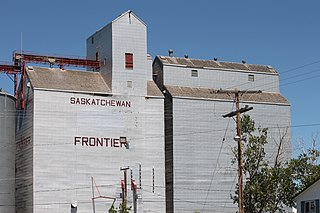
Frontier is a village in the Canadian province of Saskatchewan within the Rural Municipality of Frontier No. 19 and Census Division No. 4. Frontier is on Highway 18 and is served by the Frontier Airport located (3.7 km) south of the village.
BulyeaBUUL-yay is a village in the Canadian province of Saskatchewan within the Rural Municipality of McKillop No. 220 and Census Division No. 6.
Dilke is a village in the Canadian province of Saskatchewan within the Rural Municipality of Sarnia No. 221 and Census Division No. 6.
Duval is a village in the Canadian province of Saskatchewan within the Rural Municipality of Last Mountain Valley No. 250 and Census Division No. 11. The village is located on Highway 20 approximately 93 km north of the City of Regina.
Lintlaw is a village in the Canadian province of Saskatchewan within the Rural Municipality of Hazel Dell No. 335 and Census Division No. 9. The village is located at the intersection of Highway 49 and Highway 617, 142 km northwest of the City of Yorkton.
McTaggart is a village in the Canadian province of Saskatchewan within the Rural Municipality of Weyburn No. 67 and Census Division No. 2.
Minton is a village in the Canadian province of Saskatchewan within the Rural Municipality of Surprise Valley No. 9 and Census Division No. 2. It is on Highway 6 just north of its intersection with Highway 18, 19 km north of the Raymond-Regway Border Crossing on the Montana-Saskatchewan border. The village was named after Minton, Shropshire in England. The name was given by the Canadian Pacific Railway.

Viscount is a village in the Canadian province of Saskatchewan within the Rural Municipality of Viscount No. 341 and Census Division No. 11. Viscount is located on Saskatchewan Highway 16, the Yellowhead Highway, in central Saskatchewan east of Colonsay and west of Lanigan. As of the Canada 2016 Census, Viscount had a population of 232.
Caronport is a village in the Canadian province of Saskatchewan within the Rural Municipality of Caron No. 162 and Census Division No. 7. The village is 21 km (13 mi) west of the City of Moose Jaw on the Trans-Canada Highway.
Silton is a village in the Canadian province of Saskatchewan within the Rural Municipality of McKillop No. 220 and Census Division No. 6.
Ceylon is a village in the Canadian province of Saskatchewan within the Rural Municipality of The Gap No. 39 and Census Division No. 2. It is located alongside Gibson Creek, which is a tributary of Long Creek. No shops or businesses other than the bar remain.
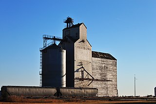
Osage is a village in the Canadian province of Saskatchewan within the Rural Municipality of Fillmore No. 96 and Census Division No. 2. The village is located on Highway 33, that runs south-east from Regina to Stoughton. The village has a grain elevator, post office, service station, and a two-sheet natural ice curling rink. Children from the area attend school in Fillmore, 13 km away. Osage celebrated its centennial in 2006.

The Rural Municipality of Pinto Creek No. 75 is a rural municipality (RM) in the Canadian province of Saskatchewan within Census Division No. 3 and SARM Division No. 3. It is located in the southern portion of the province.
The Rural Municipality of Clayton No. 333 is a rural municipality (RM) in the Canadian province of Saskatchewan within Census Division No. 9 and SARM Division No. 4.

The Rural Municipality of Grandview No. 349 is a rural municipality (RM) in the Canadian province of Saskatchewan within Census Division No. 13 and SARM Division No. 6.

The Rural Municipality of Preeceville No. 334 is a rural municipality (RM) in the Canadian province of Saskatchewan within Census Division No. 9 and SARM Division No. 4.
This page is based on this
Wikipedia article Text is available under the
CC BY-SA 4.0 license; additional terms may apply.
Images, videos and audio are available under their respective licenses.